Alta Via 1 trek
- Distance
- about 115 km (72 miles)
- Country
- Italy
- Difficulty
- Moderate
- Type of trip
- Hiking trail
The Alta Via 1 is the oldest and easiest of the numbered high routes through the Dolomites in north-east Italy. It runs south from Lago di Braies (Pragser Wildsee), a lake at about 1,496 m in the Prags valley of South Tyrol, to La Pissa in the Piave valley just north of Belluno. On the way it crosses the Fanes plateau, goes over the Lagazuoi, past the Cinque Torri and under the Pelmo, Civetta and Moiazza, and finishes in the Schiara group above Belluno. It’s waymarked with blue triangles carrying the number 1, alongside the usual red-and-white paint, and it doesn’t cross any glaciers. You also cross three languages: German in the Prags valley, Ladin around Fanes and Cortina d’Ampezzo, and Italian further south.
The Cicerone guide splits it into 11 stages and suggests allowing about two weeks. Most stages are 3 to 5½ hours of walking before stops, with anything from 200 m to about 1,150 m of climbing in a day. You sleep in rifugi (staffed mountain huts) or small hotels at the passes. Wild camping isn’t allowed in the two nature parks and the Dolomiti Bellunesi national park the route crosses, and in July and August you need to book huts well in advance. Apart from the very end, you don’t need climbing gear. The last stage drops off the Schiara by the Via Ferrata del Màrmol, a long protected route with cables and ladders, and walkers without via ferrata kit and experience take a lower path round it. Buses run from Toblach (Dobbiaco) and Niederdorf (Villabassa) to the lake, and Belluno has trains and buses at the other end. In summer the Prags valley has traffic restrictions (in 2026 they ran from 1 July to 15 September), and while they apply the buses to the lake have to be booked and paid for online, so check the current rules on prags.bz.
Highlights along the way
- Lago di Braies: the start, a lake at the foot of the Seekofel. The first day climbs about 900 m to Rifugio Biella at 2,327 m.
- Lagazuoi: the highest point of the route, where Rifugio Lagazuoi sits at 2,752 m. The mountain is full of First World War tunnels dug by Italian and Austro-Hungarian troops, now open as an outdoor museum, and you can walk down through them to the Falzarego pass with a helmet and head torch. The Cortina tourist office also advises a via ferrata kit and gloves.
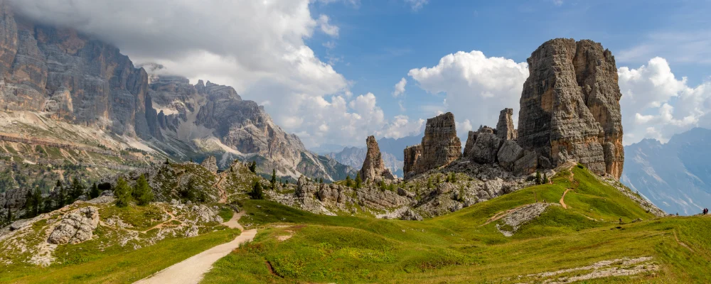
- Cinque Torri: a group of five rock towers, the tallest 2,361 m, on the way from Falzarego to Rifugio Nuvolau. The area round them is another First World War open-air museum.
- Civetta: a 3,220 m mountain whose north-west face is a cliff about 1,000 m high. The route runs along the foot of the Civetta group between Rifugio Palafavera and Rifugio Vazzoler.
- Schiara: the last mountain before Belluno, 2,565 m. The direct finish takes the Via Ferrata del Màrmol down its gorges, and there’s a walkers’ alternative round it.
Distance
About 115 km (72 miles) from Lago di Braies to La Pissa, by the Cicerone guide’s measure. Other sources give about 120 to 125 km, depending on where they finish and which variants they count.
If you have a GPX of this route from its official site or a planning app, open it in our free GPX viewer to see the distance, the climb and the height profile. The file stays on your device.
Best time to go
From about mid to late June to mid or late September, when most of the rifugi are open and the paths are largely clear of snow. Opening dates vary by hut, so check each one before you book. Snow can linger on the high passes in late June. July and August are the busiest months, and huts need booking well ahead then.
More journeys in Italy
- to Tuscany by bike · Yael Zekaria
- Euro Trip 2024 · mmalty
- Istanbul To Ashby · Harry
- Sicily Tour · fredmarien
- Livigno 2026 · Marc
- UK to Georgia by Bike · Simon & Lucy
Flyby films from Italy
- Alta_Via_1_day_1_ · harryknoblauch12
- Plane trip Saturday · fredmarien
- Dag 9: Innsbruck - Bruneck · johan
- Salzburg to Nice · Lucy
More routes like this
- Sentiero Italia on foot · about 8,000 km (4,970 miles) · Italy
- Cammino di Oropa on foot · about 65 km (40 miles) · Italy
- Tour du Mont Blanc trek · about 170 km (105 miles) · France, Italy, Switzerland
- Via di Francesco on foot · about 500 km (311 miles) · Italy
- Via Francigena on foot · 1,000 km (621 miles) · Italy
- E5 from Oberstdorf to Meran on foot · about 120 km (75 miles) · Germany, Austria, Italy