Tour du Mont Blanc trek
- Distance
- about 170 km (105 miles)
- Countries
- France, Italy, Switzerland
- Difficulty
- Challenging
- Type of trip
- Hiking trail
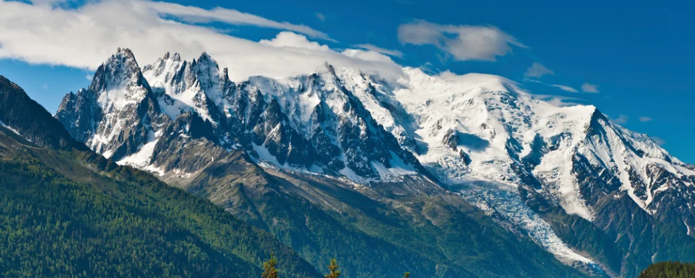
The Tour du Mont Blanc (TMB) is a loop of about 170 km round the Mont Blanc massif, through France, Italy and Switzerland, with around 10,000 m of climbing. Most people start at Les Houches, at the bottom of the Chamonix valley, and walk anticlockwise. That takes you south to Les Contamines, over the Col de la Seigne into Italy, down to Courmayeur, along the Italian Val Ferret, over the Grand Col Ferret into Switzerland, then through Champex and Trient and back into France above Chamonix.
Walkers usually take 10 or 11 days, though the official site says anything from 7 to 12. You sleep in mountain refuges, hotels and guest rooms in the villages, and there are a few campsites. Huts and rooms can be booked through the official TMB booking site, and in July and August some places are full months ahead. The highest points on the main route are cols around 2,500 m; the Fenêtre d’Arpette variant and the Col des Fours both reach 2,665 m.
Highlights along the way
- Col de la Seigne: the 2,516 m pass from France into Italy, between the Vallée des Glaciers and the Val Veny, looking straight across at the south side of Mont Blanc.
- Courmayeur: the Italian town at 1,224 m below the south face of Mont Blanc, about halfway round. The Skyway cable car goes up from nearby La Palud to Punta Helbronner at 3,466 m.
- Grand Col Ferret: at 2,537 m the highest point of the standard route, where you cross from the Italian Val Ferret to the Swiss Val Ferret.
- Fenêtre d’Arpette: a steep, rocky 2,665 m col between Champex and Trient, with a view down onto the Trient glacier. It’s a hard variant; the main route takes a lower line between the two.
- Lac Blanc: a lake at 2,352 m in the Aiguilles Rouges nature reserve above Chamonix, reached by a short detour from La Flégère, with the Mer de Glace and Aiguille Verte across the valley.
Distance
About 170 km (105 miles) for the full loop, with around 10,000 m of ascent and the same in descent. Variants such as the Fenêtre d’Arpette or Lac Blanc change the total a little.
If you have a GPX of this route from its official site or a planning app, open it in our free GPX viewer to see the distance, the climb and the height profile. The file stays on your device.
Best time to go
Mid-June to mid-September, the season the official TMB site gives. Cicerone suggests early July to late September because snow can stay on the high passes. July and August are the busiest months, so book beds early. For 2026, the Swiss path between Prayon and Branche (Les Treutsebo) has been rerouted because of rockfall risk, with a signed new route since mid-July 2026. Check trail conditions on autourdumontblanc.com before you go.
More journeys in France, Italy, Switzerland
- France June 2023 · Greg
- France Spain 2024 · Greg
- The Rick Trip · Phil
- UK to Georgia by Bike · Simon & Lucy
- to Tuscany by bike · Yael Zekaria
- Euro Trip 2024 · mmalty
Flyby films from France, Italy, Switzerland
- Cassagne 101 · André
- To Cancale for a couple days rest. · Phil
- Source de l'Angillon · CNJ tourisme
- PLM line - Champagnole to Pont-du-Navoy - 25483409 · CNJ tourisme
More routes like this
- Via Alpina on foot · 2,000 km (1,240 miles) · Slovenia, Italy, Austria, Germany, Switzerland, Liechtenstein, France, Monaco
- Haute Route trek · about 215 km (134 miles) · France, Switzerland
- Chemin de Saint-Guilhem on foot · about 240 km (149 miles) · France
- Sentiero degli Dei (Path of the Gods) · 8 km (5 miles) · Italy
- Camino de Santiago on foot · about 770 km (480 miles) · Spain, France
- Alta Via 1 trek · about 115 km (72 miles) · Italy