Pacific Crest Trail
- Distance
- about 4,265 km (2,650 miles)
- Country
- USA
- Difficulty
- Very challenging
- Type of trip
- Hiking trail
The Pacific Crest Trail runs about 4,265 km (2,650 miles) from the Mexican border near Campo, California, to the Canadian border beside E. C. Manning Provincial Park in British Columbia. It crosses California, Oregon and Washington along the Sierra Nevada and the Cascades, mostly through national forest and wilderness, and passes through seven national parks. It was first proposed in 1926 and became one of the first two National Scenic Trails in 1968, alongside the Appalachian Trail. The Pacific Crest Trail Association (PCTA) looks after it with the US Forest Service.
A thru-hike takes about five months. Most northbound hikers leave the border between mid-April and early May and reach the northern terminus around the end of September. You camp almost every night and drop into towns every few days to resupply. Anyone walking 500 miles (about 800 km) or more in one continuous trip can get a free PCT Long-distance Permit from the PCTA, but start numbers are capped and popular dates go quickly. Crossing into Canada on the trail is no longer allowed. Canada ended its PCT entry permit in January 2025, so the walk finishes at the monument on the US side of the border and you walk back south, about 48 km (30 miles) to Hart’s Pass, for a road out.
Highlights along the way
- Southern California: the trail climbs over a series of mountain ranges, including San Jacinto above Idyllwild and Mount Baden-Powell, then drops to dry, hot ground between them. Water is scarce and some stretches hold snow into early May.
- High Sierra: from Kennedy Meadows the trail climbs into Sequoia, Kings Canyon and Yosemite. Forester Pass, at 4,009 m (13,153 ft), is the highest point on the whole trail.
- Crater Lake: the lake fills the caldera of Mount Mazama and is the deepest in the United States, at 592 m. The main trail stays back in the forest, but an alternative route follows the edge of the caldera for about 10 km (6 miles).
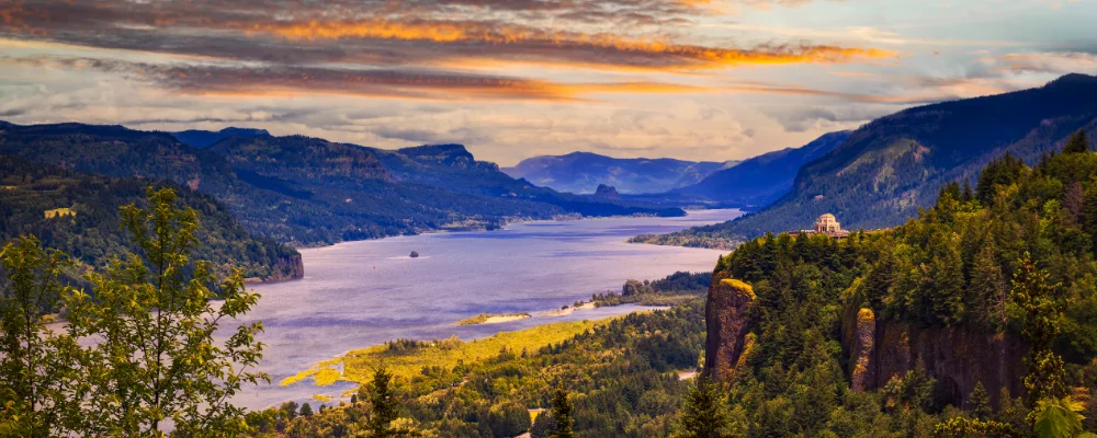
- Bridge of the Gods: at Cascade Locks the trail reaches its lowest point and crosses the Columbia River on a road bridge from Oregon into Washington.
- Goat Rocks and the North Cascades: Goat Rocks carries the highest section of the trail in Washington, under Old Snowy Mountain (2,402 m). Further north the trail passes Glacier Peak, and Stehekin, reached by bus from the trail, is the last town before the border.
Distance
About 4,265 km (2,650 miles) from the southern terminus near Campo to the northern terminus monument at the Canadian border. Because you can’t cross into Canada, add about 48 km (30 miles) back south to Hart’s Pass, or about 97 km (60 miles) to Rainy Pass on Highway 20.
If you have a GPX of this route from its official site or a planning app, open it in our free GPX viewer to see the distance, the climb and the height profile. The file stays on your device.
Best time to go
Northbound, start between mid-April and early May and aim to finish by the end of September. Southbound hikers usually start between late June and early July. Snow usually covers the high Sierra until well into June and the North Cascades into early July, and new snow can close the trail from October. Southern California gets very hot from June to August. Wildfire closures and smoke get more likely as the season goes on, so check the PCTA closures page (closures.pcta.org) before and during your hike, and apply for the long-distance permit through the PCTA well ahead.
More journeys in USA
- Long Trail · Lynn
- US Road Trip · Julia & James
- 美国西南自驾游(Southwest USA Road Trip) · Qinggong
- World Trip - One Planet Expedition · David Bossek (Nature Nomad World)
- Segundo dia · Camila
- Utah Or Bust. · Matthew
Flyby films from USA
- Friday 6th · Xiao
- Day 20 · Lynn
- Ginkgo forest · Xiao
- Second day · Camila
More routes like this
- Colorado Trail · 782 km (486 miles) · USA
- Arizona Trail · about 1,290 km (800 miles) · USA
- Appalachian Trail · 3,537 km (2,198 miles) · USA
- John Muir Trail · 340 km (211 miles) · USA
- Wonderland Trail · about 150 km (93 miles) · USA
- Continental Divide Trail · about 4,900 km (3,100 miles) · USA, Canada