John Muir Trail
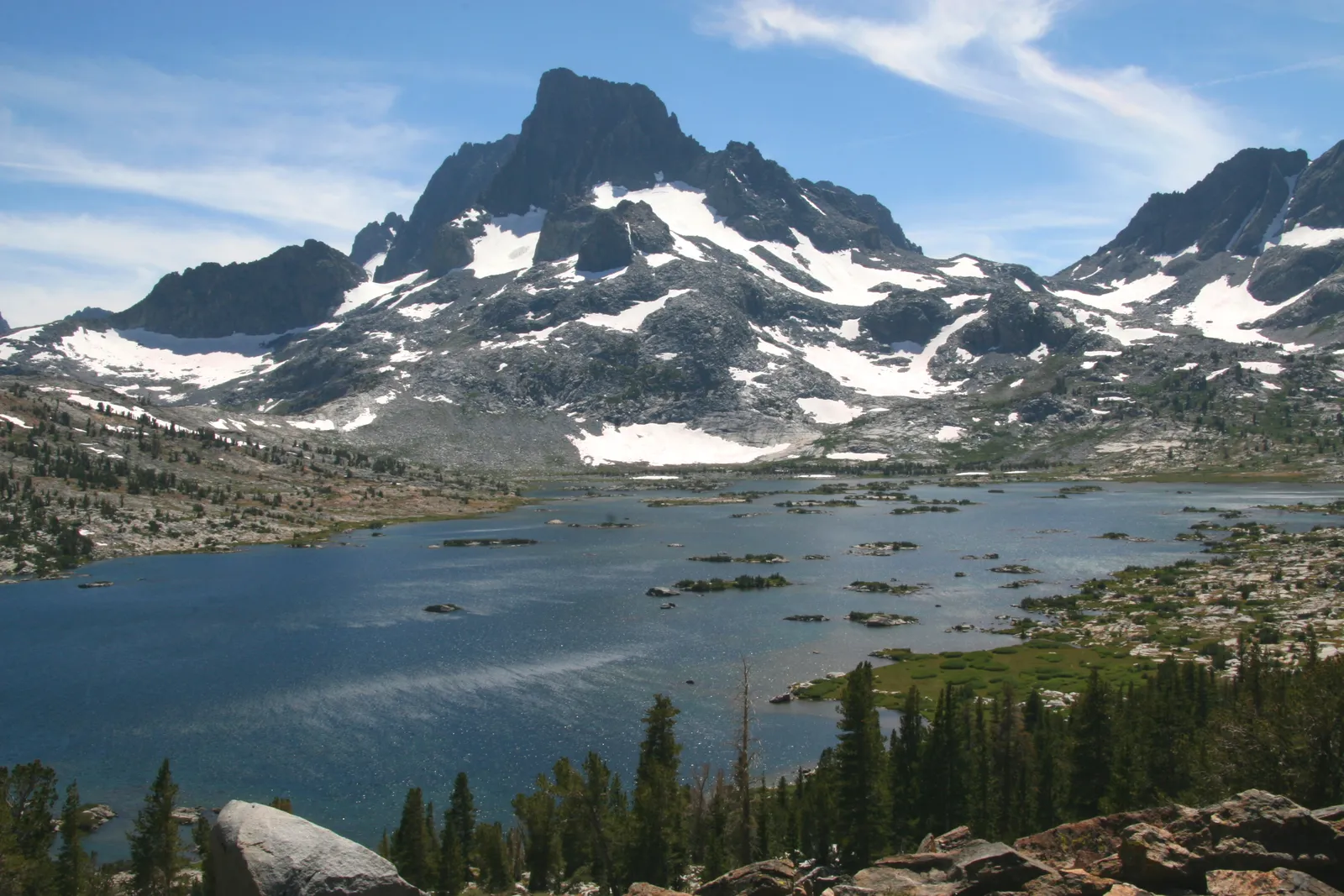
Photo: Dcrjsr, CC BY 3.0, via Wikimedia Commons
- Distance
- 340 km (211 miles)
- Country
- USA
- Difficulty
- Challenging
- Type of trip
- Hiking trail
The John Muir Trail runs through the high Sierra Nevada in California, from Happy Isles in Yosemite Valley to the summit of Mount Whitney. It's 211 miles by the National Park Service figure, through Yosemite, Kings Canyon and Sequoia National Parks, Devils Postpile National Monument and the Ansel Adams and John Muir Wildernesses. It follows the Pacific Crest Trail for most of the way. Thru-hikers usually take about three weeks. You camp the whole way and carry your food, and you resupply at Tuolumne Meadows, Reds Meadow, Vermilion Valley Resort or Muir Trail Ranch. The only roads it comes near are at the northern end and at Reds Meadow.
You need a wilderness permit. If you start in Yosemite and walk the whole trail in one go, one Yosemite permit covers it. As of the park's page updated in December 2025, 60% of reservations go by weekly lottery 24 weeks ahead, and the rest open 7 days ahead. Only 45 people a day may leave Yosemite over Donohue Pass, 30 starting from Lyell Canyon and 15 from Happy Isles. If you start at Happy Isles you can't camp at Little Yosemite Valley on the first night. Approved bear canisters are required throughout Yosemite, and you can rent one at any wilderness permit station.
Highlights along the way
- Tuolumne Meadows and Donohue Pass: Tuolumne Meadows has a post office that holds hiker parcels in summer and a backpackers' campground. Donohue Pass, at 11,056 ft (3,370 m), takes you out of Yosemite.
- Thousand Island Lake: A lake full of small rocky islands under Banner Peak, in the Ansel Adams Wilderness.
- Devils Postpile and Reds Meadow: A national monument and the only place mid-trail where a road comes in, with a resupply stop. In July 2025 the road to Reds Meadow was under construction, so check with Inyo National Forest.
- Evolution Basin and Muir Pass: A run of high lakes in Kings Canyon, then Muir Pass with the stone John Muir Hut, the only shelter on the trail.
- Forester Pass and Mount Whitney: Forester Pass, at about 4,000 m, is the highest point on the Pacific Crest Trail. The trail ends on Mount Whitney, at 14,505 ft (4,421 m) the highest summit in the contiguous United States.
Distance
The Park Service gives 211 miles (340 km), and the Wikipedia article 213.7 miles (343.9 km). The trail officially ends on the summit of Mount Whitney, so you then walk another 10.6 miles (17.1 km) down to the road at Whitney Portal, about 221 miles (356 km) in all. You start at about 1,230 m in Yosemite Valley and cross six passes over 11,000 ft (3,400 m): Donohue, Muir, Mather, Pinchot, Glen and Forester. Backpacker magazine put the total climb at about 47,000 ft (14,000 m).
Best time to go
The main season is July to September. Earlier in the summer, snow and snowmelt make it more dangerous. Permits for summer start dates go 24 weeks ahead, which means applying in the winter before. Check the current rules and conditions with Yosemite National Park (nps.gov/yose), Sequoia and Kings Canyon National Parks and Inyo National Forest before you go.
More journeys in USA
- US Road Trip · Julia & James
- Southwest USA Road Trip · Qinggong
- World Trip - Zero Impact Expedition · David
- Second day · Camila
- Utah Or Bust. · Matthew
- On the road to Harpes Ferry · Xiao
Flyby films from USA
- Ginkgo forest · Xiao
- Second day · Camila
- Saindo de lake Havasu City · Camila
- ALASKA or BUST! · Matt
More routes like this
- Pacific Crest Trail · about 4,265 km (2,650 miles) · USA
- Wonderland Trail · about 150 km (93 miles) · USA
- Colorado Trail · 782 km (486 miles) · USA
- Continental Divide Trail · about 4,900 km (3,100 miles) · USA, Canada
- Superior Hiking Trail · about 480 km (300 miles) · USA
- Appalachian Trail · 3,537 km (2,198 miles) · USA