Wonderland Trail
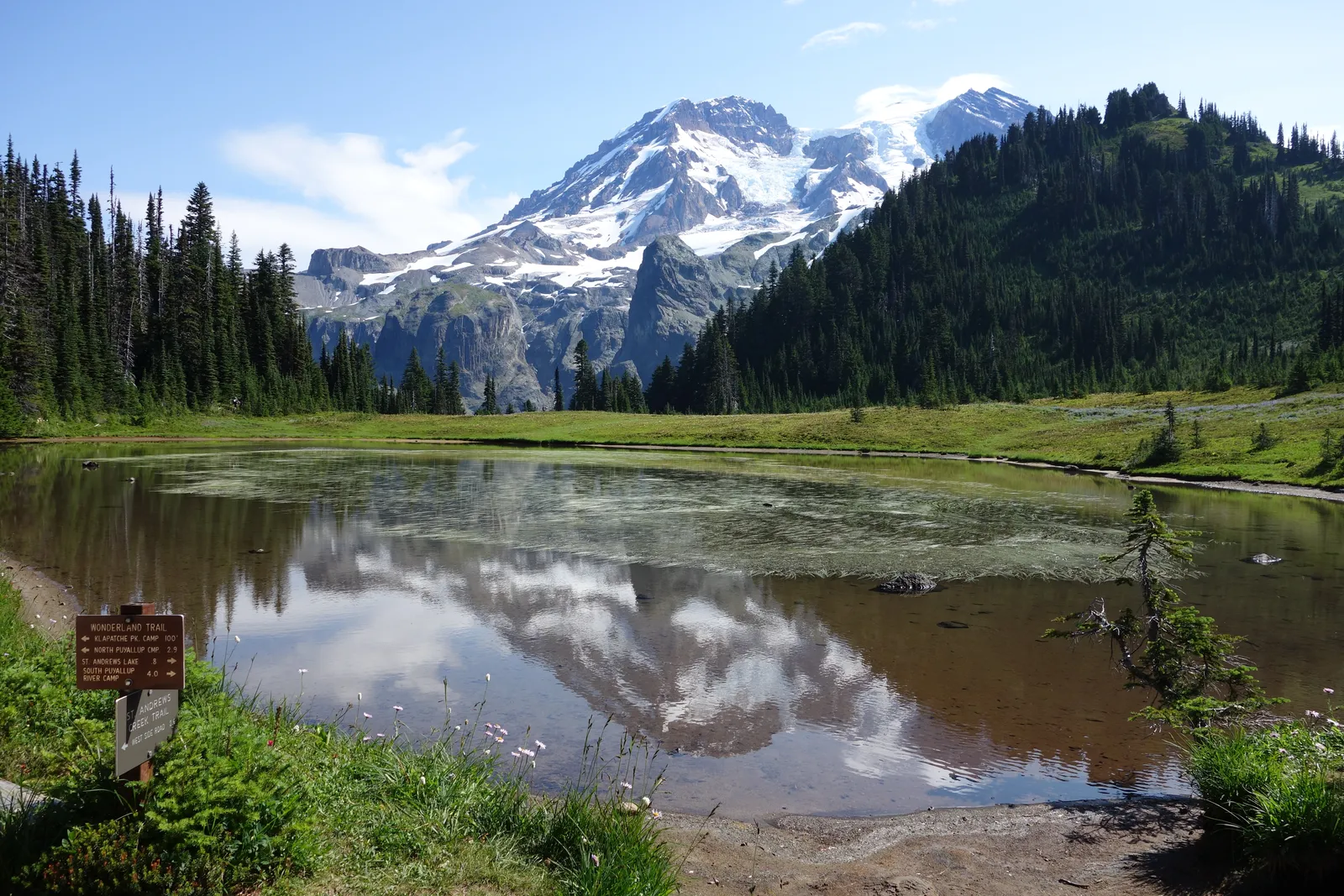
Photo: NPS, public domain, via Wikimedia Commons
- Distance
- about 150 km (93 miles)
- Country
- USA
- Difficulty
- Challenging
- Type of trip
- Hiking trail
The Wonderland Trail is a loop of about 93 miles (150 km) round Mount Rainier, all of it inside Mount Rainier National Park in Washington State. It climbs about 27,000 ft (8,230 m) in total as it drops into the valleys that run off the mountain and climbs out again, and most people take 10 to 14 days. You can only sleep in the 18 wilderness camps along the trail or in the 3 campgrounds you can drive to, at Mowich Lake, White River and Cougar Rock. There's no camping at Longmire. You can post or drop off food to be held at Longmire and White River between July and September, but not at Mowich Lake.
Every night needs a wilderness permit. In 2026 the park's pages described an early-access lottery each February, general booking on Recreation.gov from 25 April for dates between 1 June and 10 October, and about a third of camp spaces kept for walk-ups at the Wilderness Information Centers. The park also says you're unlikely to fit a whole loop together once general booking opens, so the lottery is the usual way in. The fee was $12 a person a night plus $6 a booking.
Highlights along the way
- Indian Henry's Hunting Ground: Meadows on the south-west side of the mountain. The patrol cabin beside the trail was built in 1915, the year the trail was finished, and the park still uses it.
- Klapatche Park: Aurora Lake sits in this high meadow on the western side, with Rainier behind it. The camp here has no group sites, so larger parties have to plan round it.
- Spray Park: North of Mowich Lake you can leave the main line, which goes over Ipsut Pass and down to Ipsut Creek, and take the higher route through Spray Park and Seattle Park. It has two camps of its own, Eagle's Roost and Cataract Valley, and snow often lies there until late August.
- Carbon River: The lowest part of the loop, about 2,320 ft (710 m) near Ipsut Creek. The trail crosses the river on a suspension bridge, one of two on the Wonderland.
- Summerland and Panhandle Gap: Summerland camp is at 5,940 ft, and its shelter was built by the Civilian Conservation Corps in the 1930s. Above it, Panhandle Gap is the highest point on the trail, before you drop to Indian Bar by the Ohanapecosh River.
Distance
About 93 miles (150 km) as a loop, though the park's own table of sections adds up to about 94. The 18 trailside camps are 3 to 7 miles (5 to 11 km) apart. The highest point is Panhandle Gap at 6,750 ft (2,060 m) and the lowest is near Ipsut Creek at 2,320 ft (710 m). The first trail round the mountain, finished by rangers in 1915, was 130 to 140 miles long and ran lower, nearer the park boundary.
Best time to go
The park says the trail is mostly clear of snow from mid-July to October, and in an average year it advises against setting off before mid- to late July. Earlier than that you need to find your way in snow, stop a fall with an ice axe and ford glacier rivers. A storm in November 2006 took out most of the bridges and the trail didn't reopen until August 2007. In early November 2026 the park's conditions page said the trail was closed from the Carbon River suspension bridge to White River Campground because of the Grand Park 2 and Garda Falls fires, with no permits for the full loop until further notice. Check trail conditions and permit dates on nps.gov/mora before you plan.
More journeys in USA
- US Road Trip · Julia & James
- Southwest USA Road Trip · Qinggong
- World Trip - Zero Impact Expedition · David
- Second day · Camila
- Utah Or Bust. · Matthew
- On the road to Harpes Ferry · Xiao
Flyby films from USA
- Ginkgo forest · Xiao
- Second day · Camila
- Saindo de lake Havasu City · Camila
- ALASKA or BUST! · Matt
More routes like this
- Arizona Trail · about 1,290 km (800 miles) · USA
- Pacific Crest Trail · about 4,265 km (2,650 miles) · USA
- Colorado Trail · 782 km (486 miles) · USA
- Appalachian Trail · 3,537 km (2,198 miles) · USA
- Long Trail (Vermont) · 438 km (272 miles) · USA
- Superior Hiking Trail · about 480 km (300 miles) · USA