Continental Divide Trail
- Distance
- about 4,900 km (3,100 miles)
- Countries
- USA, Canada
- Difficulty
- Very challenging
- Type of trip
- Hiking trail
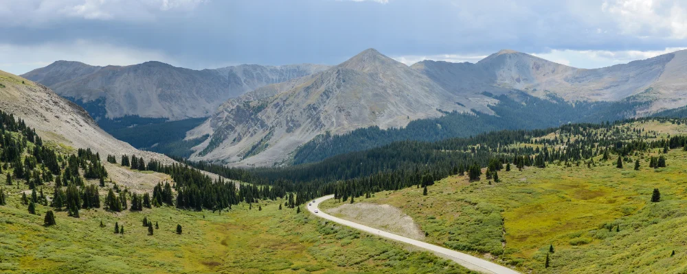
The Continental Divide Trail runs about 4,900 km (roughly 3,000 to 3,100 miles) along the Rocky Mountains from the Mexican border in New Mexico’s Bootheel to the Canadian border at Glacier National Park, through New Mexico, Colorado, Wyoming, Idaho and Montana. Congress made it a National Scenic Trail in 1978, but it still isn’t finished. The Continental Divide Trail Coalition (CDTC) says about 5% isn’t on protected public land, about 260 km (160 miles) still follow roads, and only 69% is on the single-track path it wants. There are also many recognised alternate routes, and most hikers take some of them, so no two thru-hikes are quite the same length. The trail goes from about 1,280 m (4,200 ft) to over 4,300 m, and its highest point is Grays Peak in Colorado, 4,352 m.
Numbers have grown fast. The CDTC estimated about 400 attempts to walk it end to end in 2021, and early estimates for 2024 were 800 to 1,000. A thru-hike takes about five months on average. You camp most nights, often far from roads, and leave the trail to resupply in towns such as Lordsburg, Chama, Rawlins and East Glacier. There’s no single long-distance permit. You’ll need a Blackfeet Nation recreation permit and backcountry camping permits for Yellowstone and Glacier national parks, where you must use set campsites. Since April 2025 the last 1.8 km (1.1 miles) to the southern terminus at the Crazy Cook monument has been inside a military National Defense Area, so you need permission from the US Army at Fort Huachuca to walk to the monument. The CDTC runs a shuttle from Lordsburg, which has Amtrak and Greyhound stops; ask the CDTC where it drops off while the zone is closed.
Highlights along the way
- Gila River: almost every thru-hiker leaves the official route in south-west New Mexico for the Gila River alternate, which follows the river’s canyon through the Gila Wilderness.
- San Juan Mountains: in southern Colorado the trail stays on high ridges through the Weminuche Wilderness, with one 51 km stretch that never drops below 3,660 m (12,000 ft). In a big snow year, snow can cover the trail here into June.
- Wind River Range: in Wyoming more than 190 km of the trail runs along the flanks of the Winds, past lakes and glaciers. The Cirque of the Towers is about 5 km off the trail.
- Yellowstone: the trail crosses the south of the national park and passes Old Faithful and other geyser basins. You can reserve backcountry campsites ahead on Recreation.gov, but in summer you pick up the permit in person, no more than 48 hours before you start.
- Bob Marshall Wilderness and Glacier: in northern Montana the trail runs for 35 km under the Chinese Wall, a limestone cliff about 300 m high, then into Glacier National Park, where grizzly bears live.
Distance
About 4,900 km for a full end-to-end walk. You’ll often see a round 3,100 miles (4,990 km); the CDTC measures the official route at 3,028 miles (4,873 km); and alternates such as the Gila River, the Creede cut-off and the Anaconda cut-off, which is about 97 km (60 miles) shorter, change the total either way.
If you have a GPX of this route from its official site or a planning app, open it in our free GPX viewer to see the distance, the climb and the height profile. The file stays on your device.
Best time to go
Most thru-hikers start northbound from the Mexican border in April or early May. Starting earlier risks deep snow in the San Juan Mountains, which in a big snow year can last into June. At the north end there are two termini. At Waterton you walk into Canada and must phone Canada’s Border Information Service as you cross. The Canada Border Services Agency decides entry case by case. At Chief Mountain the road border crossing is only open from 15 May to 30 September. The Chief Mountain route stays lower than the Waterton route, so it’s the better choice if you’re worried about snow. Fire danger often closes sections; check the CDTC’s Closures and Alerts page before and during your hike.
More journeys in USA, Canada
- Biking Across Canada For Charity · Jeremy
- Long Trail · Lynn
- US Road Trip · Julia & James
- 美国西南自驾游(Southwest USA Road Trip) · Qinggong
- World Trip - One Planet Expedition · David Bossek (Nature Nomad World)
- 🎶 I Would Drive 5000 Miles 🎶 · Matt
Flyby films from USA, Canada
- Friday 6th · Xiao
- Day 20 · Lynn
- Ginkgo forest · Xiao
- Second day · Camila
More routes like this
- Superior Hiking Trail · about 480 km (300 miles) · USA
- Long Trail (Vermont) · 438 km (272 miles) · USA
- West Coast Trail · 75 km (47 miles) · Canada
- Colorado Trail · 782 km (486 miles) · USA
- Wonderland Trail · about 150 km (93 miles) · USA
- Appalachian Trail · 3,537 km (2,198 miles) · USA