Appalachian Trail
- Distance
- 3,537 km (2,198 miles)
- Country
- USA
- Difficulty
- Very challenging
- Type of trip
- Hiking trail
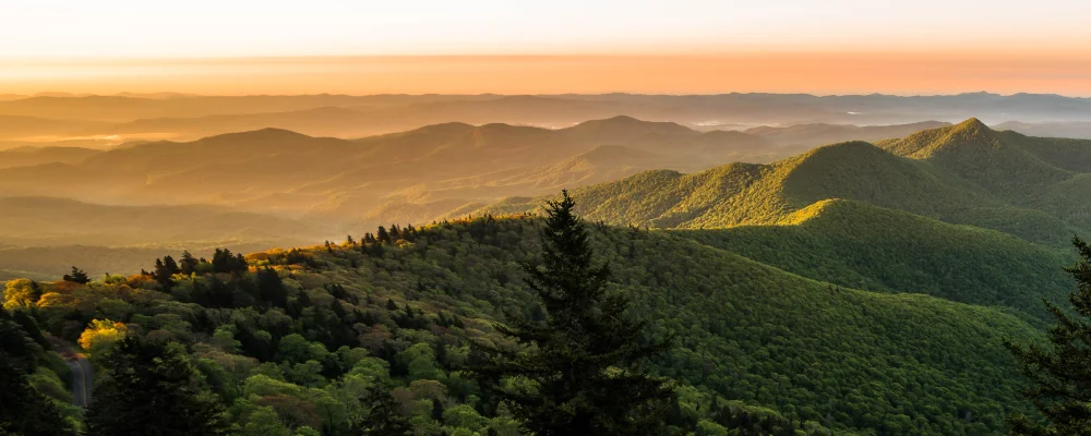
The Appalachian Trail runs 3,537 km (2,197.9 miles) along the Appalachian Mountains, from Springer Mountain in Georgia to Katahdin in Maine’s Baxter State Park, through 14 states. It was finished in 1937 and is now a unit of the US National Park System, managed with the Appalachian Trail Conservancy (ATC) and around 30 volunteer trail clubs. White paint blazes, 5 by 15 cm, mark it the whole way. Virginia has the most of it, 557 miles (about 896 km). The total climb is about 141,600 m, which the ATC compares to climbing Everest 16 times.
More than 3,000 people a year try to walk the whole trail in one go. Most go north, starting in Georgia between February and April and taking just under six months on average. About one in three finish. You sleep in a tent or in the 250-plus three-sided shelters, and the trail crosses roads often enough to reach a town every few days for food. There’s no trail-wide permit, but you need permits in Great Smoky Mountains and Shenandoah national parks and, at the end, a free Long Distance Hiker Permit from Baxter State Park before you climb Katahdin. Registering your start date on ATCamp is voluntary and helps spread hikers out.
Highlights along the way
- Great Smoky Mountains: the trail follows the high ridge on the Tennessee–North Carolina line and crosses Kuwohi (formerly Clingmans Dome), the highest point on the trail at 2,025 m. You need a backcountry permit to camp in the park and must use the shelters when there’s space.
- Shenandoah National Park: about 160 km (101 miles) of trail in Virginia, much of it built by the Civilian Conservation Corps between 1933 and 1942. You need a backcountry permit to camp, and the trail’s huts are first come, first served.
- Harpers Ferry: the trail crosses the Potomac into this small town in West Virginia, known as the trail’s psychological midpoint. The ATC’s headquarters and visitor centre are here.
- White Mountains: in New Hampshire the trail spends long stretches above the trees on the Presidential Range, crossing the summit of Mount Washington (1,917 m). The Appalachian Mountain Club’s huts sell meals and beds, and thru-hikers can sometimes work for a free stay.
- Hundred-Mile Wilderness and Katahdin: the last long stretch runs about 160 km from Monson to Abol Bridge with no towns or public roads, so carry all the food you need for it. The trail ends on the summit of Katahdin, 1,605 m.
Distance
3,537 km (2,197.9 miles), the ATC’s official length for 2026. The figure changes a little every year as the path is moved and remeasured. Add about 14 km (roughly 8.5 miles) if you walk the Approach Trail from Amicalola Falls State Park up to Springer Mountain.
If you have a GPX of this route from its official site or a planning app, open it in our free GPX viewer to see the distance, the climb and the height profile. The file stays on your device.
Best time to go
Most northbound hikers leave Georgia between mid-February and mid-April, which makes those weeks the most crowded, with cold nights early on and heat later. Baxter State Park strongly recommends climbing Katahdin before 15 October, as the summit trails close for the season soon after, depending on the weather. Southbound hikers start at Katahdin and face Maine’s hardest ground first; check Baxter State Park’s opening dates. Starting in the middle and "flip-flopping" gives milder weather and fewer people. Hurricane Helene in September 2024 still affects the south. In October 2026 the ATC listed a road-walk detour at the Nolichucky River, where the bridge was washed away; a closure and detour along the Virginia Creeper Trail near Damascus until the Creeper Trail reopens; and campfire bans in the Roan Highlands and Mount Rogers high country. Check the ATC’s Trail Updates page before you go.
More journeys in USA
- Long Trail · Lynn
- US Road Trip · Julia & James
- 美国西南自驾游(Southwest USA Road Trip) · Qinggong
- World Trip - One Planet Expedition · David Bossek (Nature Nomad World)
- Segundo dia · Camila
- Utah Or Bust. · Matthew
Flyby films from USA
- Friday 6th · Xiao
- Day 20 · Lynn
- Ginkgo forest · Xiao
- Second day · Camila
More routes like this
- John Muir Trail · 340 km (211 miles) · USA
- Colorado Trail · 782 km (486 miles) · USA
- Continental Divide Trail · about 4,900 km (3,100 miles) · USA, Canada
- Wonderland Trail · about 150 km (93 miles) · USA
- Superior Hiking Trail · about 480 km (300 miles) · USA
- Long Trail (Vermont) · 438 km (272 miles) · USA