Arizona Trail
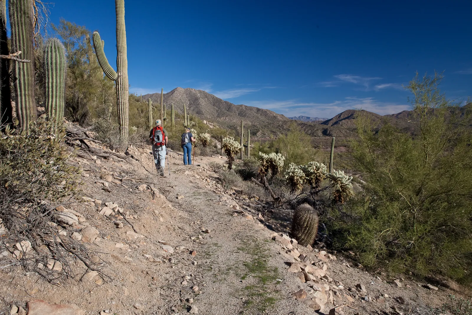
Photo: Bureau of Land Management, public domain, via Wikimedia Commons
- Distance
- about 1,290 km (800 miles)
- Country
- USA
- Difficulty
- Very challenging
- Type of trip
- Hiking trail
The Arizona Trail runs about 800 miles (1,290 km) up the whole length of the state, from the Mexican border in Coronado National Memorial to the Utah border at Stateline Campground. It became a National Scenic Trail in 2009 and was finished on 16 December 2011. The Arizona Trail Association looks after it, split into 43 passages. Thru-hikers take about six to seven weeks, and the trail passes a town where you can resupply every 4 to 6 days.
You camp most nights, and water is the thing to plan. The association says you may need a gallon (nearly 4 litres) a day, and some passages have hardly any. You don't need a permit for the trail as a whole, but you do to camp in a few parks. In Saguaro National Park you can only sleep at Grass Shack or Manning Camp, and in the Grand Canyon only at Bright Angel or Cottonwood campgrounds. As of early November 2026, Phantom Ranch and Bright Angel Campground have been closed since the flood of 29 August 2026. Grand Canyon permits are hard to get.
Highlights along the way
- Huachuca Mountains: The trail leaves the border and climbs straight into the first of the sky islands, mountain ranges that rise thousands of feet out of the desert. It gains over 3,000 ft (900 m) in the first six miles, from grassland up to pine and fir, and snow can lie up there well into spring.
- Gila River Canyons: Passage 16 follows the Gila River for miles through saguaro forest and big cottonwoods, then climbs steeply away past deep side canyons. The river, at about 1,700 ft (520 m), is the lowest point on the trail, and its water is usually muddy.
- Superstition and Mazatzal mountains: North of the Gila the trail crosses the Superstition Wilderness, passes Four Peaks and follows the Mazatzal Divide before climbing onto the Mogollon Rim. These high ridges are where lightning is most dangerous in the summer storms.
- Grand Canyon: Passage 38 goes rim to rim. The South Kaibab Trail drops over 4,000 ft (1,220 m) in about six miles to the Colorado River, with no water and little shade. Then the North Kaibab climbs past Phantom Ranch and Cottonwood to about 8,000 ft (2,440 m) on the North Rim. Bikes have to be carried across with the wheels off the ground.
- Buckskin Mountain: The last passage runs through piñon and juniper on the side of Buckskin Mountain, with the Vermilion Cliffs to the east, then drops down switchbacks to the Utah border. A sandstone monument marks the end at Stateline Campground.
Distance
About 800 miles (1,290 km) in all, from the Mexican border to Utah, in 43 passages. You can't drive to the southern end, and walking down to it from Montezuma Pass and back adds 1.8 miles (2.9 km). The southernmost mile is closed at the moment (see the closures below), so you can't walk down to the border now. About 91 miles (146 km) cross State Trust Land, where you don't need a permit as long as you stay on or near the trail.
Best time to go
Most thru-hikers go north in spring or south in autumn, to miss the worst heat and cold and to find more water. The monsoon from June to August brings afternoon lightning and flash floods, and snow can stay into late spring on the high ground and at the North Rim, where facilities close from mid-October to mid-May. As of early November 2026 the North Rim also has limited services and no lodge, after the Dragon Bravo Fire of 2025. In early November 2026 the association listed some closures. The North Kaibab Trail in the Grand Canyon was shut after flash flood damage on 29 August, and autumn thru-hikers were told to take a shuttle from the North Rim to the South Rim. Part of it is also closed for waterline work from 15 October 2026 to about February 2027. The southernmost mile, from the border to the Joe's Canyon Trail junction, has been closed since 13 April 2026 for border wall building, probably until the end of 2027. Check the closures page on aztrail.org before you go.
More journeys in USA
- US Road Trip · Julia & James
- Southwest USA Road Trip · Qinggong
- World Trip - Zero Impact Expedition · David
- Second day · Camila
- Utah Or Bust. · Matthew
- On the road to Harpes Ferry · Xiao
Flyby films from USA
- Ginkgo forest · Xiao
- Second day · Camila
- Saindo de lake Havasu City · Camila
- ALASKA or BUST! · Matt
More routes like this
- Colorado Trail · 782 km (486 miles) · USA
- Appalachian Trail · 3,537 km (2,198 miles) · USA
- Continental Divide Trail · about 4,900 km (3,100 miles) · USA, Canada
- John Muir Trail · 340 km (211 miles) · USA
- Pacific Crest Trail · about 4,265 km (2,650 miles) · USA
- Wonderland Trail · about 150 km (93 miles) · USA