West Coast Trail
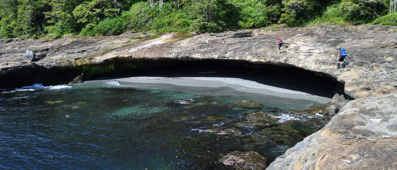
Photo: Paxson Woelber, CC BY 2.0, via Wikimedia Commons
- Distance
- 75 km (47 miles)
- Country
- Canada
- Difficulty
- Very challenging
- Type of trip
- Hiking trail
The West Coast Trail follows the coast of Vancouver Island in British Columbia, through the West Coast Trail Unit of Pacific Rim National Park Reserve. It's 75 km, with one end at Pachena Bay, 5 km south of Bamfield, and the other at Gordon River, 5 km north of Port Renfrew. Parks Canada calls it one of the hardest hikes in the province and says to allow six to eight days end to end. There are more than 100 ladder systems, plus mud, slippery roots, boulders, cable cars and river crossings. The trail runs through the traditional territories of the Huu-ay-aht, Ditidaht and Pacheedaht First Nations.
You can't just turn up. Every hiker needs a reservation, a West Coast Trail backcountry permit and a national park entry pass, and there's no standby list any more. You watch Parks Canada's online safety primer before you go, then register at an orientation centre at either end. Groups are limited to 10. You camp on the beach or at the campsites, which all have outhouses and, where there's room, metal food lockers. Apart from the two ends, the only way on or off is at Nitinaht Narrows, by water taxi from Balaats'adt (Nitinaht Village). Anywhere else, it's only in an emergency.
Highlights along the way
- Pachena Point lighthouse: About 10 km from Pachena Bay. It was built in 1907, after the SS Valencia was wrecked on this coast in 1906 and more than 125 people died. The light station is closed to the public.
- Nitinaht Narrows: At about km 32 a ferry takes you across the narrows. It's also the mid-point way in, by a once-a-day water taxi from Balaats'adt.
- Carmanah Point lighthouse: Built in 1891 and about 44 km along. Just south of it, on the beach, Nytom (once Chez Monique, started in 1993) sells burgers.
- Walbran Creek and the south end: The south is harder than the flatter north. Parks Canada says the 22 km between Gordon River and Walbran Creek takes about two to three days, with ladders, cable cars and steep slopes.
- Thrasher Cove: If you start at Gordon River, Parks Canada advises against going all the way to Camper Bay on the first day. Camp at Thrasher Cove instead.
Distance
75 km (47 miles) officially, though GPS tracks come out between 80 and 92 km (50 to 57 miles). The kilometre markers start at Pachena Bay: Pachena lighthouse is at 10, Klanawa River at 25, Nitinaht Narrows at 32, Carmanah lighthouse at 44, Walbran Creek at 53 and Camper Creek at 62, with Gordon River at 75. Most people take six to eight days.
Best time to go
The trail is only open in summer. Parks Canada gives the season as 1 May to 30 September, and the trail is closed from 7 October to 30 April; the Gordon River and Nitinaht Narrows ferries run daily from 1 May to 7 October. Bookings for 2026 opened on 5 February 2026, and 2027 dates weren't out in November 2026, so check the Parks Canada West Coast Trail page. Whenever you go, carry the tide tables and map you're given at registration, because some headlands can cut you off at high tide. Rivers can flood and hold you up for days, and you shouldn't cross when the water is above your knees.
More journeys in Canada
- Biking Across Canada For Charity · Jeremy
- 🎶 I Would Drive 5000 Miles 🎶 · Matt
- White Rock Tour · Geoffrey
- Trip To Banff · Doug
- A Weekend In Whistler · jjsereday
- Three Bridges · Geoffrey
Flyby films from Canada
- ALASKA or BUST! · Matt
- deer · David
- Day 66 · Jeremy
More routes like this
- Continental Divide Trail · about 4,900 km (3,100 miles) · USA, Canada
- Camino Lebaniego · about 73 km (45 miles) · Spain
- Ruta del Cares on foot · 22 km (14 miles) · Spain
- Pindus Way · about 460 km (286 miles) · Greece
- Te Araroa Trail · about 3,000 km (1,900 miles) · New Zealand
- Camino Sanabrés · about 362 km (225 miles) · Spain