Superior Hiking Trail
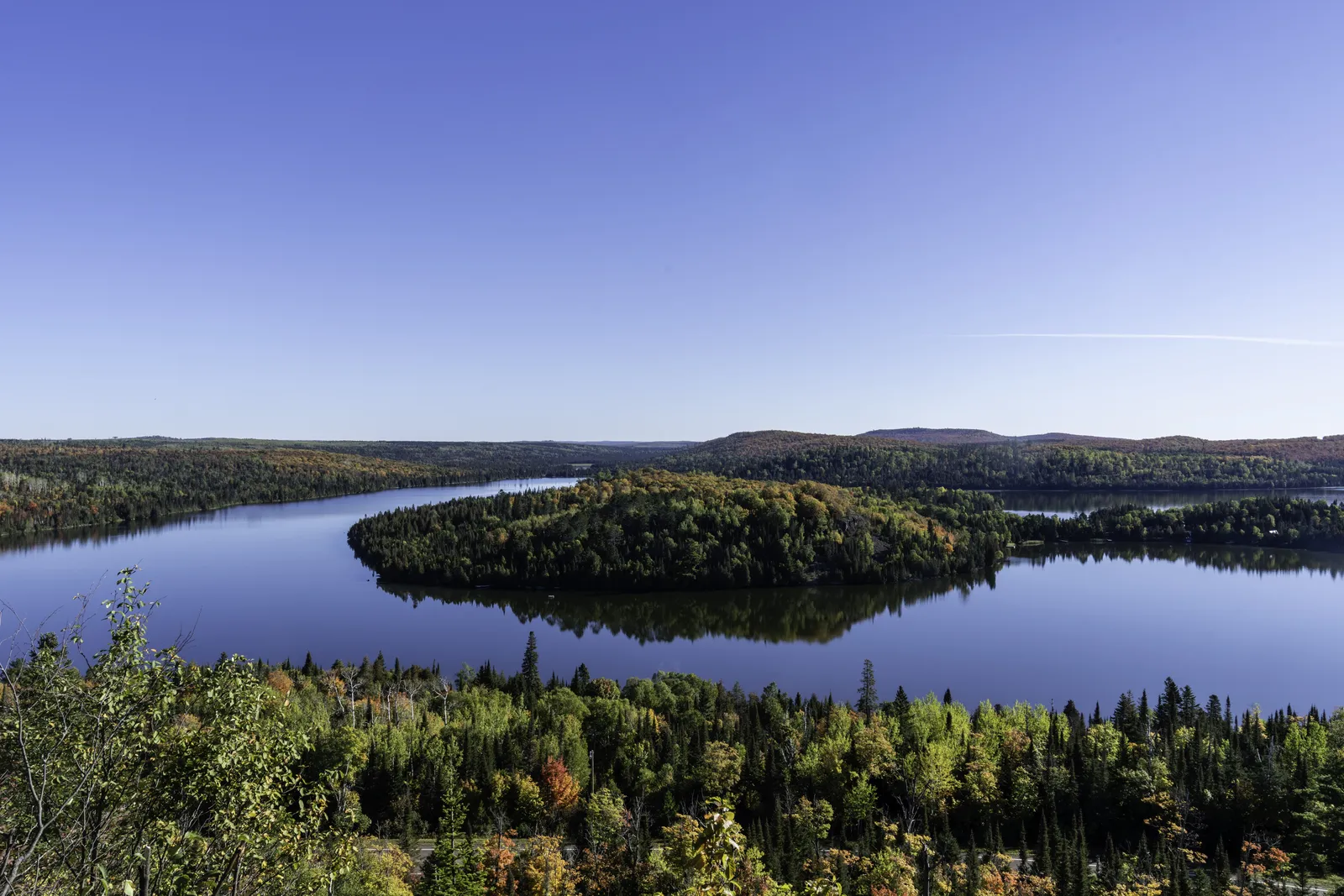
Photo: Lorie Shaull, CC BY 2.0, via Wikimedia Commons
- Distance
- about 480 km (300 miles)
- Country
- USA
- Difficulty
- Moderate to challenging
- Type of trip
- Hiking trail
The Superior Hiking Trail runs about 300 miles (480 km) through north-east Minnesota, mostly along rocky ridges above the North Shore of Lake Superior. It starts at the Wisconsin border south-west of Duluth, goes through the city and then follows the shore north-east to the 270 Degree Overlook, near the Canadian border. The Superior Hiking Trail Association has looked after it since 1986. A thru-hike usually takes 2 to 4 weeks, and the usual starting point is Martin Road on the edge of Duluth, because there are almost no trail campsites in the city.
There are 94 free campsites along the trail, with no bookings or permits, and you have to use them. Camping anywhere else isn't allowed. Hang your food at night because of bears. To resupply you walk or get a lift into small towns off the trail. There's no regular transport at either end, and shuttles can be fully booked in late summer and early autumn, so arrange your lift before you set off.
Highlights along the way
- Duluth: The first 50 miles (80 km) or so go through Jay Cooke State Park, along the St. Louis River and through the city, past Enger Park, Canal Park and the Lakewalk. There's no trail campsite inside the city limits, so you use paid campgrounds such as Spirit Mountain. At the southern end the North Country Trail carries on into Wisconsin.
- Gooseberry Falls and the Split Rock River: The trail follows the Gooseberry River for 4 miles, with a spur down to the falls and the lake. Further on, the Split Rock River loop climbs past waterfalls and tall rock pillars. There's no bridge over the Split Rock River now, so take care crossing or use the association's other route.
- Bean and Bear Lakes: Between Silver Bay and Tettegouche State Park is one of the hardest stretches. The ridge looks down on Bean and Bear Lakes, the Drainpipe drops steeply down giant rock steps, and the trail crosses the High Falls of the Baptism River, the highest waterfall entirely in Minnesota.
- Temperance River and Carlton Peak: The trail climbs beside the Temperance River in its gorge, then up to the top of Carlton Peak. Near Lutsen there's a 1.8-mile (2.9 km) loop round the overlooks of Oberg Mountain, then steep climbs over Moose and Mystery mountains.
- The northern end: Past Grand Marais the trail drops into the Devil Track River gorge, follows the Brule River past Devil's Kettle Falls and runs for 1.6 miles (2.6 km) along Lake Superior's sandy shore. The highest point, 1,829 ft (557 m), is in balsam forest with no view. The last mile is on the Border Route Trail to the 270 Degree Overlook.
Distance
About 300 miles (480 km) in all by the association's count, not including spur trails. Wikipedia gives 310 miles plus 17 miles (27 km) of spurs, with about 50 miles (80 km) in the Duluth section and 260 miles (420 km) on the North Shore, where walking north you climb about 37,800 ft (11,500 m). There are more than 60 trailheads, most of them 3 to 11 miles (5 to 18 km) apart, so it's easy to walk in pieces.
Best time to go
The association says to be ready for three-season conditions from May to October and winter conditions from October to May, and the weather by the lake swings a lot. Ticks, mosquitoes and black flies are about from April to October, though a couple of frosty autumn nights mostly clear the flies. Autumn is hunting season, so wear blaze orange. For the firearms deer season in 2026, 7 to 22 November, several stretches between Duluth and Castle Danger were closed from 31 October to 22 November. Near Grand Marais, a private parcel between Lindskog Road and Cook County Road 14 was closed for the whole firearms season, so don't try to walk through that section. Check the trail conditions page on superiorhiking.org before you go.
More journeys in USA
- US Road Trip · Julia & James
- Southwest USA Road Trip · Qinggong
- World Trip - Zero Impact Expedition · David
- Second day · Camila
- Utah Or Bust. · Matthew
- On the road to Harpes Ferry · Xiao
Flyby films from USA
- Ginkgo forest · Xiao
- Second day · Camila
- Saindo de lake Havasu City · Camila
- ALASKA or BUST! · Matt
More routes like this
- Arizona Trail · about 1,290 km (800 miles) · USA
- John Muir Trail · 340 km (211 miles) · USA
- Appalachian Trail · 3,537 km (2,198 miles) · USA
- Pacific Crest Trail · about 4,265 km (2,650 miles) · USA
- Long Trail (Vermont) · 438 km (272 miles) · USA
- Colorado Trail · 782 km (486 miles) · USA