Lycian Way
- Distance
- about 760 km (470 miles)
- Country
- Turkey
- Difficulty
- Challenging
- Type of trip
- Hiking trail
The Lycian Way (Likya Yolu) is a waymarked footpath of about 760 km round the coast and hills of ancient Lycia in south-west Turkey, from Ölüdeniz near Fethiye to Geyikbayırı in the hills west of Antalya. Kate Clow, a British-Turkish amateur historian, researched and marked it in 1999, and it was Turkey’s first long-distance walking route. It follows Roman roads, old footpaths and mule trails between the Lycian cities, and it’s marked with red-and-white stripes. The path splits in places, with coastal and inland options, a network of side routes called the St Nicholas Ways above Demre, and a high inland route over the flank of Tahtalı Dağı, the ancient Mount Olympos.
The Culture Routes Society, which maintains the trail, reckons on 35 days for the whole route. It’s hard going, stony underfoot with steep climbs between the coast and the mountains, and some stretches have little water. Except on three high sections, you can stay each night in village houses, pensions or small hotels, and there are plenty of places to camp wild. Buses run along most of the coast, so it’s easy to walk it in sections. The start is about two hours by road from Dalaman airport, and buses run from Geyikbayırı to Antalya. Check the society’s route updates page before you go, as some sections have been rerouted.
Highlights along the way
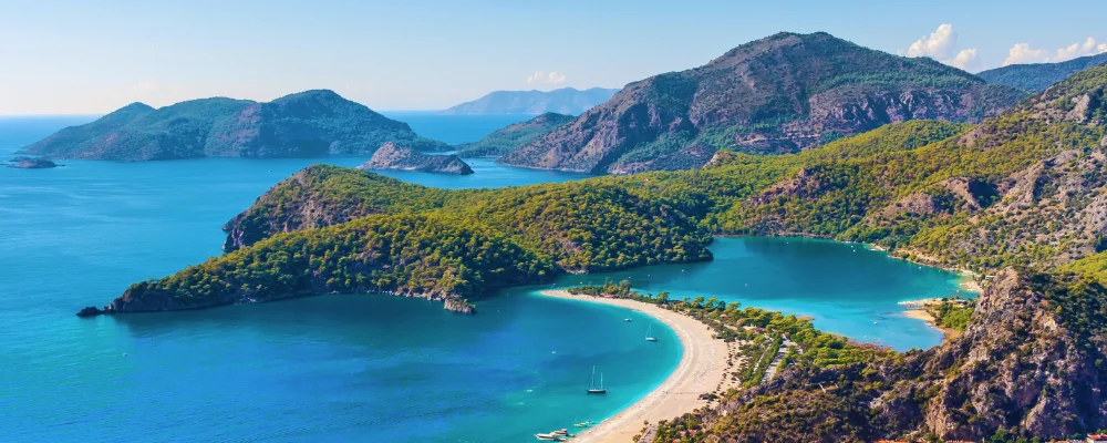
- Ölüdeniz and Butterfly Valley: the trail starts above the lagoon at Ölüdeniz and runs along the cliffs past Faralya, above Butterfly Valley, a narrow canyon with walls 350 to 400 m high.
- Xanthos and Letoon: the old Lycian capital and its sanctuary, listed together by UNESCO in 1988 for their tombs and Lycian inscriptions. A branch of the trail runs direct from Sidyma to Xanthos.
- Patara: a Lycian port city, the birthplace of Saint Nicholas around 270, with ruins running down to a long sandy beach.
- Kekova: the coast around Üçağız and Kaleköy (ancient Simena), with the partly sunken ruins of an ancient town along the north shore of Kekova island. Kaleköy has no road; you get there by boat or along the trail from Üçağız.
- Myra and the Chimaera: at Demre (Myra), Lycian tombs carved into the cliff above a Roman theatre, and the church of St Nicholas, who was bishop here. Further east, above Çıralı, the Chimaera (Yanartaş) is a hillside of small gas fires that have burned for at least 2,500 years.
Distance
About 760 km (470 miles) from Ölüdeniz to Geyikbayırı, the Culture Routes Society’s figure. Wikipedia’s infobox gives about 520 km, and older sources give figures around 500 to 540 km, so check which line your guidebook or app follows.
If you have a GPX of this route from its official site or a planning app, open it in our free GPX viewer to see the distance, the climb and the height profile. The file stays on your device.
Best time to go
February to May and September to November. The Culture Routes Society recommends February in particular, as it’s often warmer and sunnier than March. July and August are too hot for long walks, and even mid-May and mid-September can be hot on the low sections. From January to early April there’s usually snow above about 1,500 m, which affects the high inland routes, and December and January bring heavy rain and storms.
More journeys in Turkey
- Cycle Exped to Japan via Finland · Mark
- UK to Georgia by Bike · Simon & Lucy
- 2026 Solo Aegean Tour · Alkan
- Istanbul To Ashby · Harry
Flyby films from Turkey
- STAGE 15 etap 7 - July 13 2026 · Mark
- Driving Home To ... · Alkan
- Greece · Harry
- Turkey · Simon & Lucy
More routes like this
- Maarten van Rossumpad on foot · about 384 km (239 miles) · Netherlands
- Drakensberg Grand Traverse · 220–240 km (137–149 miles) · South Africa, Lesotho
- Moselcamino on foot · about 160 km (99 miles) · Germany
- E5 from Oberstdorf to Meran on foot · about 120 km (75 miles) · Germany, Austria, Italy
- Albsteig (HW1) on foot · about 360 km (224 miles) · Germany
- Alta Via 1 trek · about 115 km (72 miles) · Italy