Moselcamino on foot
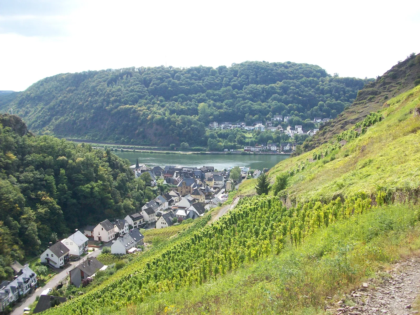
Photo: Woscho, CC BY-SA 3.0, via Wikimedia Commons
- Distance
- about 160 km (99 miles)
- Country
- Germany
- Difficulty
- Moderate
- Type of trip
- Hiking trail
The Mosel-Camino is a Way of St James pilgrim path from Koblenz-Stolzenfels, on the Rhine, to the Benedictine abbey of St. Matthias in Trier, where the Apostle Matthias is buried. It's about 160 km. It doesn't stick to the riverbank. The path runs on both sides of the Mosel and climbs onto the Eifel and Hunsrück heights to cut off the big bends. The route's own site suggests 8 stages, with nights in Alken, Treis-Karden, Bullay, Traben-Trarbach, Osann-Monzel, Klüsserath and Schweich, but says that's only a suggestion. You sleep in guesthouses, hotels, church and private rooms, and there are pilgrim hostels in Traben-Trarbach and Klausen. Booking ahead is wise in the tourist towns. Almost every stage town has a stamp for your pilgrim passport.
Karl-Josef Schäfer and Wolfgang Welter set it up as a private project, and it has been waymarked all the way since 2008, under the patronage of the St. Jakobusbruderschaft in Trier. Look for a yellow scallop shell on a blue sign and yellow arrows. The lines of the shell point the way, and the marking only works heading towards Trier. Expect about 4,400 m of climbing in total. Some of the vineyard paths are steep, so you need sure feet and good boots, and the two steepest descents, down to Alken and to Karden, have marked alternatives. The path isn't suitable for wheelchairs; the route's site points wheelchair users to the Mosel cycle path instead.
Highlights along the way
- Bleidenberg and Alken: The pilgrimage church on the Bleidenberg, above Oberfell, comes at about km 18 on the first day. From there a steep way of the cross drops to Alken. There's a gentler marked way down the Alkener Bach valley.
- Burg Eltz: The second stage goes past this castle between Hatzenport and Treis-Karden.
- Karden: The collegiate church of St. Castor has a statue of St James on its Stephanus altar, dated 1628.
- Beilstein: On stage 3 you walk via Kloster Maria Engelport, which has a sign giving the distance to Santiago, to this small Mosel town with its Carmelite church. Beilstein has a scallop shell in its coat of arms.
- Trier and St. Matthias: The last stage comes in through Quint, Ehrang and Biewer, where the Via Coloniensis from Cologne joins. It ends at the abbey of St. Matthias and the apostle's sarcophagus.
Distance
About 160 km (99 miles) from Stolzenfels to St. Matthias. The place-to-place distances on the route's site are rounded up and come to about 165 km (103 miles). Walking to the start from Koblenz station adds about 6 km along the Rhine or 9 km through the city forest, and in Trier the route past the cathedral is about 3 km longer. Stages are about 16 to 28 km. The lowest point is 64 m and the highest 434 m.
Best time to go
Spring to autumn is the usual walking season. In autumn and winter, drive hunts can close or divert parts of the path, so follow any signs on the day. The route's site keeps a list of closures and diversions. In November 2025, for example, a landslide closed the zigzag path below the Grevenburg at Traben-Trarbach. Read that list before you set off, and check the opening hours of the Dom-Information in Trier if you want to collect your pilgrim certificate there.
More journeys in Germany
- Cycle Exped to Japan via Finland · Mark
- The Great Spirits Route · johan
- UK to Georgia by Bike · Simon & Lucy
- Denmark! · Christopher
- Istanbul To Ashby · Harry
- Beer hike · Christopher
Flyby films from Germany
- Dag 8: Schongau - Innsbruck · johan
- Stuttgart-Amsterdam · JereFü
- St Malo to Vienna · Lucy
- The Start · Christopher
More routes like this
- Harzer Hexenstieg on foot · about 94 km (58 miles) · Germany
- Altmühltal-Panoramaweg on foot · about 200 km (124 miles) · Germany
- Lechweg on foot · about 125 km (78 miles) · Austria, Germany
- Westweg on foot · about 285 km (177 miles) · Germany
- Rheinsteig on foot · about 320 km (199 miles) · Germany
- Saar-Hunsrück-Steig on foot · about 415 km (258 miles) · Germany