Drakensberg Grand Traverse
- Distance
- 220–240 km (137–149 miles)
- Countries
- South Africa, Lesotho
- Difficulty
- Very challenging
- Type of trip
- Hiking trail
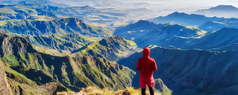
There’s no official, marked trail called the Drakensberg Traverse. What hikers mean by it is the Drakensberg Grand Traverse, a route agreed among hikers along the top of the escarpment. It runs from the Sentinel car park above Witsieshoek, in South Africa’s Free State, to the Bushman’s Nek border post in KwaZulu-Natal, and the only fixed points are the summits you have to reach: Mont-aux-Sources, Cleft Peak, Champagne Castle, Mafadi, Giant’s Castle and Thabana Ntlenyana. How you get between them is up to you. Most of the walking is on the high basalt plateau at around 3,000 m, and the top of the escarpment is Lesotho, not South Africa.
There are no huts, shops, waymarks or resupply points. You carry everything and camp, following cattle paths, grassy ridges and river beds. The only people you’re likely to meet are Basotho herders. Hiking South Africa puts the total climbing at about 10,000 m and says fit hikers take 8 to 12 days, averaging about 23 km a day. Navigation is the hard part: fog can come in at any time, so carry the Ezemvelo KZN Wildlife 1:50,000 Drakensberg maps (sheets 1 to 6) and a GPS. The South African side is the uKhahlamba-Drakensberg Park, run by Ezemvelo KZN Wildlife. Check permits, mountain registers and fees with them before you go. You finish at a border post after days in Lesotho, so carry your passport and check the current border rules. Check recent security reports for the Lesotho highlands too.
Highlights along the way
- Chain ladders and Mont-aux-Sources: the walk starts at the Sentinel car park at about 2,500 m and climbs to the plateau by chain ladders. Mont-aux-Sources, the first summit, is 3,282 m.
- Tugela Falls and the Amphitheatre: the Tugela River drops about 948 m in five falls from the edge of the Amphitheatre, a wall of cliffs more than 5 km long. The falls are seasonal, so in dry months there may be little water.
- Mafadi: at 3,446 m, the highest point in South Africa, on the border with Lesotho.
- Thabana Ntlenyana: at 3,482 m, the highest mountain in southern Africa, inside Lesotho on a ridge north of Sani Pass.
- Bushman’s Nek: the finish, usually reached by going down the Thamathu Pass to the border post.
Distance
Roughly 220 to 240 km, Hiking South Africa says, depending on the line you take between the summits.
If you have a GPX of this route from its official site or a planning app, open it in our free GPX viewer to see the distance, the climb and the height profile. The file stays on your device.
Best time to go
March to May and September to November are the most popular months. From December to February, most of the year’s rain falls as thunderstorms, with lightning on open ridges. June to August usually brings clearer, more settled weather, but nights are well below freezing and snow is possible. The weather can change fast in any month.
Flyby films from South Africa, Lesotho
- Route from Maun to Makgadikgadi · Karin
More routes like this
- Rim of Africa trek · about 700 km (435 miles) · South Africa
- Via di Francesco on foot · about 500 km (311 miles) · Italy
- Camino Portugués on foot · 241 km (150 miles) · Portugal, Spain
- Pelgrimspad on foot · about 456 km (283 miles) · Netherlands, Belgium
- Via Podiensis (GR 65) on foot · 755 km (469 miles) · France
- Kerry Way · 232 km (144 miles) · Ireland