Climbing Kilimanjaro
- Distance
- about 62 km (39 miles)
- Country
- Tanzania
- Difficulty
- Very challenging
- Type of trip
- Hiking trail
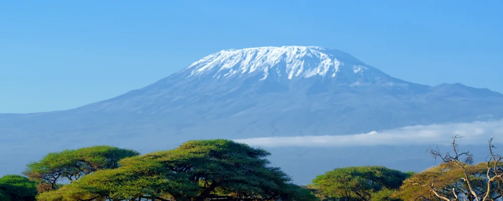
There’s no single "Kilimanjaro trek". The mountain has several official routes to Uhuru Peak (5,895 m), the highest point in Africa, on the crater rim of Kibo, the tallest of Kilimanjaro’s three volcanic cones. The main ones are Marangu, Machame, Lemosho, Rongai, Umbwe, Shira and the Northern Circuit, and most descents use the Mweka route, which is for coming down only. Machame is the most used. Marangu is the only route with huts; on the others you sleep in tents carried up by porters. Everything above the farmland is Kilimanjaro National Park, run by Tanzania National Parks (TANAPA). You can only climb on the designated routes and with a licensed guide, so in practice you book through a tour operator, who arranges the guide, porters, cook, park permits and food.
The climb isn’t technical, but the altitude is serious. Most itineraries go from park gates at roughly 1,600 to 2,100 m to the summit and back in five to nine days, and acute mountain sickness is common. In one study of climbers on the Lemosho and Machame routes, about 70% had symptoms. Longer itineraries, such as seven days on Machame or eight on Lemosho, give your body more time to adjust and have better summit rates. Summit night starts around midnight from Barafu Camp or Kibo Hut (4,730 m), so you reach the crater rim around dawn. Most climbers fly into Kilimanjaro International Airport and stay in Moshi or Arusha, an hour or two from the gates. Check park fees and the current rules with TANAPA or your operator.
Highlights along the way
- Rainforest belt: the first day on the southern routes climbs through montane forest between about 1,800 and 2,800 m, where blue monkeys and black-and-white colobus live. Large animals are rare this high.
- Shira Plateau: Lemosho and Machame cross this broad, high plain at about 3,800 m, probably the filled-in crater of the old Shira volcano.
- Lava Tower and Barranco: on Machame and Lemosho you climb to Lava Tower at about 4,630 m and drop back to sleep at Barranco Camp, about 650 m lower, to help you acclimatise. Next morning the Barranco Wall is a steep scramble but needs no climbing gear.
- The Saddle: Marangu and Rongai cross this 5 km wide high-altitude desert at about 4,400 m between Kibo and the jagged peak of Mawenzi (5,149 m).
- Uhuru Peak: the top of Africa at 5,895 m, reached by walking round the crater rim, about two hours from Gilman’s Point (5,681 m) on the Marangu side. The ice is going fast: about 85% of the ice cover disappeared between 1912 and 2011.
Distance
About 62 km on the Machame route, the most popular, from Machame Gate to Mweka Gate. Other routes are shorter or longer, from about 5 days on Marangu or Umbwe to 9 days on the Northern Circuit.
If you have a GPX of this route from its official site or a planning app, open it in our free GPX viewer to see the distance, the climb and the height profile. The file stays on your device.
Best time to go
January to March and June to October are the main climbing months. June to October is drier and busier. January to March is quieter but colder, with more chance of snow on the summit. March to May brings the heaviest rain, with another wet spell around November, which makes the forest trails muddy and the views poor. The northern slopes get less rain, so Rongai is the usual choice in the wetter months. Snow can fall on the summit in any month, and nights at the top are well below freezing all year.
More routes like this
- Nakasendo Trail · 8 km (5 miles) · Japan
- Eifelsteig trail · about 313 km (195 miles) · Germany
- Camino de Invierno · 239 km (149 miles) · Spain
- Heysen Trail · about 1,200 km (750 miles) · Australia
- Albsteig (HW1) on foot · about 360 km (224 miles) · Germany
- Dingle Way · 163 km (101 miles) · Ireland