Eifelsteig trail
- Distance
- about 313 km (195 miles)
- Country
- Germany
- Difficulty
- Moderate
- Type of trip
- Hiking trail
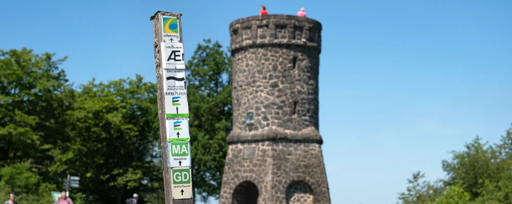
The Eifelsteig is a 313 km waymarked walking trail across the Eifel uplands of western Germany, from Kornelimünster on the edge of Aachen to Trier on the Moselle. It’s split into 15 day stages, each 15 to 28 km, and walking it end to end takes about 15 days, with about 7,400 m of climbing in total if you add up the official stage figures. It carries the Deutsches Wandersiegel as a Premiumweg, checked every three years by the Deutsches Wanderinstitut. The yellow-and-green Eifelsteig logo marks it in both directions, so you can just as easily walk it from Trier to Aachen. On stage 2 the path crosses the old Vennbahn railway line, which belongs to Belgium, and for a while it switches between Belgian and German ground, where the marking becomes a yellow-green bar.
The trail goes from moorland in the Hohes Venn, through the Eifel National Park and its reservoirs, across the limestone Kalkeifel and the volcanic Vulkaneifel with its maars, then down the Lieser and Kyll valleys to the red sandstone cliffs above Trier. You sleep in hotels, guesthouses, holiday flats and youth hostels in the stage towns. You can book luggage transfer and shuttles. Trains run to Aachen, with buses on to Kornelimünster, and Trier has trains home. Several sections have long-running diversions. Stage 14 can only be walked as far as the Deimlinger Mühle, about 5 km short of Kordel, because a bridge was destroyed in 2021. On stage 15 the Butzerbachtal near Kordel has been closed since 2021, with a signed diversion via Burg Ramstein. Forestry work has closed parts of stage 3 between Hammer and Einruhr at times. It was no longer listed on eifelsteig.de in early November 2026, so check the stage page before you go. Check each stage page on eifelsteig.de before you set off.
Highlights along the way
- Hohes Venn: a high moor on stage 2, crossed on a long straight track. Just after it you reach the Steling viewpoint, which at 658 m is the highest point on the trail. On stage 1 there are boardwalks across the smaller Struffelt Heide moor.
- Urft dam and Vogelsang: stage 4 crosses the Eifel National Park past the Urfttalsperre, one of the oldest dams in Germany, and the former Nazi training centre at Vogelsang, which now houses the national park centre.
- Gerolstein Dolomites: rock cliffs above Gerolstein on stage 9, the remains of a coral reef from a warm sea about 390 million years ago. On the same stage you pass the old millstone caves cut into the Rother Kopf volcano.
- The Daun maars: on stage 11 you walk past the Gemündener, Weinfelder and Schalkenmehrener maars, round lakes in volcanic craters, then down the Lieser valley to the castles of Manderscheid.
- Kordel to Trier: the last stage passes the Genovevahöhle, a sandstone cave you climb into by steps, and an old Roman mine, before dropping to Trier. The city’s Roman north gate, the Porta Nigra, is a UNESCO World Heritage Site.
Distance
About 313 km (195 miles) from Aachen-Kornelimünster to Trier, in 15 stages of 15 to 28 km. The official end is the Weißhaus car park, 2.5 km above Trier’s centre.
Best time to go
April to October. Broom flowers yellow on the Dreiborn plateau around May and June, and the beech and oak woods change colour from September. The weather is changeable in any month, so bring waterproofs. A bus for walkers runs along stages 5 to 7 (Kall to Mirbach) in 2026; check the timetable on eifelsteig.de.
More journeys in Germany
- Cycle Exped to Japan via Finland · Mark
- The Great Spirits Route · johan
- UK to Georgia by Bike · Simon & Lucy
- Denmark! · Christopher
- Istanbul To Ashby · Harry
- Beer hike · Christopher
Flyby films from Germany
- Dag 8: Schongau - Innsbruck · johan
- Stuttgart-Amsterdam · JereFü
- St Malo to Vienna · Lucy
- The Start · Christopher
More routes like this
- Hermannsweg on foot · about 163 km (101 miles) · Germany
- Rheinsteig on foot · about 320 km (199 miles) · Germany
- Lechweg on foot · about 125 km (78 miles) · Austria, Germany
- Saar-Hunsrück-Steig on foot · about 415 km (258 miles) · Germany
- Westweg on foot · about 285 km (177 miles) · Germany
- Marskramerpad on foot · about 372 km (231 miles) · Netherlands, Germany