Pennine Way
- Distance
- about 431 km (268 miles)
- Countries
- England, Scotland
- Difficulty
- Challenging
- Type of trip
- Hiking trail
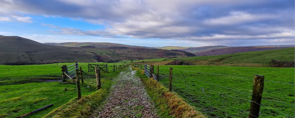
The Pennine Way runs 431 km up the Pennine hills from Edale in the Peak District to Kirk Yetholm, just over the border in Scotland. It was England’s first National Trail, opened in 1965 after the journalist Tom Stephenson proposed it in 1935. On the way it crosses the Peak District, the South Pennines, the Yorkshire Dales, the North Pennines and Northumberland National Park, mostly over open moor, gritstone edges and limestone, with long stretches between villages.
Most people take 16 to 19 days for the whole trail. You sleep in youth hostels, B&Bs, pubs and campsites, and accommodation is thin in places, so book ahead. There’s normally no right to wild camp in England, so ask the landowner. The first two days out of Edale are among the hardest, and several days cross wet peat bog. The last stage, 27 miles (43 km) over the Cheviot Hills from Byrness, has no villages at all; most walkers do it in one long day, and there are two refuge huts on the way. Trains run to Edale from Manchester Piccadilly, and from Kirk Yetholm you take a bus or taxi to Berwick-upon-Tweed for trains south.
Highlights along the way
- Kinder Scout: the trail climbs Jacob’s Ladder onto the gritstone plateau about 4 km from Edale, then follows its western edge past Kinder Downfall, the Peak District’s tallest waterfall at 30 m.
- Malham Cove: a curved limestone cliff about 80 m high just north of Malham village, with a big limestone pavement on top. The trail climbs up beside it.
- High Force: the River Tees drops about 21 m over the Whin Sill in Teesdale, with the largest volume of any unbroken waterfall in England when it’s in spate.
- Cross Fell: at 893 m the highest point of the trail, reached after Great Dun Fell and Little Dun Fell. Greg’s Hut, a bothy just north of the summit, is the highest in England, and snow often lies in the gullies until May.
- Hadrian’s Wall: from Greenhead the trail follows the wall for about 13 km (8 miles) on the same path as the Hadrian’s Wall Path, past Once Brewed towards Housesteads.
Distance
About 431 km (268 miles) counting every option, including both sides of the Bowes Loop, the High Cup Nick alternative and the detour to the summit of The Cheviot. Walking end to end on one line, you cover nearer 407 km (253 miles).
If you have a GPX of this route from its official site or a planning app, open it in our free GPX viewer to see the distance, the climb and the height profile. The file stays on your device.
Best time to go
Mid-May to September, which the National Trail site gives as the most settled weather. The trail can be walked all year, but the Pennines get around 2.5 m of rain and snow a year, the tops can be close to freezing even in July with wind-chill, and Cross Fell can hold snow into May. As of 2 November 2026 there is a diversion between Alston and Garrigill because of flood damage to a footbridge over the South Tyne, and the National Trail site lists a short road diversion through Bellingham from 16 November 2026 to 26 March 2027. Check the diversions on nationaltrail.co.uk before you go.
More journeys in England, Scotland
- Scotland West Coast Train · Greg
- Exmouth towards Poole SWCP · Greg
- Cycling the Hebridean Way · Simon & Lucy
- Folk on a Boat · Simon & Lucy
- Saga Sæunnar · saeunn
- Bristol Rides · David
Flyby films from England, Scotland
- Kenya safari · Alison Popper
- The Great Escape · saeunn
- Ferry to UK · Greg
- Exeter towards Poole · Greg
More routes like this
- South West Coast Path · about 1,014 km (630 miles) · England
- Jurassic Coast walk · about 182 km (113 miles) · England
- Cotswold Way · about 164 km (102 miles) · England
- Cleveland Way · 175 km (109 miles) · England
- Dales Way · 128 km (80 miles) · England
- Hadrian’s Wall Path · about 135 km (84 miles) · England