Cotswold Way
- Distance
- about 164 km (102 miles)
- Country
- England
- Difficulty
- Moderate
- Type of trip
- Hiking trail
The Cotswold Way is a 164 km National Trail along the Cotswold escarpment, from the market town of Chipping Campden in Gloucestershire to the centre of Bath. It became a National Trail in 2007 and is waymarked with the acorn symbol in both directions. For most of the way you’re on the edge of the hills, looking west over the Severn Vale to the Malverns, the Forest of Dean and the Welsh hills, then dropping into villages built of yellow Cotswold limestone.
The official guidebook allows seven to ten days, and the trail is split into 15 sections. Only about 8% is on roads, but there are a lot of short, steep climbs on and off the escarpment, more than most people expect. You sleep in B&Bs, inns, hotels and on campsites. Wild camping isn’t allowed, so plan nights around villages. Moreton-in-Marsh is the nearest main-line station to Chipping Campden, with local buses from there, and Bath has a main-line station at the other end.
Highlights along the way
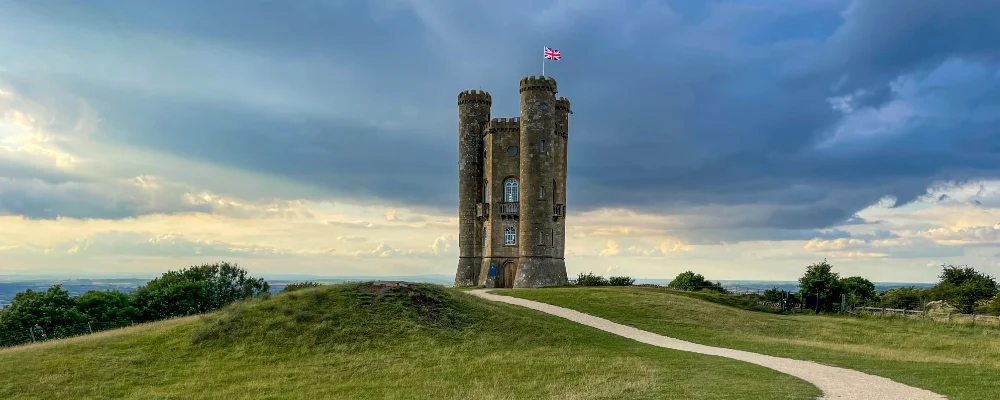
- Broadway Tower: a 20 m folly built in 1798–99 on Broadway Hill, at 312 m the second-highest point in the Cotswolds, early on the first day out of Chipping Campden.
- Belas Knap: a Neolithic chambered long barrow from around 3000 BC, about 54 m long, with a false entrance. It sits on the hill above Winchcombe, where the trail also passes Sudeley Castle and Hailes Abbey.
- Cleeve Hill: the highest point of the Cotswolds and of the trail at 330 m, above Cheltenham, with the same long view west over the Severn Vale.
- Painswick Beacon: an Iron Age hillfort, now partly a golf course, with its ramparts still standing and a view to Gloucester.
- Bath: the trail ends in the middle of the city, which is a World Heritage Site for its Roman baths and Georgian streets.
Distance
About 164 km (102 miles) from Chipping Campden to Bath. Most people take seven to ten days.
If you have a GPX of this route from its official site or a planning app, open it in our free GPX viewer to see the distance, the climb and the height profile. The file stays on your device.
Best time to go
The trail is open all year, and the National Trail site says there isn’t really a best time. For clear views from the escarpment it suggests winter, and late spring or early summer for the woods and grassland. Mid to late October is the time for autumn leaves. There’s a temporary diversion near Birdlip from 3 July 2026 for at least six months, another temporary one at Wortley, a permanent one at North Nibley and an ongoing one at Tormarton (checked 2 November 2026). Check the diversions page on nationaltrail.co.uk before you go.
Journeys that follow this route
On part of the route or all of it.
- UK Hiking · David · 20 km of the route
More journeys in England
- Exmouth towards Poole SWCP · Greg
- Folk on a Boat · Simon & Lucy
- Bristol Rides · David
- Scotland West Coast Train · Greg
- Week In UK · Greg
- Pangbourne · Ben
Flyby films from England
- Kenya safari · Alison Popper
- The Great Escape · saeunn
- Ferry to UK · Greg
- Exeter towards Poole · Greg
More routes like this
- Dales Way · 128 km (80 miles) · England
- South Downs Way · 160 km (100 miles) · England
- Thames Path · 298 km (185 miles) · England
- Ridgeway on foot · 139 km (87 miles) · England
- Cleveland Way · 175 km (109 miles) · England
- Coast to Coast Walk · 306 km (190 miles) · England