South West Coast Path
- Distance
- about 1,014 km (630 miles)
- Country
- England
- Difficulty
- Challenging
- Type of trip
- Hiking trail
The South West Coast Path is a 630-mile (1,014 km) National Trail around the south-west peninsula of England. It starts at a marker on the seafront at Minehead in Somerset, goes along the north coasts of Devon and Cornwall to Land’s End, then back east along the south coasts of Cornwall, Devon and Dorset to South Haven Point at the mouth of Poole Harbour. Most people walk it anticlockwise like this, though it’s waymarked with the National Trail acorn in both directions. It’s hard going. The path climbs and drops in and out of every cove and valley, and the total ascent is about 35,000 m, roughly four times the height of Everest.
Walking the whole path in one go takes about 52 days, and most people do it in sections over several years. There are towns and villages all the way, so you sleep in B&Bs, pubs, hostels or campsites; book ahead, because places are thin on the ground in some stretches. Several rivers have to be crossed by ferry, including the Camel at Padstow, the Fowey, the Helford, the Dart and the Exe. Some run only in the main season. The River Erme in south Devon has no ferry and has to be waded within an hour of low tide. Penzance, Plymouth, Exeter and Poole have mainline trains. For Minehead, take the train to Taunton and the bus from there. Plymouth has ferries to Roscoff in France.
Highlights along the way
- Exmoor coast: the path starts by crossing Exmoor National Park. In north Devon it reaches its highest point, Great Hangman near Combe Martin, at 318 m.
- Tintagel: the castle ruins on a headland on the north Cornish coast, linked in stories with King Arthur.
- Land’s End and the Lizard: Land’s End is the most westerly point of mainland England, and Lizard Point, further along the south coast, is the most southerly point of mainland Britain.
- St Ives: a harbour town in west Cornwall with a branch of the Tate gallery, the last big town on the north coast before Land’s End.
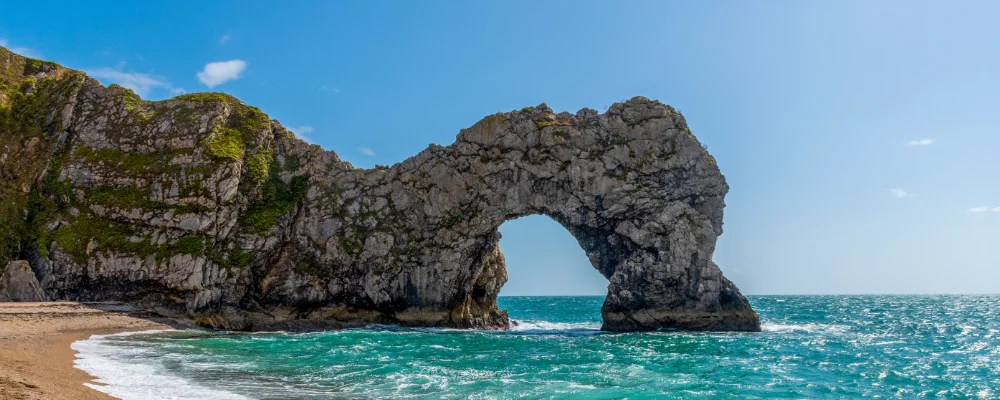
- Jurassic Coast: the last 96 miles or so, from Exmouth to Studland, is a UNESCO World Heritage Site with rocks covering 185 million years. It includes Durdle Door, a limestone arch, and Old Harry Rocks, the chalk stacks near the end.
Distance
About 1,014 km (630 miles) from Minehead to South Haven Point, Poole, with about 35,000 m of ascent in total. If the Lulworth Ranges in Dorset are closed, you have to take a long detour inland.
Best time to go
April to October. The South West Coast Path Association says spring and late summer are the best times, though autumn and winter can be good too. Several ferries are seasonal, and between Lulworth Cove and Kimmeridge the path crosses Ministry of Defence firing ranges that are only open on certain days; check the range opening times before walking that stretch. Storms and cliff falls cause temporary diversions every year, so check the current route changes on the South West Coast Path Association website before you go.
More journeys in England
- Folk on a Boat · Simon & Lucy
- Bristol Rides · David
- Scotland West Coast Train · Greg
- Week In UK · Greg
- Pangbourne · Ben
- Muse · James
Flyby films from England
- The Great Escape · saeunn
- Ferry to UK · Greg
- Exeter towards Poole · Greg
- Shanghai Stopover · David
More routes like this
- Ridgeway on foot · 139 km (87 miles) · England
- Coast to Coast Walk · 306 km (190 miles) · England
- Dales Way · 128 km (80 miles) · England
- Jurassic Coast walk · about 182 km (113 miles) · England
- Cotswold Way · about 164 km (102 miles) · England
- South Downs Way · 160 km (100 miles) · England