Hadrian’s Wall Path
- Distance
- about 135 km (84 miles)
- Country
- England
- Difficulty
- Moderate
- Type of trip
- Hiking trail
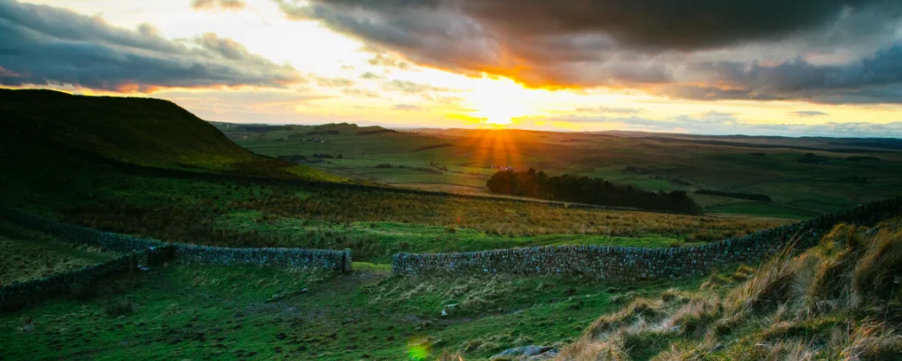
The Hadrian’s Wall Path is an 84-mile (135 km) National Trail across northern England, from Wallsend on the Tyne to Bowness-on-Solway on the Solway Firth. It opened in 2003 and follows, as closely as it can, the line of the wall the Romans began in AD 122, now part of the Frontiers of the Roman Empire World Heritage Site. The first day is mostly urban, through the middle of Newcastle and along the Tyne, and only the Tyneside section is tarmac. The middle of the walk is the high, wild part, where the wall runs along the crags of the Whin Sill past the best-preserved forts. The west end crosses farmland, goes through Carlisle and finishes on the flat Solway shore.
Most people take six or seven days, plus time for the Roman sites. It isn’t a hard mountain walk, as the highest point is only 345 m at Whinshields Crags, but the 23 miles (37 km) between Chollerford and Birdoswald are a switchback of short, steep climbs and drops. Accommodation near the wall fills up quickly, so book ahead. There are few places to buy food in the middle sections. The Newcastle–Carlisle railway has stations along the way, and the AD122 Hadrian’s Wall bus runs a daily seasonal service, so check its dates. The Solway coast between Dykesfield and Drumburgh, and between Port Carlisle and Bowness, floods at high tide; check tide times and keep off the marshes for an hour either side of high water.
Highlights along the way
- Segedunum: the Roman fort at Wallsend where the path starts, the most thoroughly excavated fort on the wall, now a museum. It’s also the first stamping station for the Walkers’ Passport.
- Housesteads Roman Fort: built around AD 124 on the end of a Whin Sill crag, and one of the best-preserved forts on the wall, with granaries and latrines you can still see.
- Sycamore Gap: the sycamore in a dip of the wall near Crag Lough, about 2 miles west of Housesteads, was illegally felled in 2023, and two men were jailed for it in 2025. The stump is sprouting again, and the gap in the crags is still a landmark on the walk.
- Carlisle Castle: begun in 1092 under William II, rebuilt in stone from 1122, and the last English fortress to undergo a siege, in 1745–46. The path passes through the city.
- Bowness-on-Solway: the end of the path is marked by a small pavilion above the shore. The village stands on the site of Maia, the second-largest fort on the wall, though nothing of the wall shows above ground here.
Distance
About 135 km (84 miles) from Wallsend to Bowness-on-Solway. The Roman wall itself was about 73 miles (117 km) long; the path is longer because it follows modern rights of way.
If you have a GPX of this route from its official site or a planning app, open it in our free GPX viewer to see the distance, the climb and the height profile. The file stays on your device.
Best time to go
May to October. The National Trail asks walkers to come then because the ground is normally dry and walking does less damage to the buried archaeology. The Passport stamping season runs from Easter to the end of October for the same reason, and some accommodation and the AD122 bus are seasonal. Near Carlisle, the A689 underpass between Grinsdale and Engine Lonning floods regularly; if it’s under water, don’t try to cross the road, go back. Check the trail news on nationaltrail.co.uk for diversions before you go.
More journeys in England
- Exmouth towards Poole SWCP · Greg
- Folk on a Boat · Simon & Lucy
- Bristol Rides · David
- Scotland West Coast Train · Greg
- Week In UK · Greg
- Pangbourne · Ben
Flyby films from England
- Kenya safari · Alison Popper
- The Great Escape · saeunn
- Ferry to UK · Greg
- Exeter towards Poole · Greg
More routes like this
- Ridgeway on foot · 139 km (87 miles) · England
- Dales Way · 128 km (80 miles) · England
- North Downs Way · 246 km (153 miles) · England
- Pennine Way · about 431 km (268 miles) · England, Scotland
- Cotswold Way · about 164 km (102 miles) · England
- South Downs Way · 160 km (100 miles) · England