Kungsleden trail
- Distance
- about 440 km (273 miles)
- Country
- Sweden
- Difficulty
- Moderate to challenging
- Type of trip
- Hiking trail
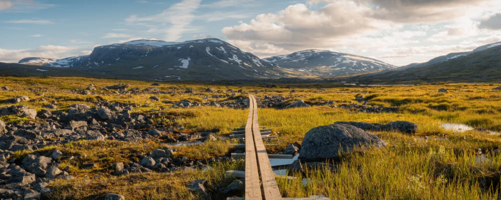
Kungsleden runs about 440 km through Swedish Lapland, from Abisko in the north to Hemavan in the south. Roughly the northern half is above the Arctic Circle, which the trail crosses between Kvikkjokk and Jäkkvik. Most people don’t walk the whole thing. The northern section, from Abisko past Kebnekaise mountain station to the road end at Nikkaluokta, is about 107 km and the most popular. STF reckons on five to seven days for it.
You sleep in mountain huts or in a tent. The Swedish Tourist Association (STF) runs 16 huts, 10 to 20 km apart, but there are none on the long stretch between Kvikkjokk and Ammarnäs and little other accommodation, so you need a tent there. About 18 km of the route is on water. Some lakes have a motorboat service; at others you row yourself, using STF’s three-boat system, which can mean crossing the lake three times. Around Abisko the sun doesn’t set from late May to mid-July, and mosquitoes are out from June to August, worst below the tree line.
Highlights along the way
- Abisko: the northern start, with its own railway stations on the Stockholm–Narvik line. Abisko sits in a rain shadow and is one of the driest places in Sweden.
- Tjäktja Pass: at about 1,150 m, the highest point on the trail, between the Tjäktja and Sälka huts. There’s a small shelter at the pass all year.
- Kebnekaise: Sweden’s highest mountain, at about 2,097 m. The mountain station is 19 km from Nikkaluokta, and the western route to the top is a long day there and back.
- Sarek: Sweden’s wildest national park, with almost 100 glaciers and no marked trails or huts inside. Kungsleden only crosses its eastern edge between Saltoluokta and Kvikkjokk.
- Hemavan: the southern end, a small ski village on the E12 with buses to Umeå.
Distance
About 440 km by the usual count. STF now gives just over 450 km, and Wikipedia gives 467 km including about 18 km of lake crossings and 30 km of road, mostly by bus. Abisko to Nikkaluokta is about 107 km.
If you have a GPX of this route from its official site or a planning app, open it in our free GPX viewer to see the distance, the climb and the height profile. The file stays on your device.
Best time to go
Late June to mid-September, when the STF huts are staffed. For 2027 STF gives Tjäktja’s summer opening as 18 June to 19 September; each hut has its own dates on the STF website. Outside the season the huts have no host and no shop, and most leave only an emergency room open.
More journeys in Sweden
- Cycle Exped to Japan via Finland · Mark
- The History of the Sea · saeunn
- Vättern Round 2026 - David · David
Flyby films from Sweden
- The Great Escape · saeunn
- Vätternrundan 2026 315 km · David
- STAGE 6 ETAP 7 - Sept 12 · Mark
More routes like this
- Hermannsweg on foot · about 163 km (101 miles) · Germany
- Camino Inglés · about 112 km (70 miles) · Spain
- Carros de Foc on foot · about 65 km (40 miles) · Spain
- Schluchtensteig on foot · 119 km (74 miles) · Germany
- Jakobsweg on foot · about 770 km (480 miles) · Germany, Spain, France, Austria
- St. Olav's Way, Oslo to Trondheim · about 643 km (400 miles) · Norway