Rota Vicentina trail
- Distance
- about 490 km (304 miles)
- Country
- Portugal
- Difficulty
- Moderate
- Type of trip
- Hiking trail
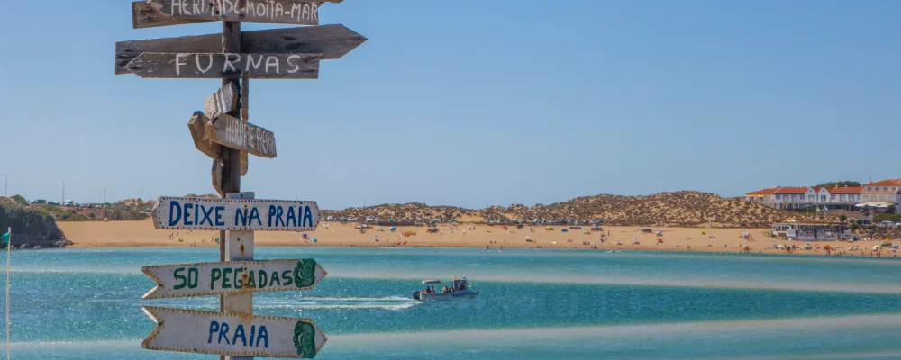
The Rota Vicentina is a signed network of walking trails in south-west Portugal, run by the Rota Vicentina Association. It has two long routes. The Historical Way goes inland for 263 km, from Santiago do Cacém to Cabo de São Vicente, on farm tracks and old paths through cork oak woods, valleys and villages. The Fishermen’s Trail keeps to the coast for 226.5 km, from São Torpes near Sines to Lagos, mostly on narrow cliff-top paths and loose sand inside the Southwest Alentejo and Vicentine Coast Natural Park. Each route has 13 one-day stages. From Odeceixe to Vila do Bispo the two run side by side, one near the sea and one inland, and share several stage towns, so you can swap between them.
Both routes are signed in both directions, so you can walk them either way. You sleep in the towns and villages at each stage end, and local transport firms listed on the association’s website move luggage between stages and run transfers. The Fishermen’s Trail is for walkers only, and the association says 60 to 70% of it is sandy. It also warns that the coast path isn’t suitable for anyone with vertigo or a fear of heights.
Highlights along the way
- Fishermen’s Trail: narrow paths along the cliff tops, with stages of up to 22.5 km. The sand makes it slower going than the distances suggest, and the association calls the stage from Sagres to Salema one of the hardest.
- Historical Way: the inland route, certified by the European Ramblers Association as a "Leading Quality Trail – Best of Europe" in 2016 and 2020. Stages are up to 25 km, except the 33 km Sabóia–Odemira link.
- Vila Nova de Milfontes: a small town on the north bank of the Mira estuary, at the end of the Fishermen’s Trail stage from Porto Covo.
- Odeceixe: the village where the Seixe stream marks the border between the Alentejo and the Algarve, and a stage town on both routes.
- Cabo de São Vicente: the end of the Historical Way, the south-western tip of mainland Europe, with a lighthouse that is one of the most powerful in Europe.
Distance
About 490 km for the two long routes together: the Historical Way is 263 km and the Fishermen’s Trail 226.5 km, each in 13 stages. Add the circular walks and the whole network is about 750 km.
If you have a GPX of this route from its official site or a planning app, open it in our free GPX viewer to see the distance, the climb and the height profile. The file stays on your device.
Best time to go
September to June, which is the association’s recommended walking season. The association advises against long walks in July and August, when it’s hottest. Winter is the wettest time, though the association says daytime temperatures don’t fall below 11°C; bring boots and a waterproof.
More journeys in Portugal
- Camino De Santiago · Ruth
Flyby films from Portugal
- Grand Departure · Windy
- Day 28 -Wet Shoes Not A Great Start · Ruth
- Guernsey To Canary Island · Adam
More routes like this
- Camino Portugués on foot · 241 km (150 miles) · Portugal, Spain
- Hadrian’s Wall Path · about 135 km (84 miles) · England
- GR 400 (Cantal volcano) on foot · about 140 km (87 miles) · France
- Chemin de Stevenson (GR 70) on foot · 272 km (169 miles) · France
- Ruta del Alba on foot · 14 km (9 miles) · Spain
- Pelgrimspad on foot · about 456 km (283 miles) · Netherlands, Belgium