GR 400 (Cantal volcano) on foot
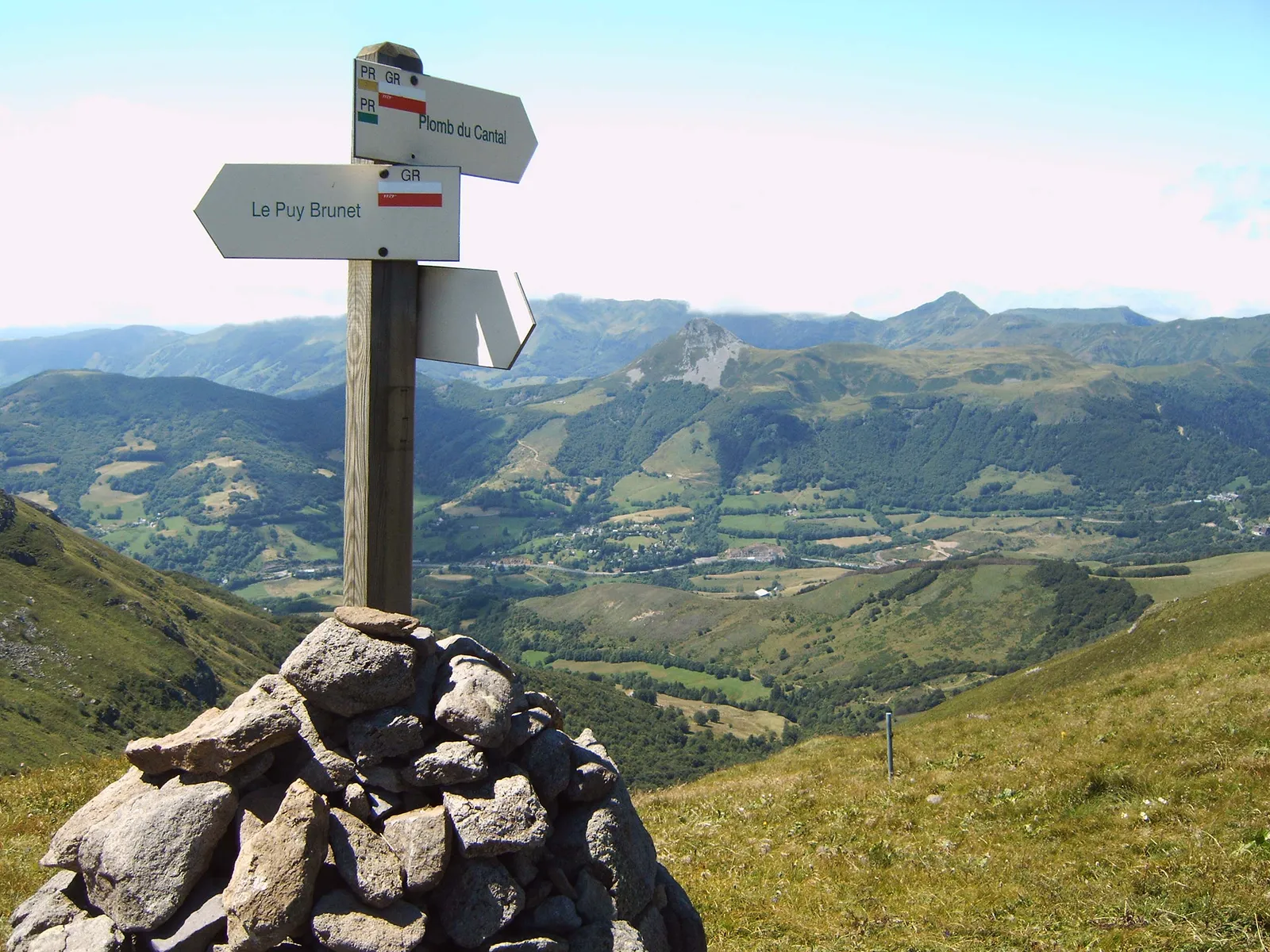
Photo: MartinD, CC BY-SA 3.0, via Wikimedia Commons
- Distance
- about 140 km (87 miles)
- Country
- France
- Difficulty
- Moderate to challenging
- Type of trip
- Hiking trail
The GR 400 goes round the Cantal volcano in Auvergne, which the département's tourist board calls the largest stratovolcano in Europe. The main loop is 140 km and takes 7 to 10 days, along ridges, glacial valleys and summer pastures between 750 m and 1,855 m. It's also split into five shorter loops, each starting from a village: the Cère from Super-Lioran, the Claux from Le Claux, the Cirque du Falgoux from Le Falgoux, the Jordanne from Mandailles and the Alagnon from Murat. You can do most of them in two or three days, and the Claux in one. You sleep in gîtes, refuges and hotels, which can be booked online through Cantal Destination. Trains stop at Murat and Le Lioran.
It's waymarked red and white, like every GR. The tourist board says any good walker used to mountain ground and carrying a rucksack can manage it, but there are steep climbs and descents, about 4,635 m of climbing on the main loop, and the ridges are exposed to wind and quick changes in the weather. It isn't a high-mountain route, though. The top is 1,855 m.
Highlights along the way
- Plomb du Cantal: At 1,855 m this is the top of the GR 400 and the highest point in the Cantal. The Alagnon loop from Murat climbs to it after passing the ski resort of Super-Lioran.
- Puy Mary: A pyramid-shaped peak of 1,783 m and a Grand Site de France. The Jordanne loop from Mandailles follows the ridges past the Brèche de Roland, the Puy Mary and the Puy Chavaroche.
- Puy Griou and Thiézac: The Cère loop from Super-Lioran gives you views of the Puy Griou, 1,690 m, follows cols and ridges down into Thiézac and comes back over the Plomb du Cantal.
- Cirque du Falgoux: This loop from Le Falgoux goes round a glacial cirque, from the Puy Violent to the Puy Mary, above the valley of the Mars, which rises at the foot of the Puy Mary.
- Vallée du Claux: The shortest loop, done in a day from Le Claux. It follows the ridge of the Puy de la Tourte, by the Suc de la Blatte and the étang de Lascourt.
Distance
About 140 km (87 miles) in all for the main loop round the volcano, with about 4,635 m (15,200 ft) of climbing. The five smaller loops are 38.5 km (Cère), 22 km (Claux), 39 km (Falgoux), 34 km (Jordanne) and 45 km (Alagnon) by the Cantal walking committee's count, or 24, 14, 24, 21 and 28 miles. FFRandonnée's own route pages give slightly different figures, and some loops share stretches of ridge.
Best time to go
The tourist board gives mid-May to mid-November as the time it can be walked, and the local shuttle buses only run in season. Check the forecast before you go up, because the ridges catch the wind and the weather can turn quickly. The FFRandonnée topo-guide Volcan du Cantal (ref. 400) has the full route. For current information, see cantal-destination.com (read for this guide on 3 November 2026).
More journeys in France
- France June 2023 · Greg
- France Spain 2024 · Greg
- UK to Georgia by Bike · Simon & Lucy
- The Rick Trip · Phil
- Sailing Around The World · Adam
- Spain France Pyrenees 2026 · Greg
Flyby films from France
- PLM line - Champagnole to Pont-du-Navoy - 25483409 · CNJ tourisme
- Lamasquère Road Cycling · Michmich
- To sea, on a ferry, off the ferry · Phil
- The Great Escape · saeunn
More routes like this
- Haute Route trek · about 215 km (134 miles) · France, Switzerland
- GR 34 (Sentier des douaniers) on foot · 2,000 km (1,240 miles) · France
- Chemin de Stevenson (GR 70) on foot · 272 km (169 miles) · France
- Via Alpina on foot · 2,000 km (1,240 miles) · Slovenia, Italy, Austria, Germany, Switzerland, Liechtenstein, France, Monaco
- GR20 trek · about 180 km (112 miles) · Corsica, France
- GR 10 across the Pyrenees on foot · 866 km (538 miles) · France