Cordillera Huayhuash Circuit
- Distance
- about 120–130 km (75–81 miles)
- Country
- Peru
- Difficulty
- Very challenging
- Type of trip
- Hiking trail
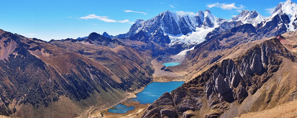
The Cordillera Huayhuash is a compact range in the Peruvian Andes, only about 30 km from north to south, but it holds seven peaks over 6,000 m. The highest is Yerupajá, at about 6,600 m, Peru’s second-highest mountain. The classic circuit walks all the way round the range, across a string of passes, most of them between 4,600 m and 5,000 m. It takes 10 to 14 days, and trek agencies run shorter 8-day versions. The range sits where the regions of Ancash, Huánuco and Lima meet, and has been a reserved zone since 2002.
Most people start from Huaraz. Buses run to Chiquián, and from there daily colectivos (shared minibuses) go on to Llamac (3,300 m). Many trekkers take a private shuttle instead, 4 to 5 hours, to the higher trailhead at Cuartelhuain (about 4,170 m). You sleep in a tent at campsites run by the villages along the way. Each community charges a fee, paid in cash on the trail or at camp. In Huayllapa, a village in the south-west, you can buy basic supplies.
Highlights along the way
- Laguna Carhuacocha: a lake camp at about 4,140 m, and one of the best-known campsites on the circuit.
- Tres Lagunas: from a viewpoint on the way to the Siula pass (about 4,800 m), you look down on three lakes in a row: Siulacocha, Quesillacocha and Gangrajanca.
- Siula Grande: the 6,344 m peak of Joe Simpson’s book Touching the Void. The circuit passes close to the climbers’ base camp.
- Punta Cuyoc and San Antonio: the two highest passes, both about 5,000 m. The climb to San Antonio looks across to Siula Grande and Yerupajá.
- Laguna Jahuacocha: a glacial lake and the usual last camp before the walk out to Llamac.
Distance
About 120 to 130 km for the classic circuit, from Cuartelhuain back round to Llamac. Variants and side trips stretch it to 180 km.
If you have a GPX of this route from its official site or a planning app, open it in our free GPX viewer to see the distance, the climb and the height profile. The file stays on your device.
Best time to go
May to September, when it rains least. June, July and August usually give the clearest views. Nights at camp regularly drop below freezing.
More journeys in Peru
- Arequipa, Peru · Lynn
- Lima, Peru · Lynn
Flyby films from Peru
- Colca canyon · Lynn
More routes like this
- Inca Trail · 42 km (26 miles) · Peru
- Hermannsweg on foot · about 163 km (101 miles) · Germany
- Camino Inglés · about 112 km (70 miles) · Spain
- Austrian Way of St James · about 750–800 km (466–497 miles) · Austria, Germany
- Routeburn Track · 33 km (21 miles) · New Zealand
- St. Olav's Way, Oslo to Trondheim · about 643 km (400 miles) · Norway