Laugavegur Trail
- Distance
- about 55 km (34 miles)
- Country
- Iceland
- Difficulty
- Moderate to challenging
- Type of trip
- Hiking trail
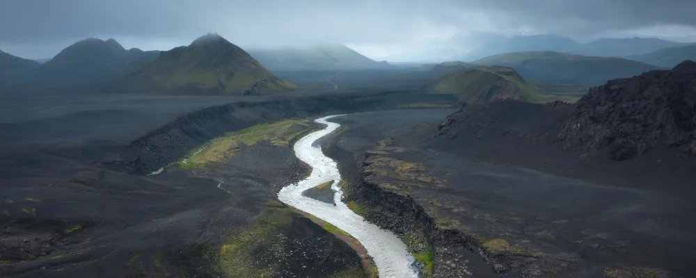
The Laugavegur runs about 55 km through the Fjallabak Nature Reserve in Iceland’s southern highlands, from the hot springs at Landmannalaugar to the green valley of Þórsmörk. Most people take four days and walk it north to south, sleeping in huts run by Ferðafélag Íslands (FÍ) at Hrafntinnusker, Álftavatn and Emstrur, or in the campsites beside them. There’s a second hut at Hvanngil, which some people use instead of Álftavatn.
FÍ expects you to have a confirmed booking for a hut bed or a campsite before you start, and wild camping is not allowed along the trail. July and August sell out months ahead. Expect to wade several rivers, including the Bláfjallakvísl and the Þröngá; others, such as the Ljósá and Krossá, have footbridges. Buses run from Reykjavík to Landmannalaugar and back from Þórsmörk in season. Many people carry on over the Fimmvörðuháls pass to Skógar on the south coast, which FÍ puts at 25 km, with a high point of about 1,000 m. In August 2026 FÍ, Útivist and the local rescue team advised against crossing it, after the retreating glacier opened ravines on part of the route; check SafeTravel and FÍ before you plan it.
Highlights along the way
- Landmannalaugar: the start, with a geothermal pool you can bathe in, rhyolite mountains and the Laugahraun lava field from an eruption around 1477.
- Hrafntinnusker: the highest part of the trail, around 1,050–1,100 m, with fields of obsidian (the name means "obsidian skerry"). The hut has no showers and only a latrine.
- Álftavatn: a lake below the mountains at the end of the second day, 12 km from Hrafntinnusker.
- Emstrur (Botnar): the third-night hut at 465 m. A short walk takes you to Markarfljótsgljúfur, a canyon about 200 m deep.
- Þórsmörk: a sheltered valley between glaciers, named after the god Thor, with birch woods, moss and ferns.
Distance
About 55 km (34 miles) from Landmannalaugar to Þórsmörk. The stages are 12 km, 12 km, 16–17 km and 15 km. With the Fimmvörðuháls extension to Skógar it’s about 80 km.
If you have a GPX of this route from its official site or a planning app, open it in our free GPX viewer to see the distance, the climb and the height profile. The file stays on your device.
Best time to go
Late June to mid-September. The huts open on average from about 25 June to 15 September, but the dates depend on when the Icelandic Road Administration opens the highland roads, which varies with snow each year. Hut bookings for the next season open months ahead; book early for July and August. Since 2024, cars arriving at Landmannalaugar during the day in summer need a parking reservation from the Environment Agency of Iceland.
More routes like this
- Chemin de Stevenson (GR 70) on foot · 272 km (169 miles) · France
- Via Postumia on foot · about 956 km (594 miles) · Italy
- Rennsteig on foot · 169 km (105 miles) · Germany
- Hadrian’s Wall Path · about 135 km (84 miles) · England
- Pacific Crest Trail · about 4,265 km (2,650 miles) · USA
- Annapurna Base Camp Trek · about 75–80 km (47–50 miles) · Nepal