Chemin de Saint-Guilhem on foot
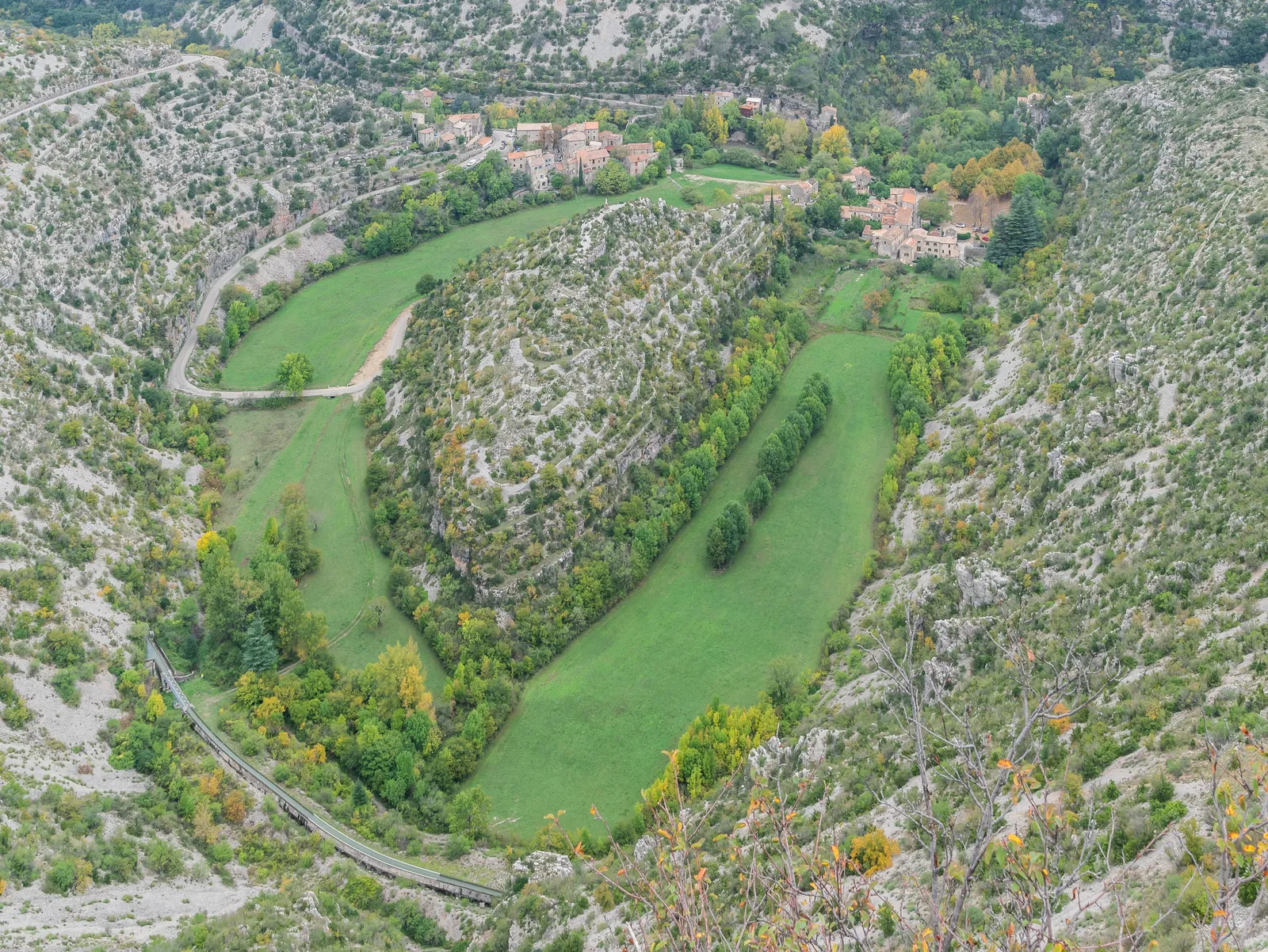
Photo: Krzysztof Golik, CC BY 4.0, via Wikimedia Commons
- Distance
- about 240 km (149 miles)
- Country
- France
- Difficulty
- Moderate
- Type of trip
- Hiking trail
The Chemin de Saint-Guilhem runs about 240 km from Aumont-Aubrac in Lozère to Saint-Guilhem-le-Désert in the hills behind Montpellier. It links two Compostela routes, the Via Podiensis (GR 65) at the top and the Voie d'Arles (GR 653) at the bottom. Much of it follows the grande draille d'Aubrac, the drove road shepherds used to take their sheep from the dry garrigue up to summer grass on the Aubrac. Most people take 12 to 15 days. You sleep in gîtes, chambres d'hôtes, hotels and campsites. The association says to book every night ahead, and at most places you also have to book dinner and the next day's picnic.
There's no single GR number. The route strings together FFRandonnée trails, the GR 65, 6, 60, 62, 7, 74 and 670, and is run by the Association des Amis du Chemin de Saint-Guilhem, set up in 2009; the route opened in 2010. The association rates it two out of three. The plateaus are gently rolling, but between them you drop into gorges and climb out again, and the climbing adds up to about 6,000 m. Some stretches have no shops for days, and some shops close on Mondays.
Highlights along the way
- The Aubrac: The first days cross the high granite and volcanic plateau of the Aubrac, through Aubrac village and past its domerie, an old monastic hospice. The climb from Saint-Chély-d'Aubrac to Les Enfrux is one of the harder ones.
- Sainte-Enimie and the Gorges du Tarn: Sainte-Enimie, a small medieval town in the Tarn gorges, had pilgrims of its own in the 1200s, coming to its Benedictine monastery. The way out of the gorges after Sainte-Enimie is another stiff climb.
- The Causses and Mont Aigoual: Next come the limestone plateaus of the Causse de Sauveterre and the Causse Méjean, then Meyrueis, whose fairs this road already served in 1020.
- Cirque de Navacelles: At the end of the Causse de Blandas the path drops into the Cirque de Navacelles, a huge bowl cut by the Vis, with a hamlet and its church at the bottom beside an abandoned meander. It's a Grand Site de France. The climb out to Saint-Maurice-Navacelles is hard work.
- Saint-Guilhem-le-Désert: After the Larzac and the Séranne you come down to Saint-Guilhem-le-Désert. Saint Guilhem founded the abbey of Gellone around 804, and from the 1000s on pilgrims came for its relics of the True Cross.
Distance
About 240 km (149 miles) in all from Aumont-Aubrac to Saint-Guilhem-le-Désert, by the association's count; French Wikipedia gives 242 km (150 miles). At 20 km (12 miles) a day that's 12 days, with about 6,000 m (19,700 ft) of climbing. There are three marked variants: Aubrac, 33.3 km (20.7 miles); Gorges du Tarn, 61.4 km (38.2 miles) by Le Rozier-Peyreleau; and Mont Saint-Baudille, 40 km (24.9 miles) across the Larzac.
Best time to go
June and September are the busiest months, going by a trail counter run from May to October 2021. The route heads south, so the association says to walk when the heat is bearable, carry plenty of water, wear something bright in the hunting season and light no fires. When its site was checked on 3 November 2026, landslides had closed two sections, just before Meyrueis (points 60 to 62 in the topo-guide) and between Navacelles hamlet and Saint-Maurice-Navacelles. Both have marked diversions. Check chemin-st-guilhem.fr before you go.
More journeys in France
- France June 2023 · Greg
- France Spain 2024 · Greg
- UK to Georgia by Bike · Simon & Lucy
- The Rick Trip · Phil
- Sailing Around The World · Adam
- Spain France Pyrenees 2026 · Greg
Flyby films from France
- PLM line - Champagnole to Pont-du-Navoy - 25483409 · CNJ tourisme
- Lamasquère Road Cycling · Michmich
- To sea, on a ferry, off the ferry · Phil
- The Great Escape · saeunn
More routes like this
- GR20 trek · about 180 km (112 miles) · Corsica, France
- Jakobsweg on foot · about 770 km (480 miles) · Germany, Spain, France, Austria
- GR 34 (Sentier des douaniers) on foot · 2,000 km (1,240 miles) · France
- Tour des Fiz on foot · about 52 km (32 miles) · France
- Tour du Mont Blanc trek · about 170 km (105 miles) · France, Italy, Switzerland
- Via Podiensis (GR 65) on foot · 755 km (469 miles) · France