Sentiero degli Dei (Path of the Gods)
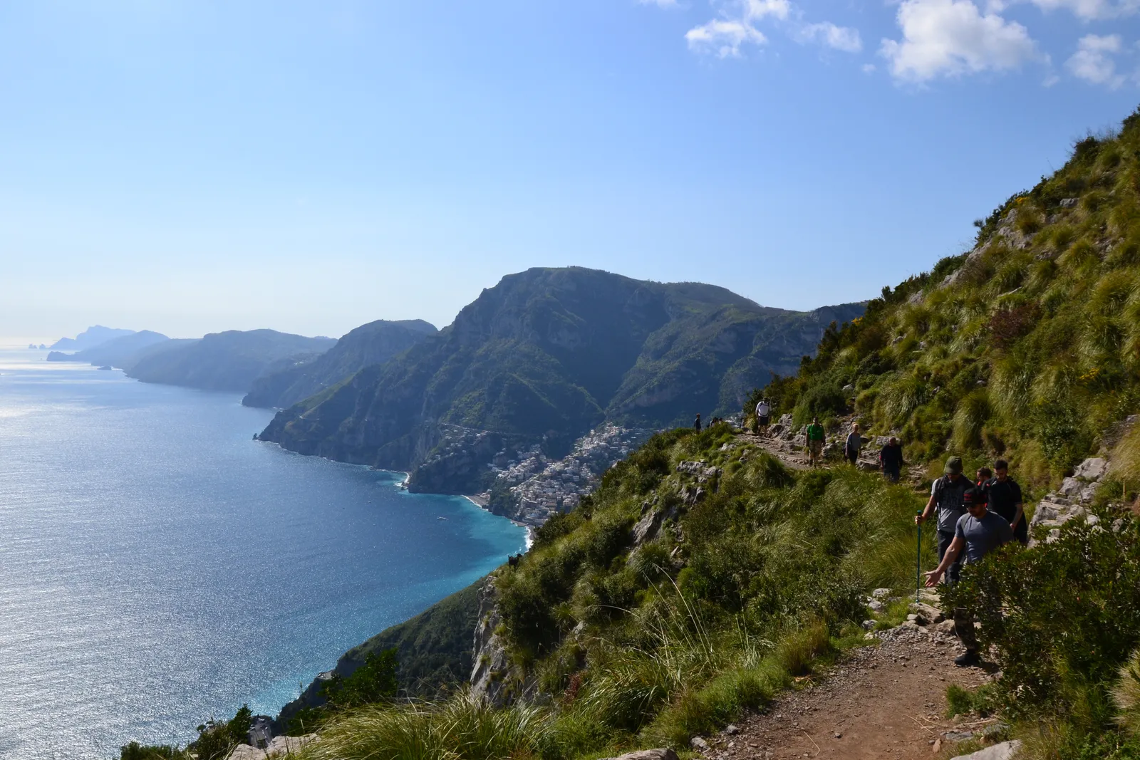
Photo: Jack45, CC BY 3.0, via Wikimedia Commons
- Distance
- 8 km (5 miles)
- Country
- Italy
- Difficulty
- Moderate
- Type of trip
- Hiking trail
The Sentiero degli Dei, or Path of the Gods, runs along the mountainside high above the Amalfi Coast, in the Monti Lattari in Campania. It starts at Bomerano, part of Agerola, and ends at Nocelle, a small village above Positano. Agerola’s Pro Loco gives about 8 km, dropping from 650 m at Bomerano to 440 m at Nocelle, so it’s mostly downhill if you start there, though you can walk it either way. Allow about 4 hours. For centuries it was the only link between the villages along this coast, until the Bourbons built the coast road. The name comes from a legend that the Greek gods came down to save Ulysses from the sirens of the Li Galli islets, landed in the wrong place and ran along here to reach them.
You sleep in Agerola or Positano, and there’s a kiosk selling food and drink at Nocelle. Most of the path is easy underfoot, but it runs along steep drops, some stretches are exposed, and it isn’t recommended if you suffer from vertigo. Wear walking shoes and a hat, and carry food, water and sun cream. Volunteers from local groups, the Italian Alpine Club (CAI) among them, look after the path.
Highlights along the way
- Grotta del Biscotto: Below the path are small houses built into caves, which may have started as hermits’ cells in the early Middle Ages. A little further on, a ruined farmhouse sits right on the edge of a rock spur.
- Colle la Serra: At 580 m the path splits and joins again at Cannati. The upper branch passes old lime kilns. The lower one is more exposed in places, and has a turning down to the Convento di San Domenico and Vettica Maggiore if you want a shorter walk.
- The terraces: Dry-stone terraces hold vines on pergolas and, lower down, groves of Sfusato d’Amalfi lemons, the ones used for the local limoncello.
- The view west: Along the way you look over Positano and the Sorrento peninsula out to Punta Campanella, with the Li Galli islets and Capri beyond.
- Nocelle: After Cannati the path winds across the Vallone Gradelle and reaches Nocelle about 2 km later. You turn off by a small chapel with a painting of the Crucifixion and a fountain.
Distance
Sources put Bomerano to Nocelle at 7.8 to 8 km (about 5 miles). Agerola’s Pro Loco gives about 9 km (5.6 miles) and 4½ hours for the walk on into Positano. From Nocelle you can follow the road 1 km to Montepertuso and take the steps down into Positano, or go down the 1,700 steps to Arienzo on the coast road and walk about 500 m along it, watching for traffic, into the centre. Don’t mix it up with the higher route from Bomerano over Monte Tre Calli (1,111 m) to Montepertuso, which some people also call the Sentiero degli Dei. It’s a lot harder.
Best time to go
Wikivoyage suggests March to October, and the path is very busy in summer. In spring the slopes flower, with myrtle, cistus, broom and rosemary among them. In November 2026 the Pro Loco’s route notes said you can get back to Agerola by SITA bus with a change at Amalfi, or in summer by boat from Positano to Amalfi. Check timetables before you go, as the boats don’t run all year.
More journeys in Italy
- to Tuscany by bike · Yael Zekaria
- Euro Trip 2024 · mmalty
- Istanbul To Ashby · Harry
- Sicily Tour · fredmarien
- Livigno 2026 · Marc
- UK to Georgia by Bike · Simon & Lucy
Flyby films from Italy
- Alta_Via_1_day_1_ · harryknoblauch12
- Plane trip Saturday · fredmarien
- Dag 9: Innsbruck - Bruneck · johan
- Salzburg to Nice · Lucy
More routes like this
- Cammino dei Briganti on foot · about 108 km (67 miles) · Italy
- Tour du Mont Blanc trek · about 170 km (105 miles) · France, Italy, Switzerland
- Via Francigena on foot · 1,000 km (621 miles) · Italy
- Sentiero Italia on foot · about 8,000 km (4,970 miles) · Italy
- Via degli Dei on foot · 124 km (77 miles) · Italy
- Cammino Materano on foot · 168 km (104 miles) · Italy