Haute Route trek
- Distance
- about 215 km (134 miles)
- Countries
- France, Switzerland
- Difficulty
- Challenging
- Type of trip
- Hiking trail
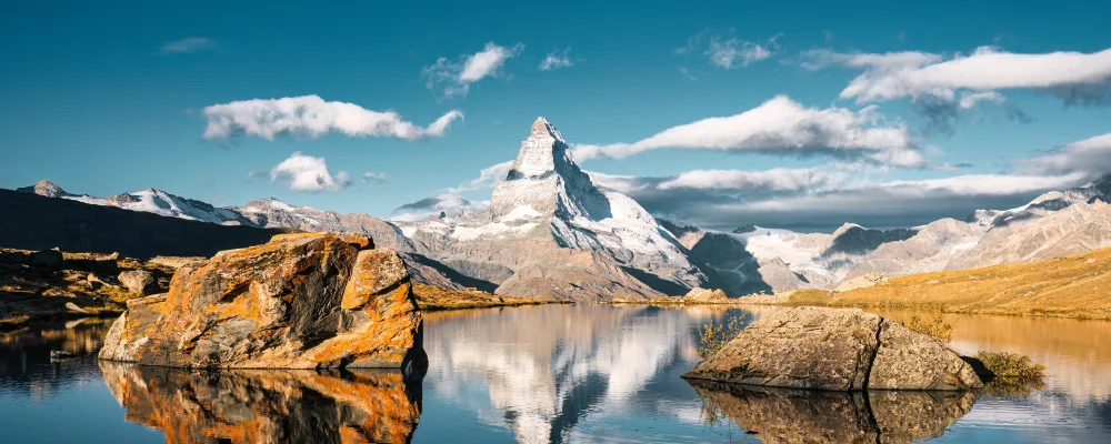
The walkers’ Haute Route goes from Chamonix in France to Zermatt in Switzerland, from Mont Blanc to the Matterhorn. Almost all of it is in the Swiss canton of Valais. It crosses 11 passes, and the route goes from one valley to the next. Each day you climb out of a valley, cross a col, and drop into the next village. The highest cols are just under 3,000 m. You need no ropes or crampons, and the route doesn’t cross any glaciers. That’s the difference from the original Haute Route, a mountaineering and ski tour across the ice.
Most people take about two weeks. The Cicerone guide splits the route into 14 stages, with shorter plans for 10 or 12 days, and about 14,000 m of ascent. You sleep in mountain huts, village inns and hotels, and there are campsites in some valleys. July and August are busy, so book huts and rooms early. The route passes Trient, Champex, Le Châble or Verbier, Arolla, Les Haudères, Zinal, Gruben and St Niklaus. Trains run home from Zermatt.
Highlights along the way
- Fenêtre d’Arpette: a narrow, steep 2,665 m col between Trient and Champex that looks down on the Trient glacier.
- Pas de Chèvres: a col above Arolla, reached up a rock wall on a set of metal ladders. The ladders were reported closed from 2024 after rockfall, and walkers were sent over the Col de Riedmatten next to it instead. Ask in Arolla or at the huts before you go.
- Augstbordpass: at almost 2,900 m, the last big pass, crossing from Gruben in the Turtmanntal down to St Niklaus in the Mattertal.
- Europaweg: a two-day high path from Grächen to Zermatt along the east side of the Mattertal. It crosses the 494 m Charles Kuonen suspension bridge, which the Europaweg’s own site calls the longest pedestrian suspension bridge in the Alps.
- Zermatt: the finish, below the Matterhorn.
Distance
About 215 km on the Cicerone route, in 14 stages. Older editions of the same guide, and other versions with shortcuts or different variants, give about 180 km.
If you have a GPX of this route from its official site or a planning app, open it in our free GPX viewer to see the distance, the climb and the height profile. The file stays on your device.
Best time to go
Cicerone gives the season as mid-June to mid-September, with July to September the best time. Snow can lie on the higher passes into July. In summer 2026 part of the Europaweg between Randa and Täsch was closed, with a signed detour, and the path and the suspension bridge close for winter from late October. Check with the tourist offices in Grächen, Randa and Zermatt before you go.
More journeys in France, Switzerland
- France June 2023 · Greg
- France Spain 2024 · Greg
- The Rick Trip · Phil
- UK to Georgia by Bike · Simon & Lucy
- Sailing Around The World · Adam
- Spain France Pyrenees 2026 · Greg
Flyby films from France, Switzerland
- Cassagne 101 · André
- To Cancale for a couple days rest. · Phil
- Source de l'Angillon · CNJ tourisme
- PLM line - Champagnole to Pont-du-Navoy - 25483409 · CNJ tourisme
More routes like this
- Via Alpina on foot · 2,000 km (1,240 miles) · Slovenia, Italy, Austria, Germany, Switzerland, Liechtenstein, France, Monaco
- Tour du Mont Blanc trek · about 170 km (105 miles) · France, Italy, Switzerland
- Chemin de Saint-Guilhem on foot · about 240 km (149 miles) · France
- GR20 trek · about 180 km (112 miles) · Corsica, France
- Swiss Way of St James (Via Jacobi) · 446 km (277 miles) · Switzerland
- Camino de Santiago on foot · about 770 km (480 miles) · Spain, France