GR20 trek
- Distance
- about 180 km (112 miles)
- Countries
- Corsica, France
- Difficulty
- Very challenging
- Type of trip
- Hiking trail
The GR20 crosses the mountains of Corsica from Calenzana in the north to Conca in the south, about 180 km with roughly 11,000 m of ascent. It’s usually described as the hardest of France’s GR routes. The regional nature park splits it into 16 stages, each from one refuge to the next, with walking times of about 4 to 8 hours a day. Vizzavona, near the middle, has a railway station, so a lot of people walk only the northern or southern half. The highest point on the route is Pointe des Éboulis at 2,607 m.
The refuges are run by the Parc Naturel Régional de Corse (PNRC), and nights in them are booked through the park’s GR20 reservation centre. Book well ahead and check current prices and rules there. You can’t pitch a tent along the trail itself, only at the refuges. The old route through the Cirque de la Solitude, between Ascu Stagnu (Haut-Asco) and the Tighjettu refuge, has been closed by prefectoral and municipal decree since a rockfall killed seven walkers there in June 2015. Its fixed equipment was removed in 2016. The official diversion between the same two points goes over Pointe des Éboulis instead.
Highlights along the way
- Pointe des Éboulis and Monte Cinto: the diversion crosses 2,607 m, the highest point of the GR20, close to Monte Cinto. At 2,706 m Cinto is Corsica’s highest mountain, and some walkers add it as a side trip.
- Lac de Nino: a small glacial lake at 1,743 m near the source of the Tavignano river, on the stage from Ciottulu di i Mori to Manganu. Horses graze on the marshy grassland around it, which the Corsicans call pozzines.
- Vizzavona: the halfway point, with a railway station. It’s where most people start or finish if they’re walking half the route.
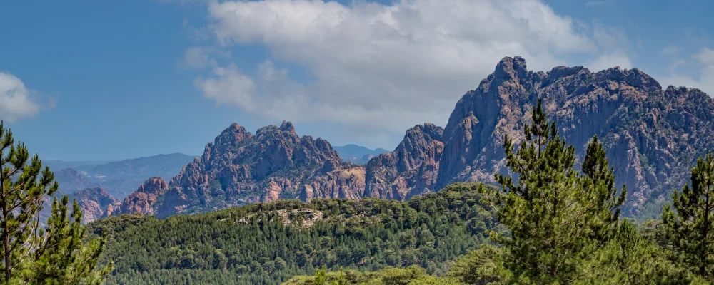
- Aiguilles de Bavella: red granite spires rising to 1,855 m at Punta Alta. The main route passes below them after the Asinau refuge. An alpine variant goes through them over the Bocca di u Pargulu (1,662 m).
Distance
About 180 km (112 miles) from Calenzana to Conca, in 16 stages.
If you have a GPX of this route from its official site or a planning app, open it in our free GPX viewer to see the distance, the climb and the height profile. The file stays on your device.
Best time to go
The refuges are staffed from mid-May to early October (16 May to 4 October in 2026). Outside those dates there's no warden, no food and no booking. Snow can lie at altitude until early July, and before mid-June you may need equipment for snow. Book through the PNRC before you go.
More journeys in Corsica, France
- France June 2023 · Greg
- France Spain 2024 · Greg
- The Rick Trip · Phil
- UK to Georgia by Bike · Simon & Lucy
- Sailing Around The World · Adam
- Spain France Pyrenees 2026 · Greg
Flyby films from Corsica, France
- Cassagne 101 · André
- To Cancale for a couple days rest. · Phil
- Source de l'Angillon · CNJ tourisme
- PLM line - Champagnole to Pont-du-Navoy - 25483409 · CNJ tourisme
More routes like this
- GR 5 through the Alps on foot · about 620 km (385 miles) · France
- Tour du Mont Blanc trek · about 170 km (105 miles) · France, Italy, Switzerland
- Chemin de Saint-Guilhem on foot · about 240 km (149 miles) · France
- Haute Route trek · about 215 km (134 miles) · France, Switzerland
- Jakobsweg on foot · about 770 km (480 miles) · Germany, Spain, France, Austria
- Chemin de Stevenson (GR 70) on foot · 272 km (169 miles) · France