GR 5 through the Alps on foot
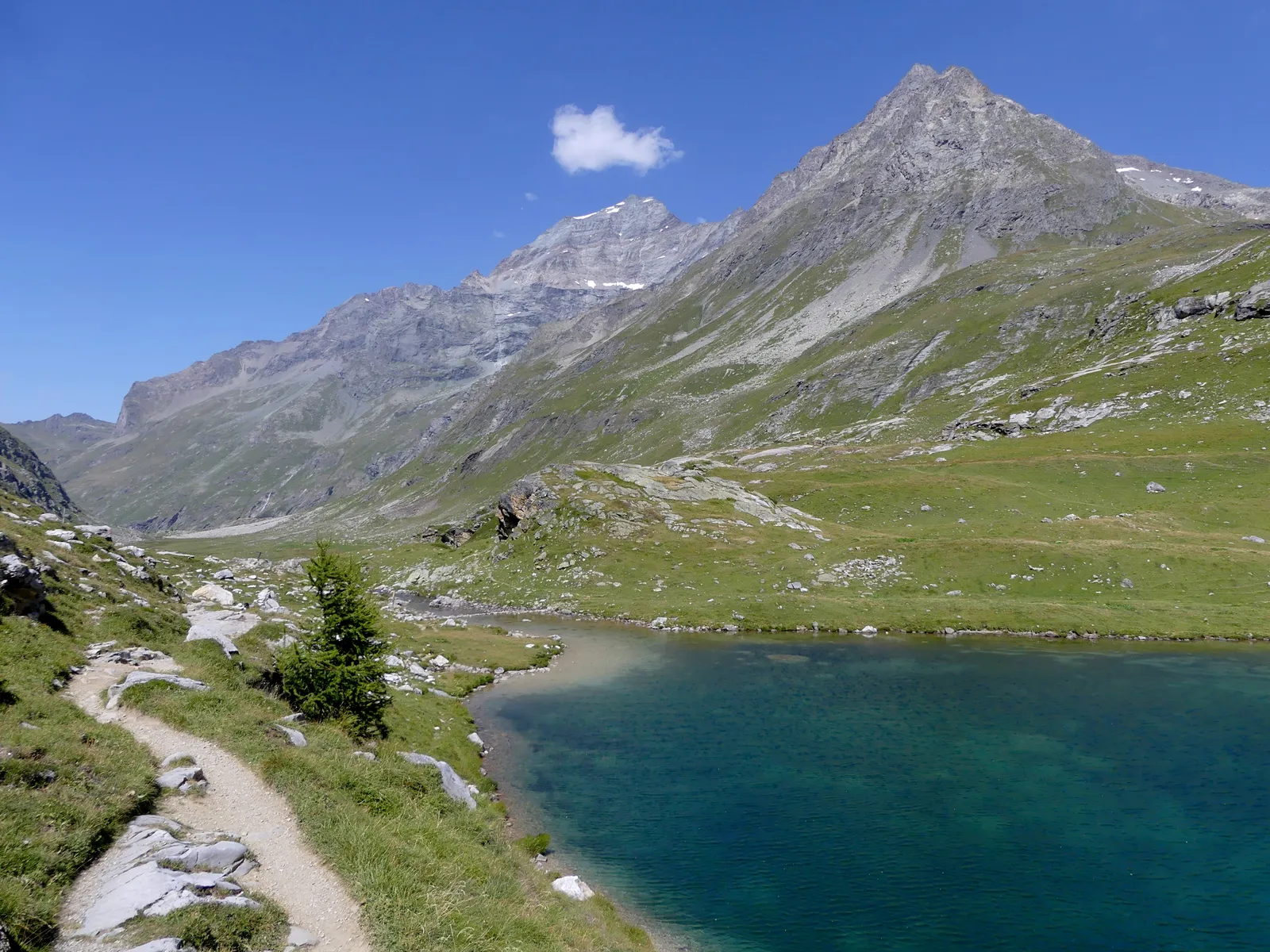
Photo: Florian Pépellin, CC BY-SA 4.0, via Wikimedia Commons
- Distance
- about 620 km (385 miles)
- Country
- France
- Difficulty
- Challenging
- Type of trip
- Hiking trail
The GR 5 runs 2,500 km from the North Sea to Nice, and its best-known part is the last one, the Grande Traversée des Alpes. It starts at Saint-Gingolph on Lake Geneva, on the Swiss border, and there's a variant from Thonon-les-Bains. On the way it crosses the Chablais, the Mont Blanc massif, the Beaufortain, the Vanoise, the Queyras, the Haute-Ubaye and the Mercantour. The association that runs the Grande Traversée des Alpes gives about 620 km in around forty stages, or more than a month of walking. You sleep in mountain refuges, gîtes d'étape, campsites, hotels and chambres d'hôtes, and the association says to book or ring ahead.
It's a mountain walk, not a climbing route, but it's hard going. The association reckons on 1,000 m of climbing on an average stage, and the FFRandonnée says up to 1,300 m, so it's for walkers with some experience. You'll cross scree on the passes and some sections are exposed, so you need to be sure-footed, above all in the wet or in fog. Camping rules change from one protected area to the next. In the Vanoise national park you can only pitch near some refuges, from 1 June to 30 September, for €5, and in the Contamines-Montjoie reserve it's banned below 2,500 m.
Highlights along the way
- Col de Bise: The first day climbs 1,701 m out of Saint-Gingolph to the col de Bise at 1,915 m, with a view back over Lake Geneva and the Jura.
- Brévent and the Bonhomme: You climb to the Brévent, at the southern end of the Aiguilles Rouges, for a wide view of the Mont Blanc massif. From the col du Brévent to the col du Bonhomme, at 2,329 m, the GR 5 shares its line with the Tour du Mont Blanc.
- Vanoise: Past Lac de la Plagne you climb to the col du Palet, at 2,652 m one of the highest points of the route. Then you follow the Leisse valley under the south face of the Grande Casse, at 3,855 m the highest summit in the Vanoise.
- Briançon and the Queyras: A short stage from Montgenèvre leaves time for Briançon's Vauban fortifications and old town. In the Queyras you pass Fort Queyras, a castle from the second half of the 13th century that Vauban later rebuilt, and above Ceillac you cross the col Girardin, at 2,699 m one of the highest passes on the route. The col de la Leisse (2,761 m) in the Vanoise is higher.
- Mercantour to the sea: From Larche, on the edge of the Mercantour national park, you cross passes such as the Croussette, at over 2,400 m. At Saint-Dalmas-Valdeblore the main route drops to Nice in three stages. The GR 52 variant stays higher, goes through the Vallée des Merveilles and finishes at Menton.
Distance
About 620 km (385 miles) in all, by the Grande Traversée des Alpes association's count. Its four sections add up to nearer 560 km (348 miles) in 36 stages, so the total depends on the variants you take.
Best time to go
The association puts the season at June to October, and the FFRandonnée's mongr.fr site gives May to October. Most refuges are only open from 15 June to 15 September, some open at weekends outside that, and in the southern Alps the season runs longer. Some village shops shut at the end of August. Early in the summer you can still find old snow in gullies and on north-facing slopes, which may mean stiff boots or mountaineering kit, and the col Girardin can hold snow late. In the dry summer of 2022 the refuge du col du Palet stayed shut all season because its springs ran dry. The weather changes fast, so check for storms and snow before you set off.
More journeys in France
- France June 2023 · Greg
- France Spain 2024 · Greg
- UK to Georgia by Bike · Simon & Lucy
- The Rick Trip · Phil
- Sailing Around The World · Adam
- Spain France Pyrenees 2026 · Greg
Flyby films from France
- PLM line - Champagnole to Pont-du-Navoy - 25483409 · CNJ tourisme
- Lamasquère Road Cycling · Michmich
- To sea, on a ferry, off the ferry · Phil
- The Great Escape · saeunn
More routes like this
- Via Alpina on foot · 2,000 km (1,240 miles) · Slovenia, Italy, Austria, Germany, Switzerland, Liechtenstein, France, Monaco
- Tour des Fiz on foot · about 52 km (32 miles) · France
- Tour du Queyras on foot · about 130 km (81 miles) · France
- GR 400 (Cantal volcano) on foot · about 140 km (87 miles) · France
- Jakobsweg on foot · about 770 km (480 miles) · Germany, Spain, France, Austria
- Chemin de Saint-Guilhem on foot · about 240 km (149 miles) · France