W Trek in Torres del Paine
- Distance
- about 75 km (47 miles)
- Country
- Chile
- Difficulty
- Moderate to challenging
- Type of trip
- Hiking trail
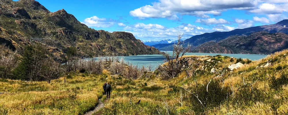
The W is the main multi-day trek in Torres del Paine National Park, in Chilean Patagonia, and gets its name from its shape on the map. It runs along the south side of the Paine massif, linking three valleys: Glacier Grey in the west, the Valle del Francés in the middle and the Ascencio valley up to the base of the Torres in the east. CONAF, which runs the park, says to allow 3 to 5 days. Most people start at one end and finish at the other: at Paine Grande, reached by catamaran across Lago Pehoé from Pudeto, or at Hotel Las Torres, reached by shuttle from the Laguna Amarga entrance. Buses run to the park from Puerto Natales, about two hours away.
You sleep in refugios (dormitory lodges that serve meals) or at campsites next to them. To walk the W you must book every night’s bed or pitch in advance. CONAF won’t let you onto the trails without bookings, and rangers check them along the way. The places are run by two companies: Las Torres Patagonia (Central, Chileno, Cuernos and Francés) and Vértice Patagonia (Paine Grande and Grey), and you can book with them directly or through an accredited operator. You also need a park entry ticket, bought online from Pases Parques at least 24 hours before you arrive. Wild camping, wood fires and leaving the marked paths are all banned, and you can only use stoves where the park allows them. There’s no phone signal on the trail. Expect strong winds, and weather that can change several times in a day.
Highlights along the way
- Glacier Grey: an outlet of the Southern Patagonian Ice Field that ends in Lago Grey in a front about 6 km wide and 30 m high, with icebergs drifting down the lake. Refugio Grey is 11 km from Paine Grande.
- Valle del Francés: from Campamento Italiano the trail climbs 5.4 km to Mirador Británico, a cirque surrounded by granite walls and peaks, with the French Glacier hanging off Paine Grande (2,884 m), the highest peak in the massif.
- Cuernos del Paine: the "horns", granite towers capped with dark sedimentary rock, above Lago Nordenskjöld on the stretch between Italiano and Los Cuernos.
- Base de las Torres: the three granite towers above a glacial lake at the head of the Ascencio valley. The last 1.4 km is a steep climb over loose moraine.
- Lago Pehoé: the brightly coloured lake you cross by catamaran to Paine Grande, with the Cuernos rising behind it.
Distance
About 75 km for the usual line, using CONAF’s trail lengths: from Paine Grande out to Refugio Grey and back (22 km), on to Italiano (7.5 km), up the Valle del Francés to Mirador Británico and back (about 11 km), along to Los Cuernos and Hotel Las Torres (about 17 km), then up to the base of the towers and back (about 19 km). Add 17 km if you walk in from the park administration instead of taking the catamaran.
If you have a GPX of this route from its official site or a planning app, open it in our free GPX viewer to see the distance, the climb and the height profile. The file stays on your device.
Best time to go
October to April, when the refugios and campsites are fully open and days are long. November to January are the windiest months and also the busiest. From May to September the trails are under snow and ice, and CONAF changes the rules through the winter. In 2026 it closed the W in June and July and required an accredited guide until 15 September. The full circuit (the “O”) stayed closed over the winter. Check CONAF’s daily trail report before you go.
Flyby films from Chile
- Lake Tota, Boyaca, Colombia · Kelly
More routes like this
- Via Podiensis (GR 65) on foot · 755 km (469 miles) · France
- Camino Inglés · about 112 km (70 miles) · Spain
- Hermannsweg on foot · about 163 km (101 miles) · Germany
- Via Alpina on foot · 2,000 km (1,240 miles) · Slovenia, Italy, Austria, Germany, Switzerland, Liechtenstein, France, Monaco
- Lycian Way · about 760 km (470 miles) · Turkey
- Everest Base Camp Trek · about 130 km (80 miles) · Nepal