Everest Base Camp Trek
- Distance
- about 130 km (80 miles)
- Country
- Nepal
- Difficulty
- Very challenging
- Type of trip
- Hiking trail
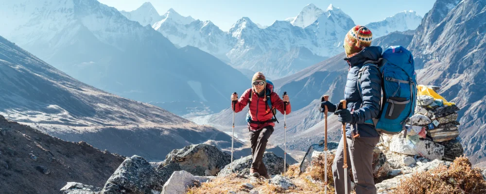
The Everest Base Camp trek starts and finishes at Lukla, an airstrip at 2,845 m in the Solukhumbu district of north-east Nepal, and climbs up the Dudh Kosi and Imja Khola valleys to the climbers’ base camp at the foot of the Khumbu Icefall, at about 5,364 m. There are no roads. Supplies go up by porter and yak, and you sleep and eat in teahouses (simple lodges) in the villages every few hours along the trail. The usual way up is two days to Namche Bazaar, then Tengboche, Pangboche, Dingboche or Pheriche, Lobuche and Gorak Shep, the last settlement, at about 5,160 m. From Gorak Shep you walk out over the glacier moraine to base camp and back, and most people also climb Kala Patthar above the village for the view of Everest, whose summit is hidden behind Nuptse from most of the valley.
Allow about two weeks. The altitude sets the pace: the standard plan is a rest day in Namche and another in Dingboche or Pheriche, and walking higher by day than you sleep. Most people fly in from Kathmandu or Ramechhap (Manthali), a drive of several hours from Kathmandu, which many Lukla flights use in the busiest months. Lukla’s runway is 527 m long and slopes at 11.7%, and cloud and wind often delay or cancel flights, so leave spare days at the end. You need a Sagarmatha National Park permit, checked at the park entrance at Jorsale just past Monjo, and a local permit. The Nepal Tourism Board lists the Everest Base Camp trek among the routes where, since 1 April 2023, foreign trekkers must be accompanied by a licensed guide with a TIMS card issued through a registered agency. The local Khumbu Pasang Lhamu Rural Municipality says a guide isn’t compulsory in the Everest region, and trekkers report still walking independently there, so check the rule and the current permits and fees with the Nepal Tourism Board or a registered agency before you go.
Highlights along the way
- Namche Bazaar: the main Sherpa town of the Khumbu, spread up a steep hillside from about 3,440 m. It’s the usual first acclimatisation stop, with a market on Saturday mornings.
- Tengboche Monastery: the largest gompa in the Khumbu, at 3,867 m, with Ama Dablam behind it. It was founded in 1916, rebuilt after the 1934 earthquake and rebuilt again after a fire in 1989.
- Sagarmatha National Park: 1,148 km² of the upper Khumbu, from 2,845 m to the summit of Everest. It was set up in 1976 and listed by UNESCO in 1979, Nepal’s first natural World Heritage Site.
- Kala Patthar: a rocky point on the south ridge of Pumori above Gorak Shep, given as 5,644 m (some sources say 5,545 m). The climb takes 1.5 to 2 hours and gives trekkers their easiest close view of Everest, Nuptse and Changtse.
- Everest Base Camp: the tent camp used by expeditions climbing the south-east ridge, on the Khumbu Glacier below the Khumbu Icefall. It’s the furthest point of the trek, a walk out and back from Gorak Shep.
Distance
About 130 km (80 miles) there and back from Lukla, the figure trekking companies usually give. There’s no official measured length. Itineraries take 12 to 14 days, including two acclimatisation days.
If you have a GPX of this route from its official site or a planning app, open it in our free GPX viewer to see the distance, the climb and the height profile. The file stays on your device.
Best time to go
March to May and late September to November. From June to early September the monsoon brings rain, cloud over the peaks and frequent Lukla flight delays. December to February is very cold, and deep snow can block the trail above Tengboche.
More routes like this
- Makalu Base Camp Trek · Nepal
- Annapurna Base Camp Trek · about 75–80 km (47–50 miles) · Nepal
- Westweg on foot · about 285 km (177 miles) · Germany
- Fish River Canyon Trail · about 85 km (53 miles) · Namibia
- Cape Wrath Trail · about 320 km (200 miles) · Scotland
- GR 400 (Cantal volcano) on foot · about 140 km (87 miles) · France