Boundary Waters Canoe Area
- Distance
- Varies with your route. For scale, the wilderness has more than 1,900 km (1,200 miles) of canoe routes and runs about 240 km (150 miles) along the border. Most people enter at one point and paddle a loop over several days.
- Country
- USA
- Difficulty
- Moderate
- Type of trip
- Kayak & canoe
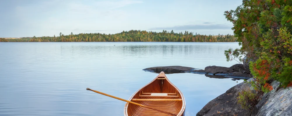
The Boundary Waters Canoe Area Wilderness (BWCAW) is a paddling area, not a single route. It covers about 1.1 million acres (4,400 square km) of lakes, rivers and forest in the Superior National Forest in north-eastern Minnesota, and stretches nearly 150 miles (240 km) along the Canadian border. Inside there are over 1,100 lakes, more than 1,200 miles of canoe routes linked by portage trails and over 2,000 designated campsites. You plan your own loop from one of the entry points. Ely and Grand Marais are the two towns with the most outfitters and services, and the Echo Trail, Fernberg Road and Gunflint Trail lead to many of the entry points.
Every visit needs a permit from the US Forest Service. From 1 May to 30 September, overnight paddling trips need a quota permit for a set entry point and entry date, and the number of permits per entry point is limited, so book early on Recreation.gov. Groups are capped at 9 people and 4 canoes or kayaks. Most lakes are paddle-only, and motors are allowed on a short list of named lakes. Across the border is Ontario’s Quetico Provincial Park, which is separate, with its own Ontario Parks permits and its own rules. Going into Quetico by water also means clearing Canadian customs. Canada is closing its Remote Area Border Crossing permit programme. Permits stay valid until 30 November 2026, and after that you report your entry by phone or at a border post, so check the current rules with the Canada Border Services Agency and Ontario Parks before you go.
Highlights along the way
- Portages: canoe routes are joined by portage trails, so you carry the boat and your packs between lakes. Light gear makes a big difference.
- Height of Land Portage: an 80-rod (about 400 m) portage on the border between North Lake and South Lake that crosses the Laurentian Divide. Water on one side drains to Hudson Bay and on the other to Lake Superior. Fur-trade voyageurs held an initiation ceremony here for newcomers.
- Hegman Lake pictographs: red ochre paintings, thought to be Ojibwe, on a rock face above North Hegman Lake, near Ely.
- Eagle Mountain: the highest point in Minnesota at 2,301 ft (701 m), reached by a 3.5-mile (5.6 km) trail from the Grand Marais side.
- Wildlife and fishing: moose, black bears, wolves, beavers, bald eagles and loons live here. The lakes hold walleye, northern pike, smallmouth bass and lake trout.
Distance
Varies with your route. For scale, the wilderness has more than 1,900 km (1,200 miles) of canoe routes and runs about 240 km (150 miles) along the border. Most people enter at one point and paddle a loop over several days.
Best time to go
June to September. In Ely, average highs are about 22 to 25°C from June to August, and nights drop to around 7°C by September. Quota permits apply from 1 May to 30 September. From 1 October to 30 April you fill in a self-issued permit at the entry point instead, but nights are near freezing by October. Fire bans, detours and closures are posted on the Recreation.gov permit page, so check it again just before you leave.
More journeys in USA
- Long Trail · Lynn
- US Road Trip · Julia & James
- 美国西南自驾游(Southwest USA Road Trip) · Qinggong
- World Trip - One Planet Expedition · David Bossek (Nature Nomad World)
- Segundo dia · Camila
- Utah Or Bust. · Matthew
Flyby films from USA
- Friday 6th · Xiao
- Day 20 · Lynn
- Ginkgo forest · Xiao
- Second day · Camila
More routes like this
- Hudson River by kayak · about 412 km (256 miles) · USA
- Sea kayaking the San Juan Islands · USA
- Green River by kayak · about 109 km (68 miles) · USA
- Kayaking Lake Powell · USA
- Everglades Wilderness Waterway by kayak · about 159 km (99 miles) · USA
- Doubtful Sound / Patea by kayak · New Zealand