Hudson River by kayak
- Distance
- about 412 km (256 miles)
- Country
- USA
- Difficulty
- Moderate to challenging
- Type of trip
- Kayak & canoe
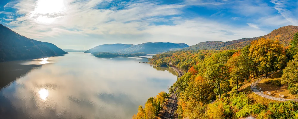
The Hudson River Greenway Water Trail is an official paddling route and a US National Water Trail, run by New York State’s Hudson River Valley Greenway. It covers 256 miles (412 km) and has two starting points: Hadley in the Adirondack Park, on the upper Hudson, and Whitehall at the head of Lake Champlain, which joins via the Champlain Canal. Both lines finish at Battery Park in Manhattan. The upper river includes white water. Below the Federal Dam at Troy the Hudson is a tidal estuary, and the tide turns the current twice a day as far north as Troy.
There are more than 100 designated access sites. The aim is a launch and take-out at least every 10 miles (16 km) on both banks and a campsite or other overnight stop every 15 miles (24 km), but railways run along both shores and cut off most of the land from the river, so plan your stops in advance. You can paddle it a day at a time or as a longer trip. The Greenway’s safety advice is blunt. The Hudson is an arm of the Atlantic, with strong tidal currents, wind, ships, tugs with barges and fast motorboats. It recommends a boat built for sea conditions, keeping out of the shipping channel or crossing it at right angles, and a buoyancy aid whenever you’re on or near the water. Some towns need a permit to use their launches, and New York City has its own boat-launch rules.
Highlights along the way
- Hudson Highlands: the river narrows between Storm King Mountain, about 408 m high on the west bank, and Breakneck Ridge on the east. The two form the northern gate of the Highlands.
- Pollepel Island: the ruins of Bannerman’s Castle, a military-surplus arsenal built from 1901 and gutted by fire in 1969. The island is closed to the public except on guided tours run by the Bannerman Castle Trust, and old causeways around it are hidden at high tide.
- World’s End: the deepest point of the Hudson, 62 m, between West Point and Constitution Island.
- Cold Spring and Beacon: riverside towns on the east bank with Metro-North stations on the Hudson Line to Grand Central, handy for getting back after a one-way paddle.
- Manhattan: the trail ends at Battery Park, at the southern tip of the island, where the river meets New York Harbor.
Distance
About 412 km (256 miles) for the whole Water Trail, from Hadley or Whitehall to Battery Park. The whole Hudson is 507 km (315 miles) from its source in the Adirondacks. You can do it in sections.
Best time to go
June to September, when the water is warmest. The Greenway warns that cold water is a danger in colder weather, especially in spring and autumn, so dress for immersion if you go then. Check tides and currents (NOAA publishes both) and the weather before you set off. Conditions can turn rough quickly.
More journeys in USA
- Long Trail · Lynn
- US Road Trip · Julia & James
- 美国西南自驾游(Southwest USA Road Trip) · Qinggong
- World Trip - One Planet Expedition · David Bossek (Nature Nomad World)
- Segundo dia · Camila
- Utah Or Bust. · Matthew
Flyby films from USA
- Friday 6th · Xiao
- Day 20 · Lynn
- Ginkgo forest · Xiao
- Second day · Camila
More routes like this
- Sea kayaking the San Juan Islands · USA
- Green River by kayak · about 109 km (68 miles) · USA
- Boundary Waters Canoe Area · USA
- Everglades Wilderness Waterway by kayak · about 159 km (99 miles) · USA
- Kayaking Lake Powell · USA
- Sognefjord by kayak · Norway