Kayaking Lake Powell
- Distance
- Varies with your plan. For scale, the lake is up to 299 km (186 miles) long when full, and much shorter now. The Escalante Arm is about 56 km (35 miles) by water from Halls Crossing.
- Country
- USA
- Difficulty
- Moderate
- Type of trip
- Kayak & canoe
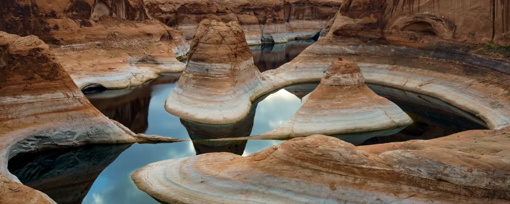
There’s no set kayak route on Lake Powell. It’s a paddling area: the reservoir behind Glen Canyon Dam on the Colorado River, mostly in southern Utah with its south-western end in Arizona near Page, inside Glen Canyon National Recreation Area. When full, at 3,700 ft (1,128 m) above sea level, it runs for up to 299 km (186 miles) through flooded side canyons of red sandstone. It’s nowhere near full now. Drought since 2001 has pulled the shoreline back. On 15 September 2026 the lake fell to 3,516.6 ft (1,072 m), its lowest since it first filled in 1980, and on 1 November it stood at 3,532 ft (1,077 m), so check the NPS lake-level page for today’s figure. As the water drops, some ramps close to motorboats but stay open to paddlecraft at your own risk, and some close to all boats, so check the National Park Service launch-ramp table. Kayaks can also launch from beach camping areas such as Lone Rock Beach and Stanton Creek.
You can camp on the shore for up to 14 days without a camping permit or fee. If you’re more than 200 yards from a developed area you must carry an approved human-waste system, such as a portable toilet or a bag system, and you can be fined without one. There’s no extra fee to launch a kayak, but the park entrance fee applies. Vessel passes are for motorboats. Check current fees with the park. The NPS warns that beaches near Wahweap and Lone Rock can be crowded with motorboats and that channels narrow as the water drops. Check the forecast and the launch-ramp status before you drive out.
Highlights along the way
- Antelope Canyon by water: the flooded lower end of Antelope Canyon, reached from Antelope Point, is one of three wakeless canyons on the lake. The dry slot canyons upstream are on Navajo Nation land, and you can only visit them on a guided tour.
- Rainbow Bridge: one of the largest natural bridges in the world, 88 m (290 ft) high with an 84 m (275 ft) span, and sacred to the Navajo, Hopi, San Juan Southern Paiute, Kaibab Paiute and White Mesa Ute. At today’s levels the dock doesn’t reach land, so you beach and walk through mud to the trail. It’s about two hours by motorboat from the marinas near Page.
- Escalante Arm: about 35 miles (56 km) by water downstream of Halls Crossing. The NPS says nearly every side canyon here has good paddling and hiking, with alcoves, arches, rock art and hanging gardens.
- Cathedral in the Desert: a sandstone chamber at the head of a side canyon off the Escalante Arm. It was under water for most of the lake’s life, but its floor shows whenever the lake drops below about 3,605 ft, as it is now.
- Moqui Canyon and Lost Eden Canyon: NPS picks near Halls Crossing for the upper lake. Moqui is a long canyon with high walls and large alcoves about 7–8 km upstream. Lost Eden is a short three-fingered canyon about 1.6 km downstream and is wakeless.
Distance
Varies with your plan. For scale, the lake is up to 299 km (186 miles) long when full, and much shorter now. The Escalante Arm is about 56 km (35 miles) by water from Halls Crossing.
Best time to go
April to June and September to October. July and August are hot. The average July high in Page is about 36 °C (97 °F). The NPS warns of monsoon storms and flash floods in summer and autumn, and long spells of wind in spring. Lake levels change through the year, so check the NPS launch-ramp table before every trip.
More journeys in USA
- Long Trail · Lynn
- US Road Trip · Julia & James
- 美国西南自驾游(Southwest USA Road Trip) · Qinggong
- World Trip - One Planet Expedition · David Bossek (Nature Nomad World)
- Segundo dia · Camila
- Utah Or Bust. · Matthew
Flyby films from USA
- Friday 6th · Xiao
- Day 20 · Lynn
- Ginkgo forest · Xiao
- Second day · Camila
More routes like this
- Hudson River by kayak · about 412 km (256 miles) · USA
- Sea kayaking the San Juan Islands · USA
- Everglades Wilderness Waterway by kayak · about 159 km (99 miles) · USA
- Boundary Waters Canoe Area · USA
- Green River by kayak · about 109 km (68 miles) · USA
- Sognefjord by kayak · Norway