Sea kayaking the San Juan Islands
- Distance
- Varies with your plan. For scale, Jones Island is about 1.6 km off Orcas Island, and Haro Strait is about 36 km long. The Cascadia Marine Trail aims for a place to land roughly every three hours of paddling.
- Country
- USA
- Difficulty
- Moderate to challenging
- Type of trip
- Kayak & canoe
There’s no single kayak route through the San Juan Islands. It’s a paddling area: an archipelago in the far north-west of Washington State, between the mainland and Vancouver Island, with more than 400 islands and rocks at high tide, 128 of them named. No bridges reach the islands. Washington State Ferries sail from Anacortes to Lopez, Shaw, Orcas and San Juan islands, and many paddlers take a kayak across on the ferry and set off from Friday Harbor, Roche Harbor or Orcas. For overnight trips the Cascadia Marine Trail, run by the Washington Water Trails Association, has campsites for kayaks, canoes and other human- or wind-powered boats. In the San Juans these include Jones Island, Posey Island, Stuart Island and Saddlebag Island state parks, Roche Harbor, and the county parks on San Juan and Shaw islands.
The channels are not calm water. Tidal currents run hard between the islands, Haro Strait on the west side is a major shipping route to Vancouver with rip tides and little shelter, and the ferries cross the channels you’ll be paddling. The sea is cold all year. WWTA warns that water travel is potentially hazardous, so check tides, currents and the weather yourself, and have a back-up landing in mind. Check fees and booking for each Marine Trail site with its managing agency. Since 1 January 2025 every boat in Washington waters, kayaks and paddleboards included, must stay 1,000 yards (about 900 m) from Southern Resident killer whales.
Highlights along the way
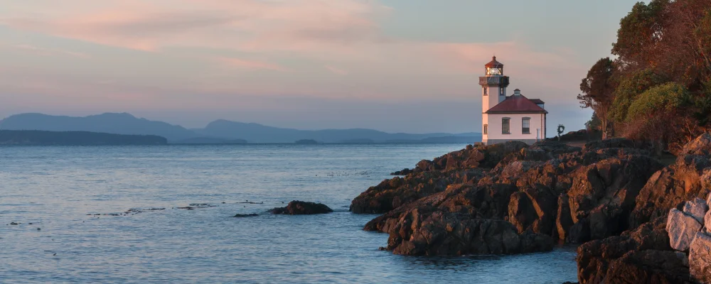
- Lime Kiln Point State Park: a 42-acre park on the west shore of San Juan Island, above Haro Strait, with a lighthouse and an interpretive centre. It’s one of the best places in the world to watch wild orcas from land.
- Jones Island State Park: a 188-acre island about 1.6 km off the south-west corner of Orcas Island, reachable only by boat. It has 24 primitive campsites, two of them set aside for Cascadia Marine Trail paddlers, and about 6 km of trails.
- Roche Harbor: a sheltered harbour on the north-west tip of San Juan Island that grew up around a lime works founded in 1886. The old Hotel de Haro still stands, and the harbour is a Marine Trail site.
- Friday Harbor: the ferry port and the only incorporated town in the islands, on San Juan Island. It’s the easiest place to start, stock up and finish.
- Haro Strait: the channel between San Juan Island and Canada’s Gulf Islands, and the international border since 1872. Orcas, sea lions, seals and seabirds feed here, and most of the Fraser River salmon run passes through.
Distance
Varies with your plan. For scale, Jones Island is about 1.6 km off Orcas Island, and Haro Strait is about 36 km long. The Cascadia Marine Trail aims for a place to land roughly every three hours of paddling.
Best time to go
June to September. The islands sit in the rain shadow of the Olympic Mountains and get much less rain than Seattle, and summer highs are around 21 °C (70 °F). The water stays cold in every month, so dress for a swim. Wind against tide and ferry traffic can make crossings hard at any time of year. Plan around the current tables, not the clock.
More journeys in USA
- US Road Trip · Julia & James
- Southwest USA Road Trip · Qinggong
- World Trip - Zero Impact Expedition · David
- Second day · Camila
- Utah Or Bust. · Matthew
- On the road to Harpes Ferry · Xiao
Flyby films from USA
- Ginkgo forest · Xiao
- Second day · Camila
- Saindo de lake Havasu City · Camila
- ALASKA or BUST! · Matt
More routes like this
- Kayaking Lake Powell · USA
- Hudson River by kayak · about 412 km (256 miles) · USA
- Green River by kayak · about 109 km (68 miles) · USA
- Everglades Wilderness Waterway by kayak · about 159 km (99 miles) · USA
- Boundary Waters Canoe Area · USA
- Katherine Gorge by canoe · Australia