Marlborough Sounds by kayak
- Distance
- Varies with your plan. For scale, the Queen Charlotte Track is 73.5 km from Ship Cove to Anakiwa, Pelorus Sound’s main channel is about 55 km long, and Tory Channel is about 17 km.
- Country
- New Zealand
- Difficulty
- Easy to moderate
- Type of trip
- Kayak & canoe
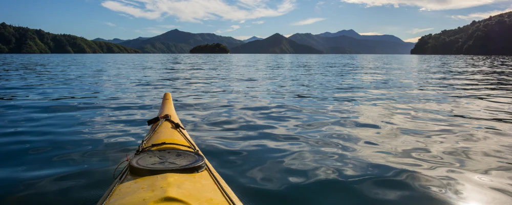
There’s no set paddling route in the Marlborough Sounds. It’s a paddling area of sea-drowned valleys at the top of the South Island, about 4,000 km² of water and hills. Its coastline is about a tenth of the length of New Zealand’s coast. Most kayakers start in Queen Charlotte Sound / Tōtaranui, from Picton at its head or from Anakiwa at the end of the Grove Arm, where kayak hire and guided trips are based. The other two big sounds are Pelorus Sound / Te Hoiere, the largest, which runs about 55 km up to Havelock, and Kenepuru Sound, one of Pelorus’s arms. Picton is the South Island end of the Cook Strait ferries from Wellington.
Those ferries share the water with you. Interislander and Bluebridge ships sail between Wellington and Picton through Tory Channel and Queen Charlotte Sound, and Tory Channel has strong tidal currents. Marlborough District Council’s Navigation Bylaw sets how far small craft must keep from these ships and when you must wear a lifejacket, so read it before you go. The Department of Conservation (DOC) runs campsites around the sounds, including some along the Queen Charlotte Track. Check booking rules with DOC before you go.
Highlights along the way
- Meretoto / Ship Cove: near the mouth of Queen Charlotte Sound, Cook’s favourite anchorage. He first anchored the Endeavour here in January 1770 and came back five more times over his three voyages. There’s a memorial from 1913, and the Queen Charlotte Track starts here.
- Motuara Island: a predator-free island in Queen Charlotte Sound, about 32 km from Picton, where rats were wiped out in 1992. You can land at the jetty from a kayak and look for tīeke (South Island saddleback), bellbirds and kererū. Young rowi kiwi are raised here.
- Queen Charlotte Track: a 73.5 km walking and biking track from Ship Cove to Anakiwa along the ridges and bays between Queen Charlotte and Kenepuru sounds. Some operators combine a few days’ kayaking with a section of the walk. Part of the track crosses private land, and you need a Queen Charlotte Track Land Cooperative pass for those sections.
- Pelorus Sound / Te Hoiere: quieter and longer than Queen Charlotte, with arms such as Tennyson Inlet and Kenepuru Sound. Most of the marine farms in the Marlborough Sounds are here, mainly growing green-lipped mussels, so expect working boats and farm lines.
- Shags of the Sounds: the entire breeding population of the rare rough-faced shag (king shag) lives in the Marlborough Sounds.
Distance
Varies with your plan. For scale, the Queen Charlotte Track is 73.5 km from Ship Cove to Anakiwa, Pelorus Sound’s main channel is about 55 km long, and Tory Channel is about 17 km.
Best time to go
December to March has the warmest weather. At Blenheim, south of Picton and one of New Zealand’s sunniest towns, January and February average about 23 °C by day. From October to April it’s mild enough for camping trips. June to August are the coolest and wettest months at Blenheim. Wind and sea state in the sounds can change quickly, so check the marine forecast every day.
More journeys in New Zealand
- Te Araroa · The long walk of Te Waipounamu
- Van Life In New Zealand · Nick
- Bikepacking Through NZ · Kate
Flyby films from New Zealand
- Sunday 15th · The long walk of Te Waipounamu
- Auckland-Santiago-Buenos Aires · Karen
- French Polynesia to Fiji · Adam
- North Island · Nick
More routes like this
- Doubtful Sound / Patea by kayak · New Zealand
- Loch Lomond by kayak · Scotland
- Sea kayaking the San Juan Islands · USA
- Hudson River by kayak · about 412 km (256 miles) · USA
- Katherine Gorge by canoe · Australia
- Andaman Sea by kayak · Thailand