Fish River Canyon Trail
- Distance
- about 85 km (53 miles)
- Country
- Namibia
- Difficulty
- Challenging
- Type of trip
- Hiking trail
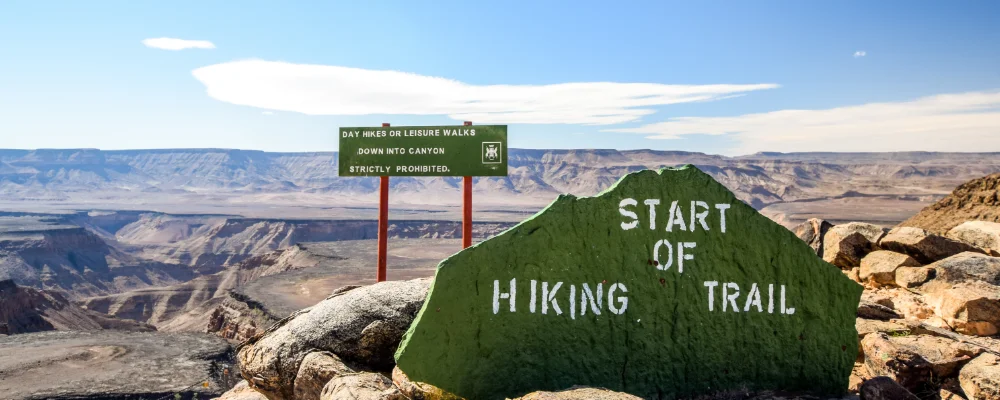
The Fish River Canyon in southern Namibia is about 160 km long and up to 550 m deep, and it’s generally described as the largest canyon in Africa. The hiking trail follows the canyon floor south from Hikers’ Point, near the Hobas camp, to the hot springs resort at Ai-Ais. It’s about 85 km and takes four to five days. Namibia Wildlife Resorts (NWR) runs the trail and issues the permits. You check in at Hobas, where your permit and medical certificate are checked.
There are no huts, toilets or shops. You carry everything and sleep on the sand by the river. Fires aren’t allowed. Most of the route has no proper path, apart from occasional markings on rocks. You follow the river and cross it many times. The first part is a steep descent from the rim on loose rock. If someone is hurt, the rest of the group has to get them to one of the few emergency exit points, where park vehicles patrol. You need to arrange transport back from Ai-Ais to Hobas.
Highlights along the way
- Hikers’ Point: the trail starts on the rim, with the river far below, and drops straight down into the canyon.
- The river crossings: you wade across the Fish River again and again. It’s Namibia’s longest interior river, but it only flows at certain times of year.
- Sulphur Springs: a spring on the canyon floor that you smell before you see. It’s also one of the official emergency exit points.
- Four Finger Rock: a rock landmark further down the canyon, and another of the emergency exits.
- Ai-Ais: the finish. The name means "scalding hot" in Khoekhoe, and the thermal water comes out of the ground at around 60 °C and is piped into the resort’s indoor pools.
Distance
About 85 km from Hikers’ Point to Ai-Ais. Sources give anything from 80 to 90 km, depending on how many bends you cut across.
Best time to go
The trail is only open from 1 May to 15 September, because of the summer heat and the risk of floods the rest of the year. Groups must have at least three people, hikers must be over 12, and you need a doctor’s certificate of fitness issued within 40 days of the start. Book with NWR. In October 2026 its online booking was unavailable and it was taking bookings by email at reservations@nwr.com.na. High water can close the trail even in season: it closed in late June 2026 and didn’t reopen until 17 July.
More routes like this
- Laugavegur Trail · about 55 km (34 miles) · Iceland
- Kerry Way · 232 km (144 miles) · Ireland
- Via Postumia on foot · about 956 km (594 miles) · Italy
- Goldsteig on foot · about 660 km (410 miles) · Germany
- Kumano Kodo on foot · about 38 km (24 miles) · Japan
- South West Coast Path · about 1,014 km (630 miles) · England