GPX tools
What a GPX file is
A GPX file is a route saved as a list of points on the map, usually with the height and the time at each one. Watches, bike computers and apps such as Strava, Garmin Connect and Komoot all save and open them. The GPX tools let you look at one, tidy it, change it, join several together, or turn it into another type of file. They run in your browser, so your files aren't uploaded and there's nothing to sign up for.
The GPX viewer
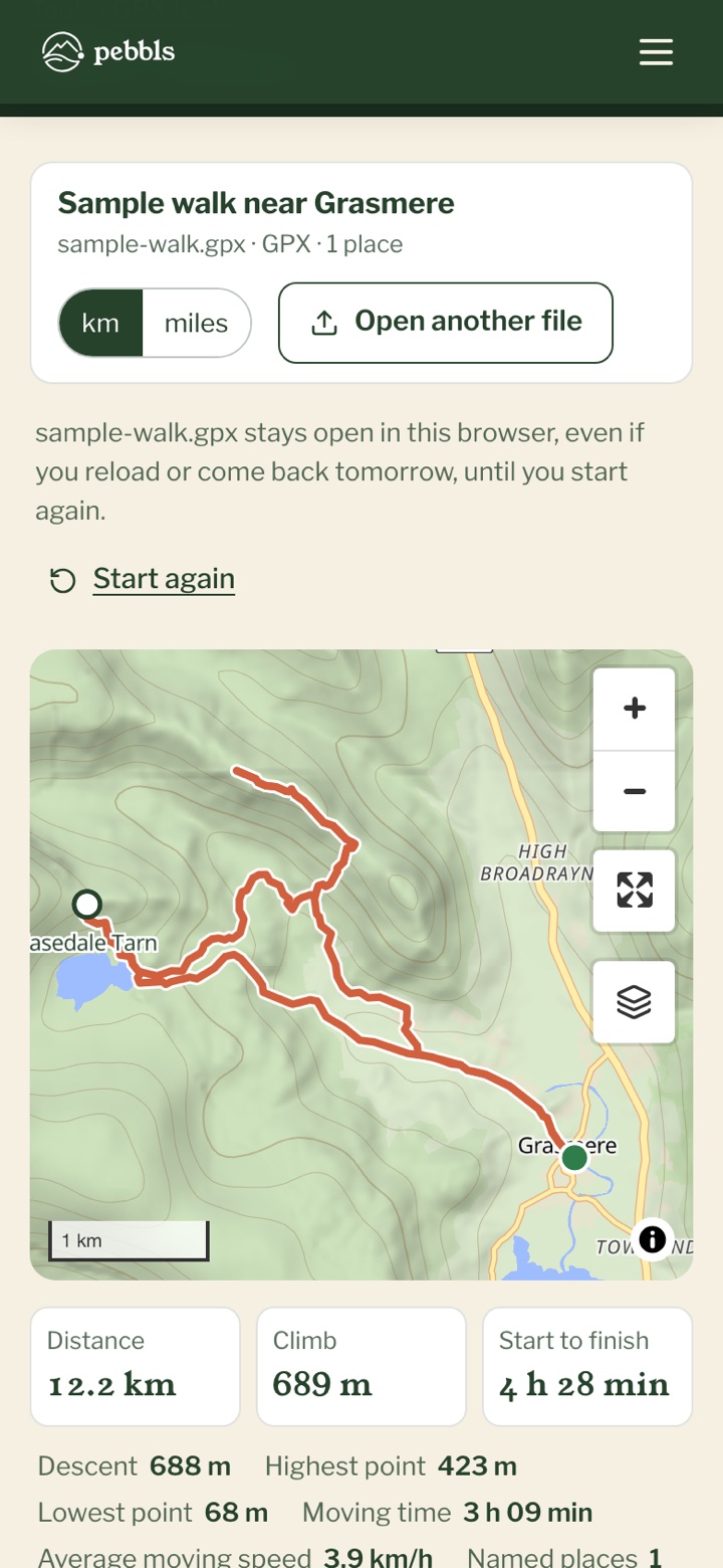
Tap "Choose a file", or drop a file on the page, and the route goes on the map with the distance, the climb and a height profile underneath. If the file has times you also see how long it took and how much of that was moving. Under "Tidy the track", drag the two dark handles on the height profile inwards to cut off the drive to the car park at the start, and "Take them out" clears points where the GPS jumped away. Then pick a type under "Save as" and save it. Your original file isn't changed. If you haven't a file to hand, "Try it with a sample walk" opens one of ours.
The GPX editor
For bigger changes, tap "Open in the full editor" in the viewer, or go straight to the GPX editor. The editor has five tools along the top, and "Undo" takes back any change.
- "Pick": tap two points on the line for the stretch between them, then "Delete this stretch", "Keep only this stretch", or redraw it along the paths. One point gives you "Split into two files here"
- "Draw": tap the map to add to the route. It follows footpaths, cycle routes or roads, or goes straight for a ferry crossing
- "Bend": drag a wobbly bit of line back onto the path
- "Tidy": take out stray points, use fewer points for an older device, or "Turn the route round"
- "Files": show, hide and rename files, join them, or split a long recording into days
- "Save" saves the result to your downloads
Joining files together
Merge GPX files puts several routes into one, such as a walk over three days or a ride you recorded in two halves. Choose the files, put them in order with the arrows or "Put in time order", and choose what happens between them: "Leave a gap" keeps them as separate pieces of one track, and "Join with a line" draws a straight line from the end of one to the start of the next. Give it a name and save it.
Changing the file type
The GPX tools page has converters for KML to GPX, GPX to KML, KMZ to GPX, and FIT files from a Garmin, Wahoo or Coros to GPX. Choose the file, check "Change to", and save. Heart rate and other extras are only kept in GPX.
Doing more with a route
From the viewer you can make a 3D flyby film of the route, or keep it on a map of your trips with a free Pebbls account. Those two send the route to Pebbls. Nothing else on these pages does.
What they don't do
They can't add times or heart rate that weren't recorded, and a route you draw only follows paths that are on OpenStreetMap. If a path is missing, the editor has a link to add it there.