Camino Sanabrés
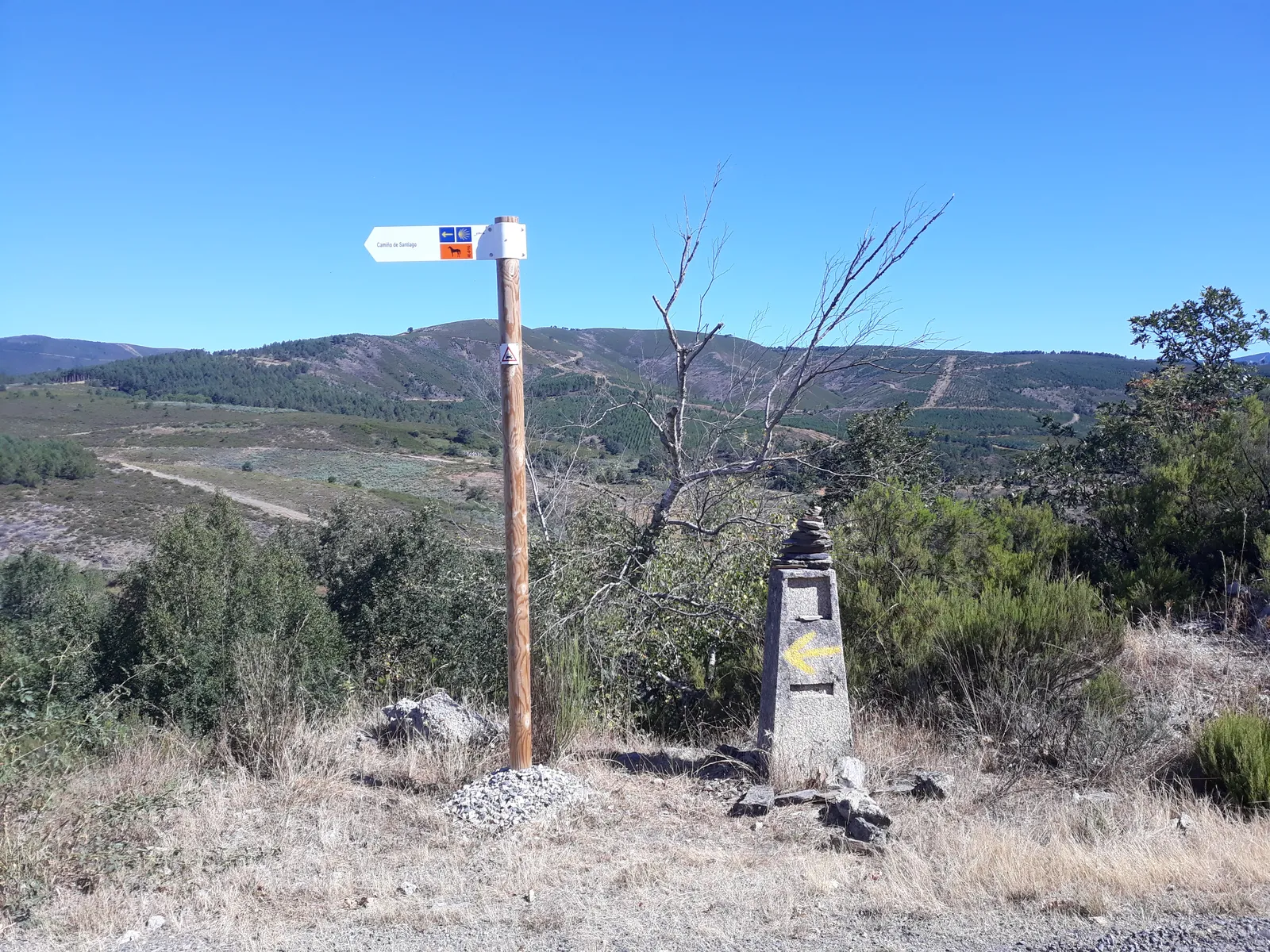
Photo: Simon Burchell, CC BY-SA 4.0, via Wikimedia Commons
- Distance
- about 362 km (225 miles)
- Country
- Spain
- Difficulty
- Moderate to challenging
- Type of trip
- Hiking trail
The Camino Sanabrés is the branch of the Vía de la Plata that turns north-west at Granja de Moreruela, north of Zamora, and goes straight to Santiago through Sanabria and Ourense, instead of carrying on to Astorga and the Camino Francés. In Galicia it’s also called the Camino Mozárabe. Gronze splits it into 14 stages from Granja de Moreruela, so allow about two weeks, more with rest days. You sleep in albergues (pilgrim hostels), many of them public and cheap, as well as hostales and rural guesthouses. It’s waymarked all the way. For the Compostela you need at least the last 100 km on foot and a credencial (pilgrim passport) stamped as you go.
The Xunta de Galicia traces the route to the Roman road between Mérida and Astorga, and says Almanzor’s army came this way to attack Santiago in 997. Don’t expect the crowds or the bed count of the Francés. Two passes come on consecutive days, Padornelo and A Canda, and from A Gudiña you choose between the main line by Laza and a longer, flatter variant by Verín.
Highlights along the way
- Santa Marta de Tera: The Romanesque church at the end of the second stage has a stone figure of Saint James dressed as a pilgrim, which Gronze calls the oldest carving of the saint. The public albergue is next to the church.
- Puebla de Sanabria: The capital of the Sanabria district, with a medieval old town, the church of Santa María del Azogue and the castle of the Counts of Benavente. Gronze lists hostales and hotels here but no pilgrim albergue.
- Padornelo and A Canda: Padornelo, at 1,356 m, is on the stage to Lubián. Next morning a track climbs about 310 m in 4 km from the Tuiza sanctuary to A Canda, 1,265 m, where you cross into Galicia. Gronze says the villages beyond have few or no services, so buy food in Lubián.
- A Gudiña to Laza: 34 km, which Gronze calls long, lonely and mountainous, much of it above 1,000 m. You can split it by sleeping in Campobecerros or As Eiras. Gronze reckons the Verín variant is the more sensible choice on a bike.
- Ourense: The Romans valued the city for its gold. The Ponte Vella is Roman in origin, the cathedral is San Martiño, and the public albergue is in the old town.
Distance
About 362 km (225 miles) in all from Granja de Moreruela to Santiago by Laza, adding up Gronze’s 14 stages, or about 392 km (244 miles) by Verín. Granja de Moreruela is about 43 km (27 miles) north of Zamora on the Vía de la Plata. Stages run from 14.5 to 36.1 km, and the longest is Santa Marta de Tera to Mombuey. For the part in Galicia, the Xunta de Galicia gives 222.5 km by Laza and 253.3 km by Verín.
Best time to go
American Pilgrims on the Camino say July and August are hot and best avoided, and recommend April into May or September into October. Both passes are over 1,200 m, so in winter check the forecast before those two days. Gronze lists the albergues stage by stage with prices, and the Xunta’s site, caminodesantiago.gal, lists the public ones in Galicia.
More journeys in Spain
- Camino De Santiago · Julia & James
- France Spain 2024 · Greg
- Cycling the Basque Region · Lucy
- Sailing Around The World · Adam
- Road trip tenerife · Josephine
- Camino De Santiago · Ruth
Flyby films from Spain
- Tenerife · Josephine
- The Great Escape · saeunn
- Bilbao to....? · Greg
- León, Mediterranean disease · Eike
More routes like this
- Ruta del Cares on foot · 22 km (14 miles) · Spain
- Caminito del Rey on foot · 8 km (5 miles) · Spain
- GR 11 (Senda Pirenaica) on foot · about 840 km (520 miles) · Spain, Andorra
- Camino from Sarria · 114 km (71 miles) · Spain
- Camino Inglés · about 112 km (70 miles) · Spain
- Camino de Invierno · 239 km (149 miles) · Spain