Caminito del Rey on foot
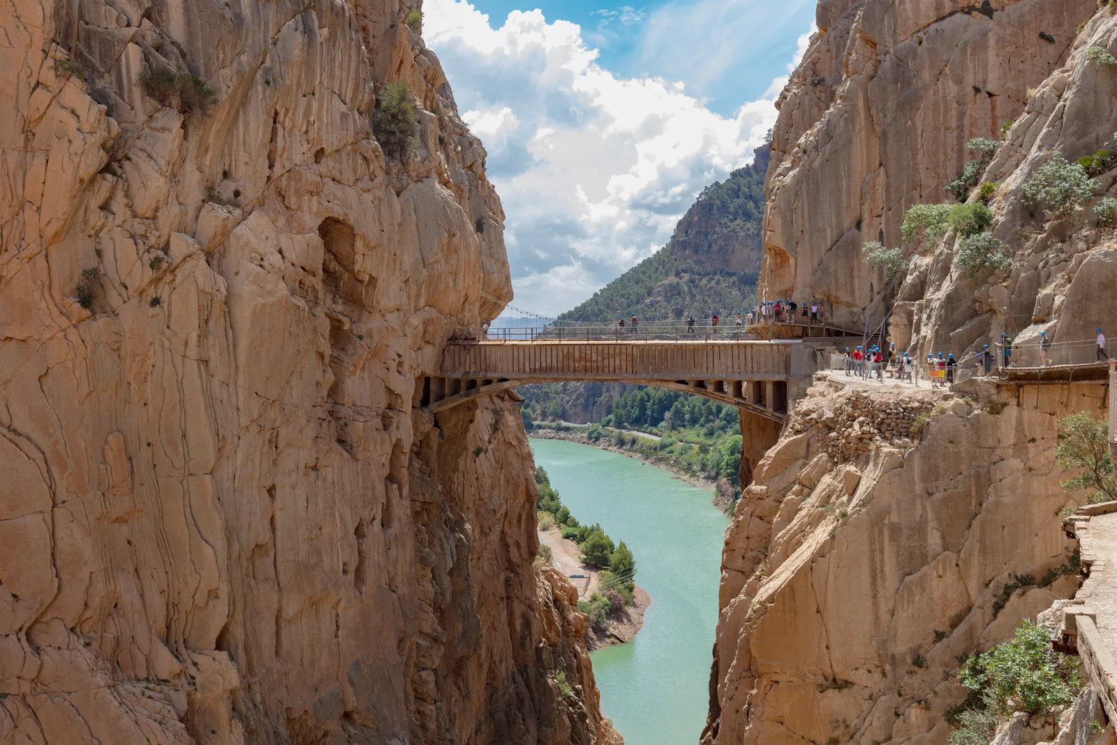
Photo: Diego Delso, CC BY-SA 4.0, via Wikimedia Commons
- Distance
- 8 km (5 miles)
- Country
- Spain
- Difficulty
- Easy to moderate
- Type of trip
- Hiking trail
The Caminito del Rey is a walkway fixed to the walls of the Desfiladero de los Gaitanes, the gorge the Guadalhorce river cuts near El Chorro, less than 60 km from Málaga. It was built in 1901–05 for the hydroelectric company working there, and got its name after King Alfonso XIII crossed it in 1921 to open the Conde del Guadalhorce dam. It later fell apart, was closed after four walkers died in 1999 and 2000, and reopened in March 2015 with new boardwalks. You walk it one way only, north to south, from the Ardales end to El Chorro, and the whole visit takes 3 to 4 hours.
You need a ticket, bought in advance from the official site, caminitodelrey.info. The ticket office at the north entrance sells whatever is left on the day. Tickets are in your name, so bring ID. Children under 8 aren’t allowed in, and under-18s must be with an adult. Be at the gate 30 minutes early. At the control hut you’re given a helmet, which you keep on until El Chorro, and staff check your shoes and bags. Wear hiking shoes. Flip-flops, big rucksacks, walking poles, selfie sticks and dogs, guide dogs included, aren’t allowed. Part of the path is more than 100 m above the river, and the organisers advise against it if you suffer from vertigo.
Highlights along the way
- Gaitanejo gorge: The first canyon, about 10 m from wall to wall, with round potholes worn into the rock by the river.
- Valle del Hoyo: An open green valley between the gorges, with the old water channel in view.
- Desfiladero de los Gaitanes: The highest stretch, more than 100 m above the river under walls about 250 m high. The Balcón de Cristal has a glass floor and room for four people at a time.
- The hanging bridge: A metal bridge about 35 m long with a grating floor, hung about 105 m up, near the end of the boardwalks.
- El Chorro: A 2.1 km path takes you down past the old village to the hut where you hand in your helmet, by El Chorro station. Trains from Málaga take 45 minutes to an hour.
Distance
The official site gives 7.7 km (4.8 miles) in all, of which 2.9 km (1.8 miles) is boardwalk and 4.8 km (3 miles) is paths in and out. From the north end it’s 2.7 km to the control hut through the big tunnel by the El Kiosko restaurant, or 1.5 km by the shorter footpath tunnel. The boardwalks take about 1½ to 2 hours. It’s a one-way route and you can’t turn back, so you return by road. A shuttle bus links the two ends from 07:40 to 19:00.
Best time to go
It’s open Tuesday to Sunday all year, except 24, 25 and 31 December and 1 January, from 9:00 until 14:50 or 17:20 depending on the season. The managers can close it for rain or wind. There are no refunds, and moving to another date depends on availability. Take water, food and sun cream, and a raincoat if rain is forecast, as umbrellas aren’t allowed. In November 2026 the official site listed general entry at €10, a guided visit at €18 and the shuttle at €2.50, paid in cash on the bus.
More journeys in Spain
- Camino De Santiago · Julia & James
- France Spain 2024 · Greg
- Cycling the Basque Region · Lucy
- Sailing Around The World · Adam
- Road trip tenerife · Josephine
- Camino De Santiago · Ruth
Flyby films from Spain
- Tenerife · Josephine
- The Great Escape · saeunn
- Bilbao to....? · Greg
- León, Mediterranean disease · Eike
More routes like this
- Ruta del Alba on foot · 14 km (9 miles) · Spain
- Camino Lebaniego · about 73 km (45 miles) · Spain
- Jakobsweg on foot · about 770 km (480 miles) · Germany, Spain, France, Austria
- Camino de Santiago on foot · about 770 km (480 miles) · Spain, France
- Camino Primitivo · about 320 km (199 miles) · Spain
- Camí de Ronda (Costa Brava) on foot · 200+ km (124+ miles) · Spain