Ruta del Cares on foot
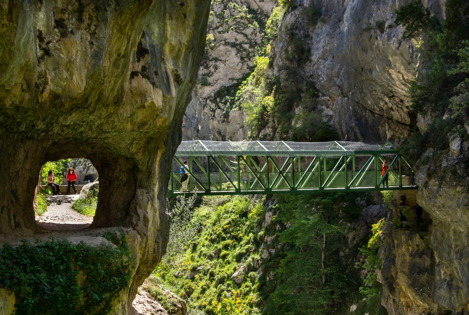
Photo: Gabriel González, CC BY-SA 2.0, via Wikimedia Commons
- Distance
- 22 km (14 miles)
- Country
- Spain
- Difficulty
- Moderate
- Type of trip
- Hiking trail
The Ruta del Cares is a path cut into the side of the Cares gorge in the Picos de Europa National Park in northern Spain. It runs between Poncebos, in Cabrales in Asturias, and Caín, a small village in Posada de Valdeón in León. It started as a works path for a canal that takes the river’s water to the Camarmeña power station above Poncebos. Work on the canal began in 1916 and finished in 1921, and the path you walk today was built for its upkeep from 1945. It’s the national park’s waymarked route PR-PNPE 3. Most people walk it there and back in a day, which takes 6 to 8 hours. If you only want to walk it one way, local firms run 4x4 transfers back round by road.
There’s no village or help point along the gorge, so you sleep at one end or the other. Poncebos and Caín both have restaurants and places to stay. The path is often only about a metre and a half wide, with no railing on the drop side, and some stretches are high above the river. The park warns that stones can fall anywhere along it, more so in rain or wind and on the days after. Asturias tourism suggests children should be over 12, and that younger ones hold an adult’s hand and keep to the inside of the path.
Highlights along the way
- Los Collados: From Poncebos the path climbs about 300 m in the first 2 km to this small meadow at 520 m, the highest point between Poncebos and Caín. The river is more than 150 m below.
- Culiembro: A meadow with two old farm buildings. Down in the gorge you can see the Puente de la Vieya, on an old shepherds’ route across between the two massifs.
- Puente de Bolín and Puente de los Rebecos: Two bridges where the path swaps from one side of the gorge to the other. The second is in the narrowest part.
- The tunnels: Near Caín the gorge is so narrow that the path runs through tunnels cut in the rock. Openings in the side let the light in, so you don’t need a torch.
- Caín: The path crosses the river on top of the small dam that feeds the canal, then comes out into the wider, greener Valdeón valley. Caín has restaurants, guesthouses and casas rurales.
Distance
Asturias tourism gives 22.1 km (13.7 miles) there and back from Poncebos, with 831 m of climbing in all, between 210 m and 532 m above sea level. Other sources give 11 to 12 km (6.8 to 7.5 miles) each way. Starting at Poncebos puts the steepest climb at the beginning, while you’re fresh. You can carry on from Caín to Posada de Valdeón, about 9 km (5.6 miles) more, but the road to Caín now follows much of that old path, and you walk on the narrow road in places.
Best time to go
Asturias tourism lists the route as open all year. There’s little shade and it gets very hot in summer, and you can’t buy anything between the two ends, so carry food and water. In late October 2026 the national park said a metal walkway had been fitted where part of the path had sunk, and that the whole route could be walked again in both directions. Check the alerts on parquenacionalpicoseuropa.es before you go.
More journeys in Spain
- Camino De Santiago · Julia & James
- France Spain 2024 · Greg
- Cycling the Basque Region · Lucy
- Sailing Around The World · Adam
- Road trip tenerife · Josephine
- Camino De Santiago · Ruth
Flyby films from Spain
- Tenerife · Josephine
- The Great Escape · saeunn
- Bilbao to....? · Greg
- León, Mediterranean disease · Eike
More routes like this
- Caminito del Rey on foot · 8 km (5 miles) · Spain
- Camí de Ronda (Costa Brava) on foot · 200+ km (124+ miles) · Spain
- Camino Lebaniego · about 73 km (45 miles) · Spain
- Ruta del Alba on foot · 14 km (9 miles) · Spain
- Camino Sanabrés · about 362 km (225 miles) · Spain
- Camino Portugués on foot · 241 km (150 miles) · Portugal, Spain