Cammino dei Briganti on foot
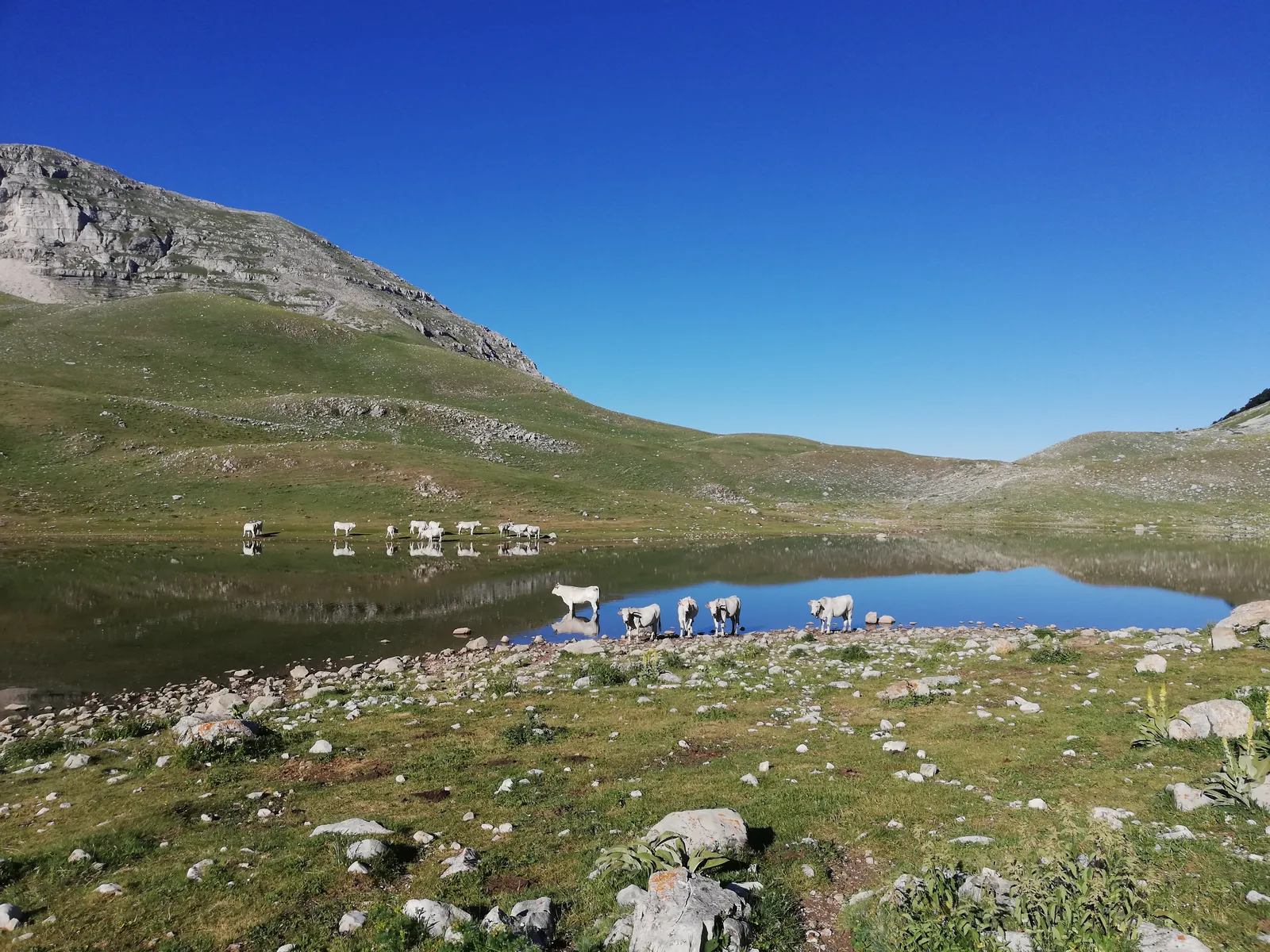
Photo: Vides Ut Alta, CC BY-SA 4.0, via Wikimedia Commons
- Distance
- about 108 km (67 miles)
- Country
- Italy
- Difficulty
- Moderate
- Type of trip
- Hiking trail
The Cammino dei Briganti is a walking loop of about 108 km that starts and ends at Sante Marie, near Tagliacozzo in Abruzzo. It goes through the Val de Varri, the Salto valley and the slopes of Monte Velino, on the border between Abruzzo and Lazio. That border once divided the Papal States from the Bourbon kingdom, and after Italian unification brigands moved back and forth across it to fight the new Savoy rulers. The band of Cartore, led by Berardino Viola, was one of them. Local people started work on the route in 2015, without public money, and it opened on 21 May 2016. Most of it is between 800 and 1,300 m, and it takes 7 days, walked clockwise.
You sleep in small family-run places in the villages, and the association says to book every bed and every meal before you go. You can camp, preferably at the agricampeggi, or at least 500 m from houses. Campers must carry a small trowel, and you won’t get the salvacondotto without one. That’s the route’s pass, collected from the office in Sante Marie town hall. With stamps from along the way it gets you a certificate at the end. This isn’t the Via Francigena. The country is wild in places, and the volunteers who run it say the guidebook and map are essential, even though it’s marked with red and white paint and metal plates. There are cash machines only at Corvaro, Magliano de’ Marsi and Scurcola, with a Postamat in Sante Marie, and few places take cards, so carry cash. Expect big white sheepdogs guarding flocks. To get to the start, take the train to Tagliacozzo and the bus to Sante Marie, which only runs in the morning.
Highlights along the way
- Val de Varri: The second day goes through the least touristy valley of the walk, where the road was only surfaced a few years ago, then over a small mountain to the medieval village of Nesce.
- Lago della Duchessa: The fourth day climbs from Corvaro through wild beech woods to this high lake, then drops to Cartore, home of the Cartore band. It’s the one mountain stage, and the classic route spends two nights at Cartore.
- Santa Maria in Valle Porclaneta: After the Forche pass under Monte Velino, the fifth day comes down to this fine Romanesque church, then goes on through the medieval village of Rosciolo.
- Alba Fucens: A Roman town founded in 303 BC, 8.5 km into the sixth day, inside 3 km of polygonal stone walls. Digs that started in 1949 uncovered the town centre and the amphitheatre.
- Sante Marie: The loop ends where it began. The small museum of brigandage is open on request through the pass office, for 3 euro in 2026.
Distance
About 108 km (67 miles) in all, as the official site gives it, and it.wikipedia also says about 108 km. The seven stage lengths on the site add up to about 106 km. The first stage is only 6 km (3.7 miles), so you can start after travelling in the morning, and the longest is the last, 21 km (13 miles) back to Sante Marie. The Duchessa stage is 15.3 km (9.5 miles), but it climbs 1,140 m and takes about 7 hours. The association asks people not to join two stages together, and says the distances are harder than they look.
Best time to go
The association says you can walk it all year, because apart from the Duchessa stage it doesn’t go above 1,300 m. In winter carry snowshoes just in case. The paths are cleared in spring, so after heavy snow there may be fallen trees, and in snow the marks can disappear. Summer middays can be hot, but most of the route is shaded and breezy. In 2025 the association added variants, including one through Grotti and Torano, for when the beds at the usual stage ends are full. They’re not in the guidebook, so check camminodeibriganti.it before you book.
More journeys in Italy
- to Tuscany by bike · Yael Zekaria
- Euro Trip 2024 · mmalty
- Istanbul To Ashby · Harry
- Sicily Tour · fredmarien
- Livigno 2026 · Marc
- UK to Georgia by Bike · Simon & Lucy
Flyby films from Italy
- Alta_Via_1_day_1_ · harryknoblauch12
- Plane trip Saturday · fredmarien
- Dag 9: Innsbruck - Bruneck · johan
- Salzburg to Nice · Lucy
More routes like this
- Via Postumia on foot · about 956 km (594 miles) · Italy
- Via degli Dei on foot · 124 km (77 miles) · Italy
- Sentiero degli Dei (Path of the Gods) · 8 km (5 miles) · Italy
- Via Francigena on foot · 1,000 km (621 miles) · Italy
- Via Alpina on foot · 2,000 km (1,240 miles) · Slovenia, Italy, Austria, Germany, Switzerland, Liechtenstein, France, Monaco
- Tour du Mont Blanc trek · about 170 km (105 miles) · France, Italy, Switzerland