Cammino Materano on foot
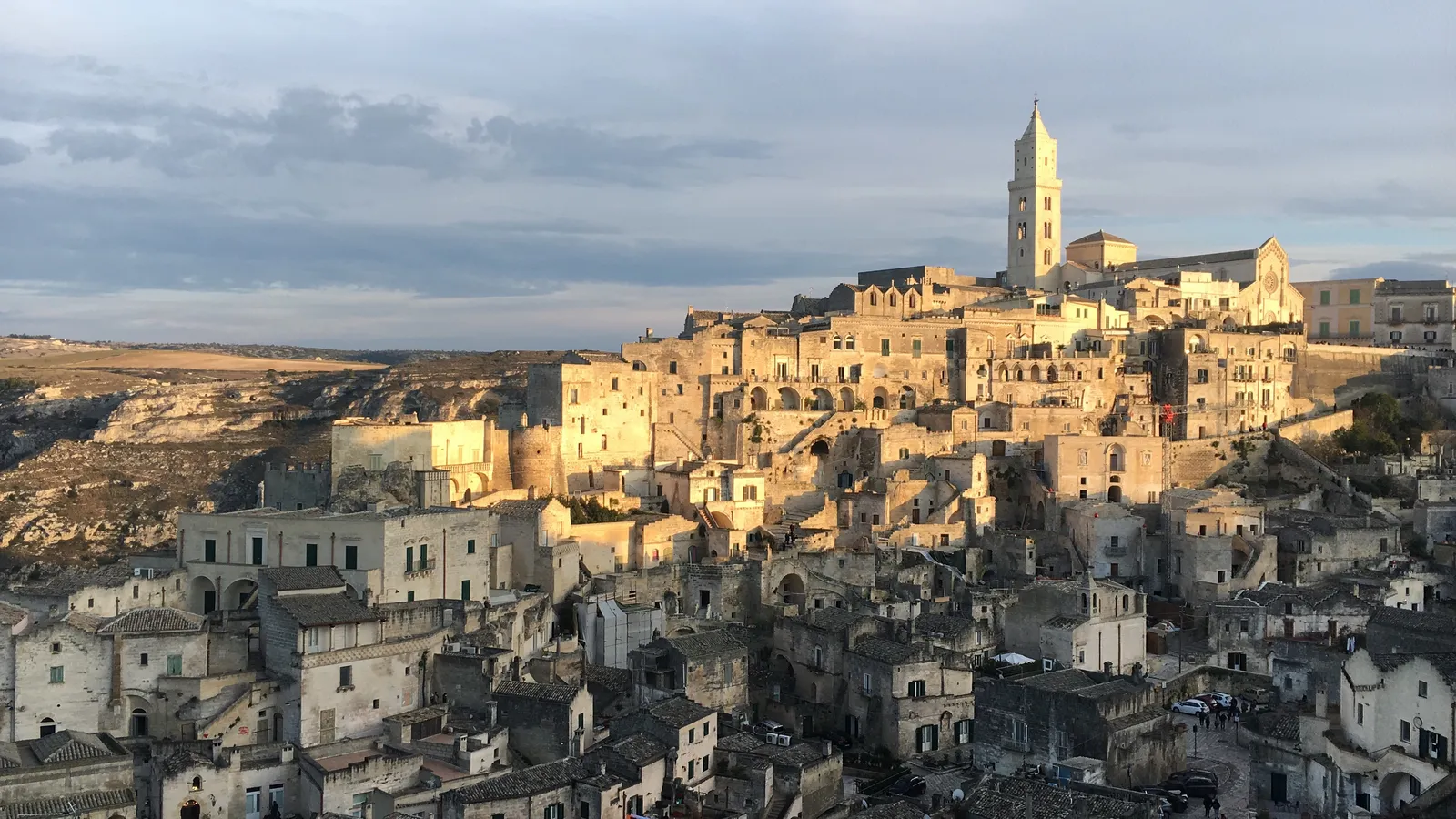
Photo: Gigi.Parentini, CC BY-SA 4.0, via Wikimedia Commons
- Distance
- 168 km (104 miles)
- Country
- Italy
- Difficulty
- Easy to moderate
- Type of trip
- Hiking trail
The Cammino Materano is a set of walking routes in southern Italy that all end in Matera, at the cathedral of the Madonna della Bruna. They come in from Bari, Brindisi, Trani, Termoli and inland Basilicata, using old Roman side roads, medieval roads, drove roads and paths. It isn’t a historic pilgrim road followed line by line, and the association that runs it says so. This guide follows the Via Peuceta, 168 km from the Basilica of San Nicola in Bari to Matera in 7 stages. It crosses the olive groves of the coastal plain, the open grassland of the Murgia plateau and the ravines around Gravina and Matera.
You sleep in the towns where the stages end, and there are B&Bs at every one of them. Places in the Cammino’s network charge capped prices if you carry the credential. You get it by filling in the online form and making a donation of your choice. It’s posted to you if you ask at least 20 days before you start, or you can collect it from a distribution point. With at least 100 km on foot, or 150 km by bike, you can collect the Testimonium in Matera for a 3 euro contribution, arranged with the volunteers at least two days ahead. Follow the green and yellow marks. Yellow arrows always point to Matera and green ones the other way, and in open country there’s a mark at least every 300 m.
Highlights along the way
- Basilica of San Nicola, Bari: Built between 1087, when the relics of St Nicholas arrived from Myra, and 1197. The first day goes through the old town and out on the medieval road to Bitetto, which you enter by Porta Barese, its only surviving medieval gate.
- Altamura: The fifth stage starts at the cathedral of Santa Maria Assunta, built in 1232 at the wish of Frederick II, and follows old drove roads to Gravina.
- Gravina in Puglia: The Norman cathedral, from 1095, stands on the edge of the ravine. You leave town over an old stone aqueduct bridge and climb past Botromagno hill, the site of the ancient town of Sidion.
- Bosco Difesa Grande: One of the largest woods in Puglia, with about 10 km of paths. After it the route crosses the wheat country of the Fossa Bradanica to the Benedictine sanctuary of Picciano.
- Matera: You come in through the Casalnuovo district straight into the Sassi, and finish at the cathedral. The Crypt of Original Sin is a detour of about 4 km there and back on the last day, and you need to book it.
Distance
The Via Peuceta is 168 km (104 miles) in all, in 7 stages, and the route page rounds it to 170 km. Stages run from 16.8 km (10.4 miles), Bari to Bitetto, to 29.9 km (18.6 miles), Gravina to Picciano. The last two are both about 30 km and 8 hours, and they’re the only ones graded hard. You can make it 8 stages by splitting Gravina to Picciano at the Terra Rossa car park in the wood, 14 km into the stage, where places to stay in Gravina or Picciano will pick you up. On the last day a 15 km (9.3 miles) short cut through the La Martella industrial area gets you to Matera in about 4 hours.
Best time to go
The association suggests autumn, winter and spring for the Via Peuceta, and leaves summer off the list. The wheat fields after the Bosco Difesa Grande turn bright yellow in May and June. In March 2026 it asked walkers to avoid roadworks on Strada Santa Caterina, on the first stage, by taking the FAL train from Bari to Modugno. Check the news page at camminomaterano.it before you go.
More journeys in Italy
- to Tuscany by bike · Yael Zekaria
- Euro Trip 2024 · mmalty
- Istanbul To Ashby · Harry
- Sicily Tour · fredmarien
- Livigno 2026 · Marc
- UK to Georgia by Bike · Simon & Lucy
Flyby films from Italy
- Alta_Via_1_day_1_ · harryknoblauch12
- Plane trip Saturday · fredmarien
- Dag 9: Innsbruck - Bruneck · johan
- Salzburg to Nice · Lucy
More routes like this
- Alta Via dei Monti Liguri on foot · about 440 km (273 miles) · Italy
- Sentiero degli Dei (Path of the Gods) · 8 km (5 miles) · Italy
- Sentiero Italia on foot · about 8,000 km (4,970 miles) · Italy
- Cammino dei Briganti on foot · about 108 km (67 miles) · Italy
- Via Francigena on foot · 1,000 km (621 miles) · Italy
- Via degli Dei on foot · 124 km (77 miles) · Italy