Alta Via dei Monti Liguri on foot
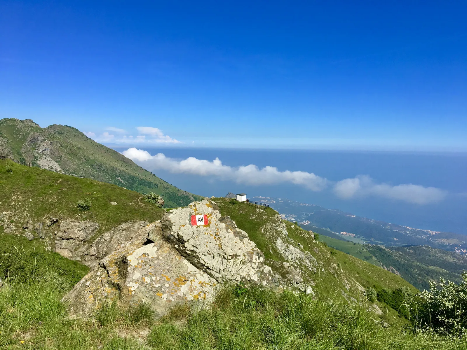
Photo: Silviamaestri, CC BY-SA 4.0, via Wikimedia Commons
- Distance
- about 440 km (273 miles)
- Country
- Italy
- Difficulty
- Moderate to challenging
- Type of trip
- Hiking trail
The Alta Via dei Monti Liguri is a marked walking route along the watershed above the Ligurian coast, the whole length of the region. It runs from Ventimiglia, near the French border, round the arc of the Ligurian Alps and the Ligurian Apennines to Ceparana, in the Bolano plain on the border with Tuscany. It began in 1983 as a joint project of the Ligurian chambers of commerce’s study centre, the Italian Alpine Club (CAI) and the Italian Hiking Federation (FIE). A regional law has protected it since 1993, and CAI Liguria looks after it. It’s split into 44 stages and is part of the Sentiero Italia. Most of it is on grassy ridges and through woods, and the managers say that on a clear day you can see Corsica, Monviso and Monte Rosa from it.
This isn’t a village-to-village walk. Many stages end at a pass, and link paths lead off the ridge to villages and places to stay. The official list of accommodation includes mountain huts (rifugi) and other places near the route, and partner places may give discounts to CAI and FIE members. Stages are short, so you can join some together. Follow the red-white-red marks with AV in the white band. You can also ride long sections on horseback or by mountain bike, and some stages or parts of them follow roads and tracks you could drive. In November 2026 the old altaviadeimontiliguri.it site was being rebuilt, and the CAI Liguria page sends you to the regional tourism site, lamialiguria.it, which has the map of every stage and the full track.
Highlights along the way
- Monte Saccarello: The highest point of the route at 2,201 m, on the fifth stage, where Liguria, Piedmont and France meet. The next stage goes over Monte Cimonasso at 2,085 m, then drops to the Colle San Bernardo di Mendatica.
- Monte Carmo: Stage 13 climbs it at 1,389 m, between the Giogo di Toirano and the Giogo di Giustenice, in the province of Savona.
- Monte Beigua: Stage 19, from the Colle del Giovo, crosses the top of Monte Beigua at 1,287 m. It’s inside the Beigua regional park, which lies between Genoa and Savona.
- Monte Aiona: In the east the route crosses the Aveto regional park, and stage 33 goes over Monte Aiona at 1,701 m.
- Monte Gottero: Stage 38, from the Passo della Cappelletta to the Passo dei Due Santi, is the longest at 17 km and crosses Monte Gottero at 1,640 m. From there it’s six more stages down to Ceparana.
Distance
About 440 km (273 miles) in all, according to Wikipedia. The 44 stage lengths listed there add up to 442 km, and the regional tourism site gives 422 km. Stages run from 5 km (3.1 miles), Passo di Centocroci to Passo della Cappelletta, to 17 km (10.6 miles) over Monte Gottero. Most are 6 to 15 km. A 2023 book on the route by Carnovalini, Rastello and Dagone is subtitled four weeks on foot from Ventimiglia to La Spezia.
Best time to go
The regional tourism site says you can walk it all year. The western stages around Monte Saccarello go above 2,000 m, though, so check conditions there outside summer. Fog sometimes sits on the ridges. After heavy rain the old official site asked walkers to take extra care, as landslides can cut paths, to check the weather first and to let a nearby rifugio know where they were going. Look at lamialiguria.it before you go.
More journeys in Italy
- to Tuscany by bike · Yael Zekaria
- Euro Trip 2024 · mmalty
- Istanbul To Ashby · Harry
- Sicily Tour · fredmarien
- Livigno 2026 · Marc
- UK to Georgia by Bike · Simon & Lucy
Flyby films from Italy
- Alta_Via_1_day_1_ · harryknoblauch12
- Plane trip Saturday · fredmarien
- Dag 9: Innsbruck - Bruneck · johan
- Salzburg to Nice · Lucy
More routes like this
- Via Alpina on foot · 2,000 km (1,240 miles) · Slovenia, Italy, Austria, Germany, Switzerland, Liechtenstein, France, Monaco
- Via degli Dei on foot · 124 km (77 miles) · Italy
- Sentiero degli Dei (Path of the Gods) · 8 km (5 miles) · Italy
- Cammino dei Briganti on foot · about 108 km (67 miles) · Italy
- Via Francigena on foot · 1,000 km (621 miles) · Italy
- Cammino Minerario di Santa Barbara on foot · about 500 km (311 miles) · Italy