Alta Via 2 on foot
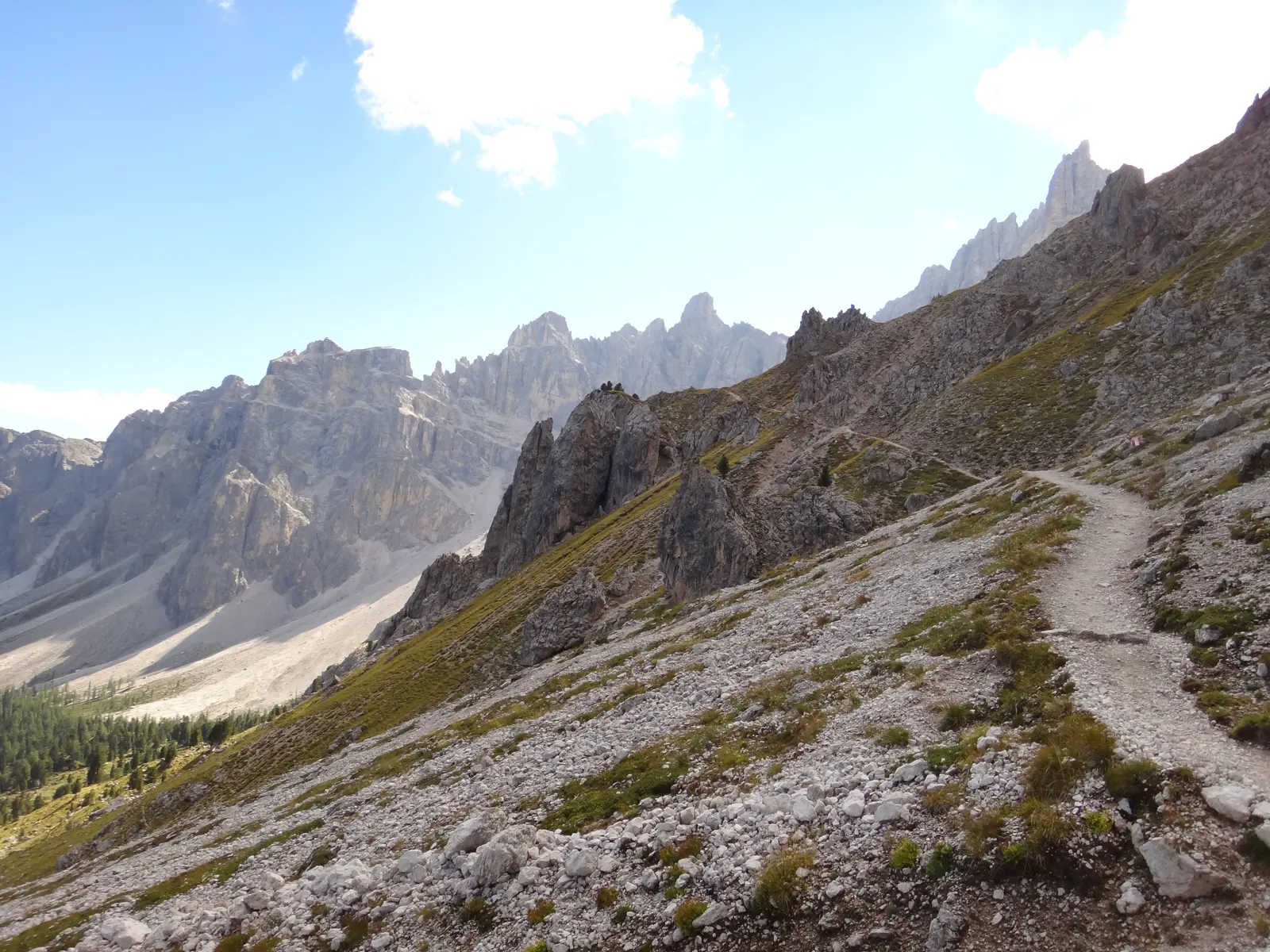
Photo: Hans Braam, CC BY 3.0, via Wikimedia Commons
- Distance
- about 180 km (112 miles)
- Country
- Italy
- Difficulty
- Challenging
- Type of trip
- Hiking trail
The Alta Via 2 is a hut-to-hut walk across the Dolomites from Bressanone (Brixen) in South Tyrol to Feltre in the province of Belluno. It’s marked with a blue triangle with a 2 in it, and crosses the Plose, Putia, Odle, Puez, Sella, Marmolada, Pale di San Martino and Feltre mountains. Mario Brovelli first proposed it in the Italian Alpine Club’s newsletter in 1966, and two walkers from Feltre made the first full crossing in July 1969. The Belluno province guide calls it one of the easier Alte Vie, with well-marked paths, but eight of its 13 stages have short rock sections with fixed cables, sometimes exposed. It’s for fit, experienced walkers, and the province grades it difficult.
You sleep in mountain huts, with two unstaffed bivouacs and a few hotels at road passes. The huts serve meals and open roughly from 20 June to 20 September. In high summer, August above all, book ahead. The bivouacs are always open and have only bunks, mattresses and blankets. Water is short in the middle and south after July, so carry some. On the via ferrata variants a helmet, harness and karabiners are compulsory, and the guide says to carry light crampons too. Get a stamp at each hut. Show the stamps at the tourist office in Feltre and you get a free Alta Via 2 badge.
Highlights along the way
- The Sella plateau: A bare, high plateau where you need to follow the marks closely in fog. You pass the Boè hut at 2,871 m, drop to Passo Pordoi and take the Viel dal Pan, an old path between Val di Fassa and the Agordino, with the Marmolada straight ahead.
- The Marmolada: The Castiglioni hut sits by the Fedaia lake under the Marmolada. A variant goes up to Punta Penia, the summit at 3,343 m, where you can meet snow and ice even in midsummer.
- Passo delle Farangole: At 2,932 m, the highest point of the classic route. The Sentiero delle Farangole is exposed but well equipped with fixed ropes, and in early summer deep snow can bury them.
- The Pale di San Martino: The route crosses the Pale plateau, about 50 km² of bare rock between 2,000 and 2,500 m, by the Rosetta hut, then drops to the Pradidali and Treviso huts.
- The Vette Feltrine: The last mountains before the Venetian plain, where fog, rain and strong wind are common. The stage from the Feltre bivouac to the Dal Piaz hut is one of the longest, with nowhere to stop on the way.
Distance
About 180 km (112 miles) of mountain path, or 210 km (130 miles) town to town, by the Belluno province guide, with about 11,300 m of climbing and 11,200 m of descent. It splits the walk into 13 stages of 4.5 to 9 hours. The stages are about 8 km (5 miles) to 27 km (16.8 miles) long. The first, from Bressanone up to the Plose hut, is the longest, but the Plose cable car from just above Sant’Andrea takes you up to Valcroce, about 1.5 hours’ walk below the hut. Stage 6 starts with about 9 km (5.6 miles) of tarmac from Passo Fedaia down to Malga Ciapela.
Best time to go
The guide says late June to September, when the huts are open. Snow lingers in some gullies early in the season, and even in midsummer you can meet snow or ice at the Passo delle Farangole and on the Marmolada. The guide was written for an EU project that ran from 2000 to 2006, so hut dates and details may have changed. Check opening dates with each hut, and ask the tourist offices in Belluno province or South Tyrol about path closures, before you set off.
More journeys in Italy
- to Tuscany by bike · Yael Zekaria
- Euro Trip 2024 · mmalty
- Istanbul To Ashby · Harry
- Sicily Tour · fredmarien
- Livigno 2026 · Marc
- UK to Georgia by Bike · Simon & Lucy
Flyby films from Italy
- Alta_Via_1_day_1_ · harryknoblauch12
- Plane trip Saturday · fredmarien
- Dag 9: Innsbruck - Bruneck · johan
- Salzburg to Nice · Lucy
More routes like this
- Cammino Minerario di Santa Barbara on foot · about 500 km (311 miles) · Italy
- Cammino Materano on foot · 168 km (104 miles) · Italy
- Sentiero degli Dei (Path of the Gods) · 8 km (5 miles) · Italy
- Alta Via 1 trek · about 115 km (72 miles) · Italy
- Sentiero Italia on foot · about 8,000 km (4,970 miles) · Italy
- Tour du Mont Blanc trek · about 170 km (105 miles) · France, Italy, Switzerland