Cammino Minerario di Santa Barbara on foot
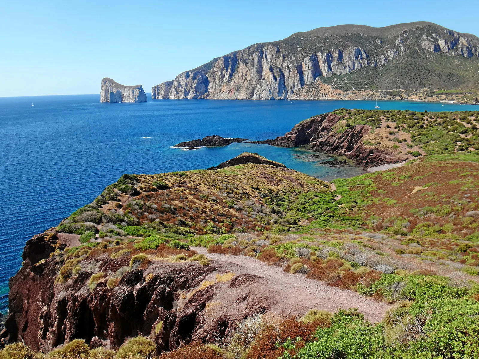
Photo: Mboesch, CC BY-SA 4.0, via Wikimedia Commons
- Distance
- about 500 km (311 miles)
- Country
- Italy
- Difficulty
- Moderate
- Type of trip
- Hiking trail
The Cammino Minerario di Santa Barbara is a walking loop of about 500 km through the old mining country of south-west Sardinia: the Sulcis, the Iglesiente and the hills round Guspini and Arbus. The foundation that runs it treats Iglesias as the start and finish, but you can join wherever you like. It’s split into 30 stages, and the foundation’s plan for the whole loop is 30 days. It follows old miners’ paths, mule tracks, dirt roads and disused railways past dozens of sites of the Parco Geominerario, among them Monteponi and Montevecchio. Santa Barbara is the miners’ patron saint, and the waymark is her tower, yellow on blue.
Walkers carry the credenziale, a walker’s passport you can order online or pick up at the foundation’s office in Iglesias. It gets you into the Posadas the foundation runs itself, which in November 2026 charged 25 euro a person with a basic breakfast, often in shared rooms. The foundation says to book ahead, at least for the first six stages. There’s hardly any water between stage towns, so set off with at least 2 litres, or 3 in summer. Many villages have one cash machine or none, so carry cash for two or three days. The nearest airport is Cagliari, and the train from there to Iglesias takes about 50 minutes, though until April 2027 buses replace the trains on the Decimomannu to Iglesias and Carbonia line while it’s upgraded.
Highlights along the way
- Monteponi and the Buon Cammino: The first stage leaves Piazza Quintino Sella in Iglesias, climbs to the church of the Beata Vergine del Buon Cammino, then drops through the ruins of the Monteponi mine on the way to Nebida.
- Laveria Lamarmora, Nebida: An ore-washing plant built in 1897 on the cliffs above the sea and worked until the middle of the last century. The path gets to it through a tunnel that once carried the ore.
- Porto Flavia and the Pan di Zucchero: Near Masua, a loading port cut into the cliff in 1924 so ore could go straight into the ships, facing the Pan di Zucchero sea stack. It’s a 1.4 km detour from Masua, and the next stage runs high above the sea to the cove at Cala Domestica. In March 2026 the foundation reported rockfalls from the cliff between Cala Domestica and Cala Lunga, by the Cala Lunga tunnel, so take care there.
- Piscinas and Ingurtosu: After a mix of beach and rocks from Portixeddu you come to the big dunes at Piscinas. The next day passes the Naracauli mines and the Laveria Brassey, then the mining village of Ingurtosu with its church of Santa Barbara, and goes on to Montevecchio.
- Sant’Antioco and Carloforte: In the south the loop takes in the islands of Sant’Antioco and San Pietro. Sant’Antioco, the old Sulky, is one of the oldest towns in the Mediterranean, with lagoons and salt pans round it, and Carloforte grew up as a fishing town.
Distance
About 500 km (311 miles) in all, by the foundation’s figure, in 30 stages. It gives an average of 16 km (10 miles) a stage, but its FAQ puts the range at 15 to 30 km (9 to 19 miles), so some days are long. For a weekend the foundation suggests two or three stages in a row and the ARST bus back. There are variants for cyclists and riders, and the third edition of the official guide, from June 2026, adds new walking variants, so stage lengths can differ from older guides.
Best time to go
The foundation’s calendar marks April, May, October and November as the best months, and its FAQ names spring (April to June) and autumn (September to November). July and August are very hot, inland and on the coast. Winters are mild, and with the right clothes you can walk it then too. The route and its variants change from year to year, so check cmsb.it and the official app before you set off.
More journeys in Italy
- to Tuscany by bike · Yael Zekaria
- Euro Trip 2024 · mmalty
- Istanbul To Ashby · Harry
- Sicily Tour · fredmarien
- Livigno 2026 · Marc
- UK to Georgia by Bike · Simon & Lucy
Flyby films from Italy
- Alta_Via_1_day_1_ · harryknoblauch12
- Plane trip Saturday · fredmarien
- Dag 9: Innsbruck - Bruneck · johan
- Salzburg to Nice · Lucy
More routes like this
- E5 from Oberstdorf to Meran on foot · about 120 km (75 miles) · Germany, Austria, Italy
- Cammino di San Benedetto on foot · about 300 km (186 miles) · Italy
- Alta Via 1 trek · about 115 km (72 miles) · Italy
- Alta Via 2 on foot · about 180 km (112 miles) · Italy
- Cammino Materano on foot · 168 km (104 miles) · Italy
- Munich to Venice on foot (Traumpfad) on foot · about 550 km (340 miles) · Germany, Austria, Italy