Death Road by bike
- Distance
- about 64 km (40 miles)
- Country
- Bolivia
- Difficulty
- Challenging
- Type of trip
- Cycling route
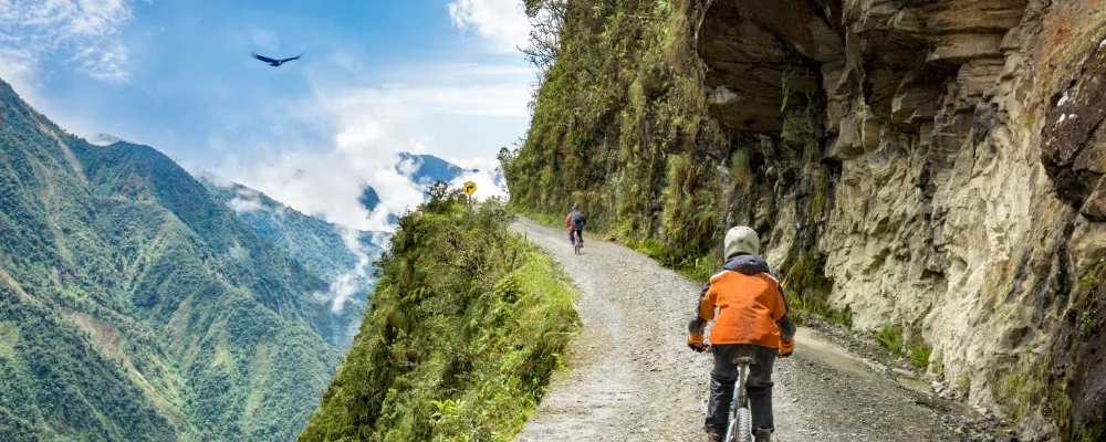
The Death Road is the old North Yungas Road in Bolivia. It isn’t a purpose-built bike route. It’s a 1930s road that drops from the La Cumbre pass, at about 4,650 to 4,700 m north-east of La Paz, to Yolosa at about 1,200 m, below the town of Coroico. The ride is about 64 km and almost all downhill. The first part follows the asphalt highway. The rest is the old gravel road, cut into the mountainside and less than 3 m wide in places, with long drops on the outside. A new highway was finished in 2006 and took most of the traffic, so the old road is now used mainly by cyclists, motorbikes and walkers.
Most people ride it with a La Paz tour operator. The company drives you up to La Cumbre and gives you a bike, helmet and protective gear, and a guide rides with the group. Some riders rent a bike and take the bus up on their own. The UK Foreign Office says Bolivia has no official minimum standards for tour operators. Before you set off, check the bike’s brakes and make sure your guide carries safety equipment and a first-aid kit. Riders have died on the road since the tours began. Cyclists pay a toll on the old road, so check the current amount locally. As of 2 November 2026, the UK Foreign Office reports a state of emergency declared on 21 June and road blockades without warning, which have led to fuel and food shortages in some areas. Read its latest Bolivia advice before you travel.
Highlights along the way
- La Cumbre: the pass where rides start, at about 4,650 to 4,700 m. It’s exposed and windy, and on a clear day you can see Huayna Potosí (6,088 m).
- The asphalt descent: the first stretch follows the newer highway down from the pass, past villages, grazing llamas and a police drug checkpoint.
- The old road: the narrow gravel section drops about 2,000 m through forest, under rock overhangs and through waterfalls that run across the road. Unlike the rest of Bolivia, traffic here keeps to the left, so drivers on the outside can see the edge.
- Yolosa and La Senda Verde: the ride ends at Yolosa, where it’s hot and dusty after the wind at the top. Several operators finish at La Senda Verde, an animal refuge just below the village.
- Coroico: the hill town above Yolosa, at about 1,700 m, reached by minibus. If you stay a night or two, you can walk up Cerro Uchumachi (2,533 m).
Distance
About 64 km (40 miles) from La Cumbre to Yolosa, with a descent of around 3,500 m. Roughly 30 km of that is the old gravel road; the rest is on the asphalt highway.
If you have a GPX of this route from its official site or a planning app, open it in our free GPX viewer to see the distance, the climb and the height profile. The file stays on your device.
Best time to go
May to October, when it’s drier. From November to March the UK Foreign Office warns that floods and landslides are common in the mountains and roads can be impassable for days. Mist and rain can still come in any month, and the temperature changes a lot between the pass and Yolosa.
More journeys in Bolivia
- World Trip - One Planet Expedition · David Bossek (Nature Nomad World)
Flyby films from Bolivia
- South America 1 · David Bossek (Nature Nomad World)
More routes like this
- Salar de Uyuni by bike · Bolivia
- Annapurna Circuit by Bike · about 385 km (240 miles) · Nepal
- Ostseeküstenradweg by bike · about 1,100 km (680 miles) · Germany
- TransAmerica Trail by bike · 6,804 km (4,228 miles) · USA
- Mainradweg by bike · about 557 km (346 miles) · Germany
- Neckartal-Radweg by bike · about 370 km (230 miles) · Germany