Salar de Uyuni by bike
- Distance
- Varies with your line across the salt. For scale, Uyuni to Tahua by way of Colchani and Isla Incahuasi is roughly 130 km: about 20 km by road to Colchani, 70 km across the salt to the island and 40 km north to Tahua. Llica is about 80 km west of the island. These are straight-line estimates.
- Country
- Bolivia
- Difficulty
- Moderate to challenging
- Type of trip
- Cycling route
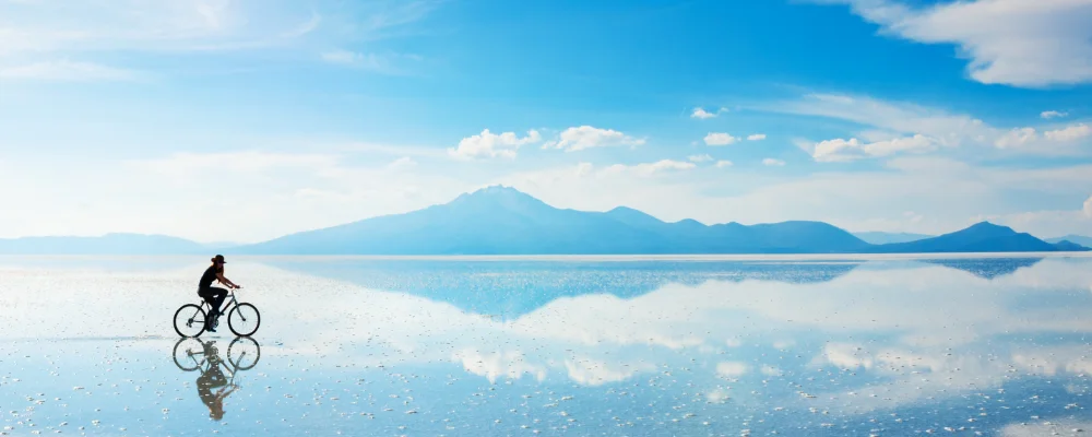
There’s no marked or official cycling route across the Salar de Uyuni. The world’s largest salt flat covers about 10,582 km² at around 3,656 m in south-west Bolivia, and cyclists ride their own line across it, often on the tracks left by tour 4x4s. The usual crossing starts in Uyuni and goes north to the salt village of Colchani. From there it heads west across the salt to Isla Incahuasi, then north to Tahua, below the Tunupa volcano. Some riders head further west to Llica instead. Most people camp on the salt or stay in the salt-block hotels around the edge. The only facilities out on the flat are at Isla Incahuasi, so carry all the water and food you need.
The salt is flat to within a metre across the whole flat, but nothing on it tells you where you are. Ride with a GPS track and keep track of the hills on the horizon. The altitude, strong sun, glare off the salt and nights between −9 and 5 °C all year make it harder than the flat surface suggests, and the UK Foreign Office names the salt flats as a place where altitude sickness is a risk. Check the situation in Bolivia before you go: as of September 2026 the UK Foreign Office reports a state of emergency declared on 21 June and road blockades without warning, which have led to fuel and food shortages in some areas, and says buses can’t always guarantee to reach their destination.
Highlights along the way
- Isla Incahuasi: a rocky former island of about 25 ha in the middle of the salt, covered in giant cacti, with a path to the top and a restaurant. There’s an entry fee, so check the current price locally.
- Tunupa and Tahua: Tunupa is a dormant volcano, 5,321 m high, on the northern shore of the salt flat. Tahua village sits at its foot, and there’s a cave with mummies about halfway up the mountain.
- Colchani: a salt-processing village about 20 km north of Uyuni. Everyone who mines salt on the salar belongs to its cooperative, and the salt is piled up to dry nearby.
- Train cemetery: about 3 km outside Uyuni, where steam locomotives were abandoned after the mining industry collapsed in the 1940s. The line to the Pacific coast was built between 1888 and 1892.
- Flamingos: three species, Chilean, Andean and the rare James’s, breed on the salar in November.
Distance
Varies with your line across the salt. For scale, Uyuni to Tahua by way of Colchani and Isla Incahuasi is roughly 130 km: about 20 km by road to Colchani, 70 km across the salt to the island and 40 km north to Tahua. Llica is about 80 km west of the island. These are straight-line estimates.
Best time to go
May to November, when the salt is dry and firm. Between April and November it rains only 1 to 3 mm a month, but June is the coldest month and nights are well below freezing. From December to April rain floods the surface and turns it into a mirror. It’s at its wettest in January, and riding through standing water is slow going.
More journeys in Bolivia
Flyby films from Bolivia
- South America 1 · David
More routes like this
- Death Road by bike · about 64 km (40 miles) · Bolivia
- Friendship Highway by bike · about 800 km (497 miles) · People's Republic of China, Tibet, Nepal
- Tasmanian Trail by bike · about 480 km (300 miles) · Australia
- EuroVelo 7 – Sun Route by bike · about 7,650 km (4,753 miles) · Austria, Czech Republic, Denmark, Germany, Italy, Malta, Norway, Sweden, Finland
- Alps 2 Ocean Cycle Trail · 315 km (196 miles) · New Zealand
- Danube Cycle Path · about 320 km (199 miles) · Austria, Germany, Hungary, Slovakia