Bibbulmun Track
- Distance
- about 1,000 km (620 miles)
- Country
- Australia
- Difficulty
- Moderate to challenging
- Type of trip
- Hiking trail
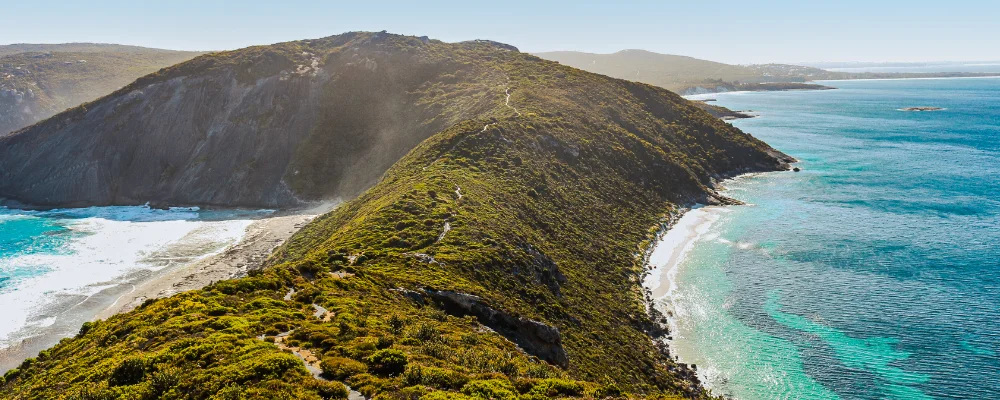
The Bibbulmun Track runs about 1,000 km through the south-west of Western Australia, from Kalamunda in the hills on the edge of Perth to Albany on the south coast. It’s for walkers only (no bikes) and is marked all the way with yellow triangles showing the Waugal, the rainbow serpent of Noongar belief. The northern half goes through jarrah, marri and wandoo forest on the Darling Range. Further south come karri and tingle forest, and then the last stretch follows beaches, dunes and heath along the Southern Ocean. On the way it passes through Dwellingup, Collie, Balingup, Donnelly River Village, Pemberton, Northcliffe, Walpole, Peaceful Bay and Denmark.
Walking the whole track takes most people six to eight weeks. There are 49 campsites roughly a day’s walk apart, each with a three-sided shelter, tent sites, a rainwater tank and a pit toilet. They’re free and you can’t book them, and camping between campsites isn’t allowed. From Kalamunda the next town is Dwellingup, 211 km away, with nowhere to buy food in between, so plan your food carefully. The track is managed by the state’s Parks and Wildlife Service with the Bibbulmun Track Foundation, a not-for-profit group that sells the maps and guidebooks and posts current conditions.
Highlights along the way
- Mundaring Weir: the track crosses the dam wall early on. The weir was finished in 1902, and from 1903 its water was piped about 530 km to the Kalgoorlie goldfields. The gates close in the evening, and there’s a signed way round when they do.
- Gloucester Tree: just outside Pemberton the track passes this karri, about 61 m tall and once a fire lookout.
- Donnelly River: karri forest, swimming holes and old timber-railway bridges.
- Valley of the Giants: past Walpole the track goes by the Tree Top Walk, a 600 m walkway nearly 40 m up in the tingle forest canopy.
- Irwin Inlet: east of Peaceful Bay you cross the inlet, about 200 m wide at the crossing, in canoes left in sheds on either bank. Canoes must be left on both sides for the next walkers, so if you take the last one you paddle back and tow one across.
Distance
About 1,000 km (620 miles) from Kalamunda to Albany. Temporary diversions and permanent realignments can add distance on some days.
If you have a GPX of this route from its official site or a planning app, open it in our free GPX viewer to see the distance, the climb and the height profile. The file stays on your device.
Best time to go
April to early November, which the Foundation recommends for weather and wildflowers. Wildflowers are at their best from September to November. The bushfire risk is highest from about December to March, and the Foundation asks walkers to think again about long walks then. Campfire bans usually run from the start of summer to mid-April, starting at different times in different sections, and many southern campsites never allow fires. In early November 2026 the Foundation’s section guides listed a diversion round a bridge closure on Chesapeake Road south of Northcliffe, and a seasonal diversion at Perkins Beach headland west of Albany. Inlet crossings on the south coast change with the sandbars. Check the Section by Section guide on bibbulmuntrack.org.au, Emergency WA and Park Alerts before you go.
More journeys in Australia
- Western Australia · Newluks
- Katoomba tourist! · Greg
- North With Larinda · Chris
- World Trip - One Planet Expedition · David Bossek (Nature Nomad World)
Flyby films from Australia
- Pacific Crossing - Panama To Austra · David Bossek (Nature Nomad World)
- Katoomba! · Greg
- South Bound. · Chris
- Turning Toward Home · Newluks
More routes like this
- Overland Track · 65 km (40 miles) · Australia
- Heysen Trail · about 1,200 km (750 miles) · Australia
- Three Capes Track · 48 km (30 miles) · Australia
- Great Ocean Walk · about 100 km (62 miles) · Australia
- Larapinta Trail · about 223 km (139 miles) · Australia
- Pindus Way · about 460 km (286 miles) · Greece