Three Capes Track
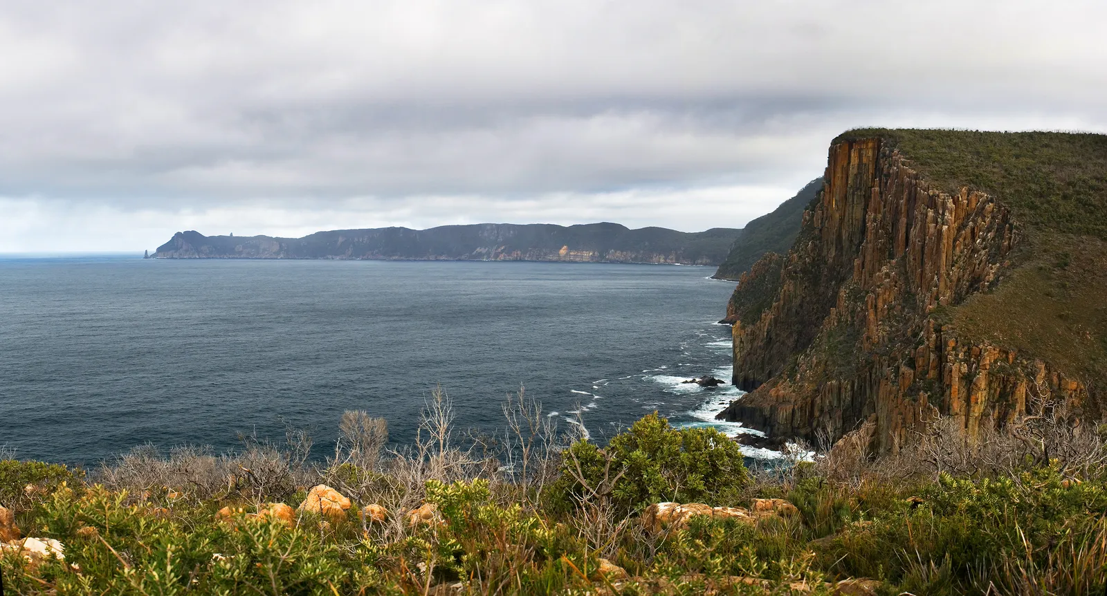
Photo: JJ Harrison, CC BY-SA 3.0, via Wikimedia Commons
- Distance
- 48 km (30 miles)
- Country
- Australia
- Difficulty
- Moderate
- Type of trip
- Hiking trail
The Three Capes Track is a 48 km walk in Tasman National Park, on the Tasman Peninsula in south-east Tasmania. The Tasmania Parks and Wildlife Service (PWS) runs it, and it opened in December 2015. You walk it one way only, over 4 days and 3 nights. You check in at the Port Arthur Historic Site, 90 minutes south-east of Hobart, and a boat takes you on a cruise of up to 75 minutes under the sea cliffs to Denmans Cove, where the track starts. You may have to wade ashore. The track finishes at Fortescue Bay, and a bus takes you back to Port Arthur in 30 minutes. PWS rates it grade 3 and says it suits a wide range of ages, but the longest day is 19 km with about 650 m of climbing.
You can't choose your stops. Everyone spends one night at each of three cabin sites, Surveyors, Munro and Retakunna, in shared bunk rooms for 4 or 8. Each site has mattresses, gas cooktops and pans, and a common hut with heating and lights, but the bunk rooms aren't heated, so bring a sleeping bag and head torch. Up to 48 walkers start each day and you have to book. In November 2026 the standard fee was $650 for an adult and $515 for a concession or child, in Australian dollars. That covers the cabins, the boat, the bus back, entry to the Port Arthur Historic Site, park entry and a guidebook with maps.
Highlights along the way
- Port Arthur Historic Site: The World Heritage-listed site is where you start and finish, and your booking includes entry, valid for 2 years.
- Arthur's Peak: On day 2 a short climb gives views over Crescent Bay to Cape Raoul. Then the track drops off Crescent Mountain and crosses the open, windswept Ellarwey Valley to Munro.
- Munro: The middle cabin site looks out over Munro Bight to Cape Hauy. It's the only one with showers, two of them, outdoors.
- Cape Pillar: Day 3 is the long one. You leave your pack at Munro and walk out and back to Cape Pillar, climbing The Blade on the way, with Tasman Island just offshore. The dolerite cliffs here and on Tasman Island are about 300 m high.
- Cape Hauy: The last day climbs Mount Fortescue first, then goes out to the tip of Cape Hauy, where you may see climbers on the Totem Pole and the other dolerite columns. From there it's mostly downhill to the beach at Fortescue Bay.
Distance
48 km (30 miles) in all, one way from Denmans Cove to Fortescue Bay. PWS splits it into 4 km on day 1, 11 km on day 2, 19 km on day 3 with the out-and-back to Cape Pillar, and 14 km on day 4. Despite the name you don't walk to Cape Raoul, the third cape. There's a separate track out to it that you can do as a day walk before or after, and your pass covers park entry for a day either side.
Best time to go
The track is open all year apart from a two-week closure each year for maintenance and fuel reduction burns. In November 2026 PWS gave the next one as 5 to 18 April 2027. Demand is highest from September to April. Winter is quieter, with cold nights, wind and some rain, and a chance of seeing the aurora australis. PWS suggests a sleeping bag rated to -5C or lower. From September to December the wade at Denmans Cove can be knee-deep. See the Three Capes Track pages on parks.tas.gov.au for prices, availability and alerts before you book.
More journeys in Australia
- Western Australia · Newluks
- Katoomba tourist! · Greg
- North With Larinda · Chris
- World Trip - Zero Impact Expedition · David
Flyby films from Australia
- Pacific Crossing - Panama To Austra · David
- Katoomba! · Greg
- South Bound. · Chris
- Turning Toward Home · Newluks
More routes like this
- Larapinta Trail · about 223 km (139 miles) · Australia
- Heysen Trail · about 1,200 km (750 miles) · Australia
- Bibbulmun Track · about 1,000 km (620 miles) · Australia
- Overland Track · 65 km (40 miles) · Australia
- Great Ocean Walk · about 100 km (62 miles) · Australia
- Coast to Coast Walk · 306 km (190 miles) · England